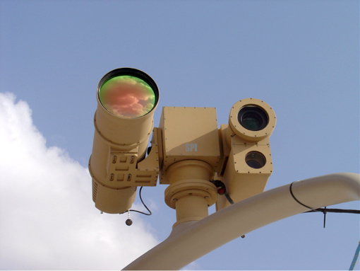
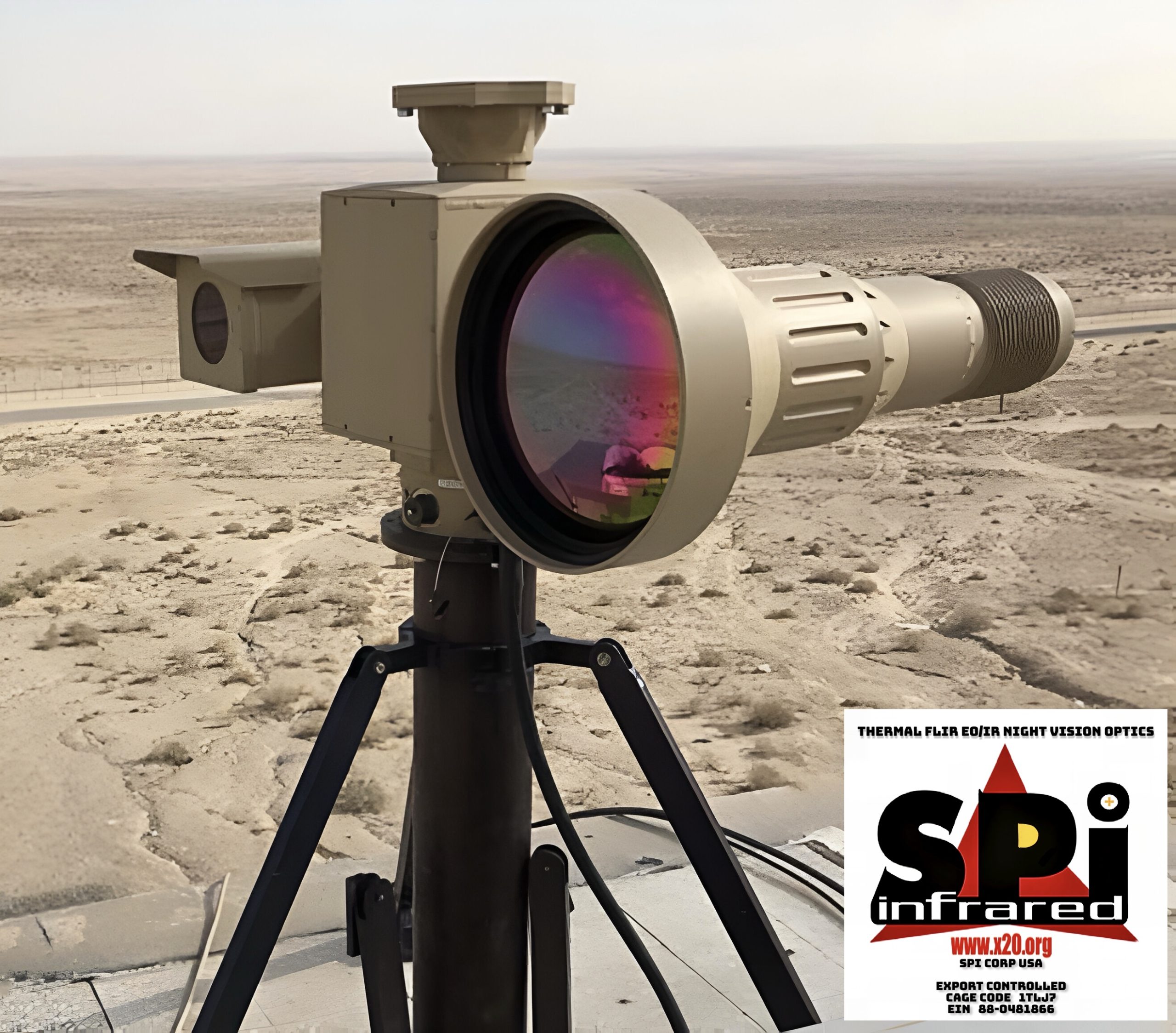
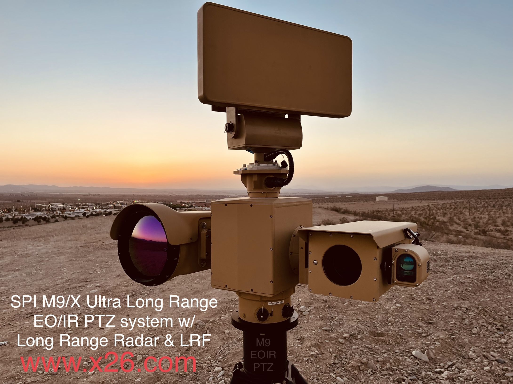
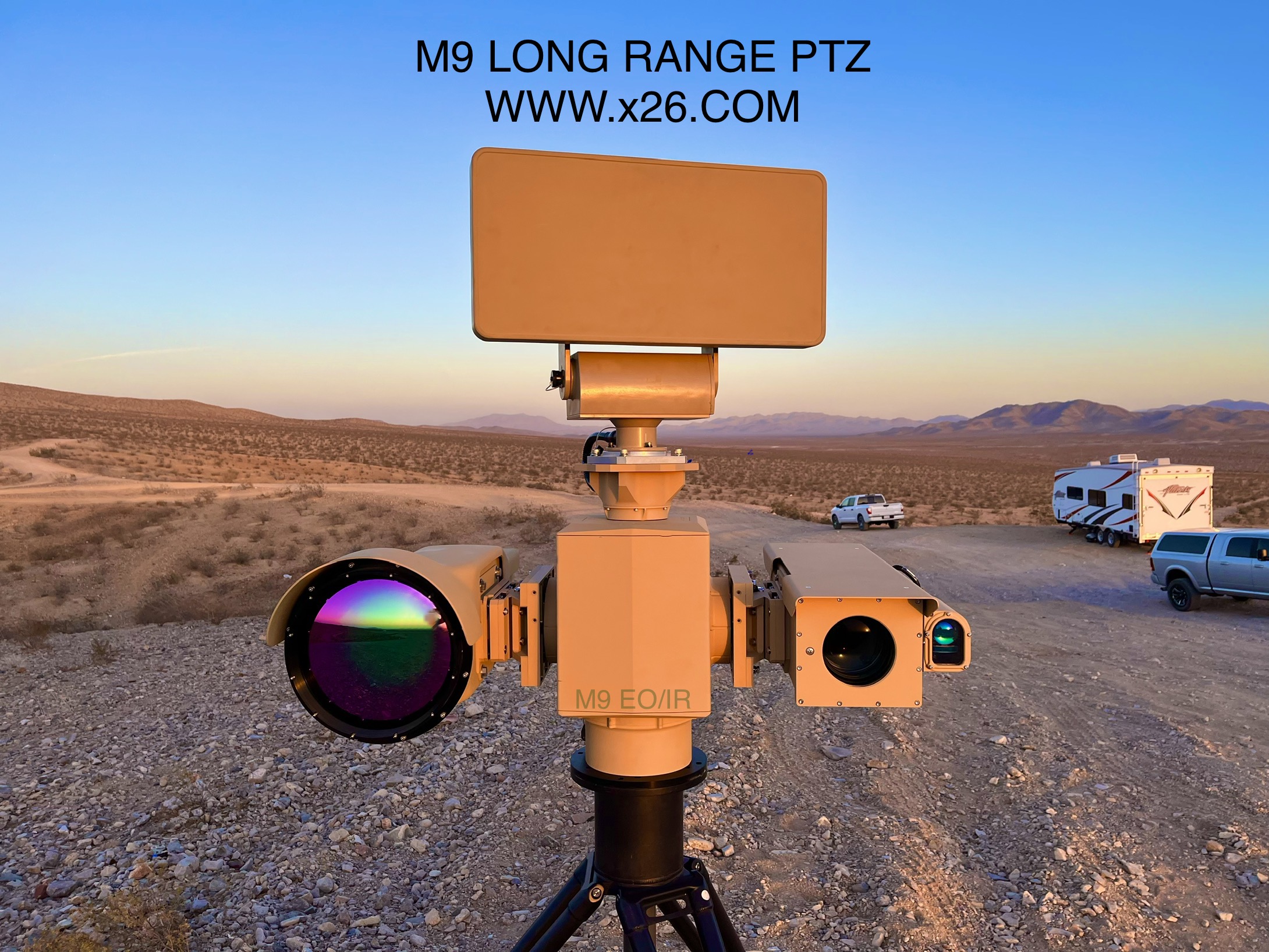
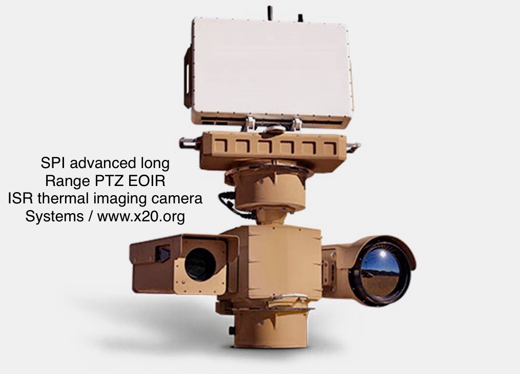
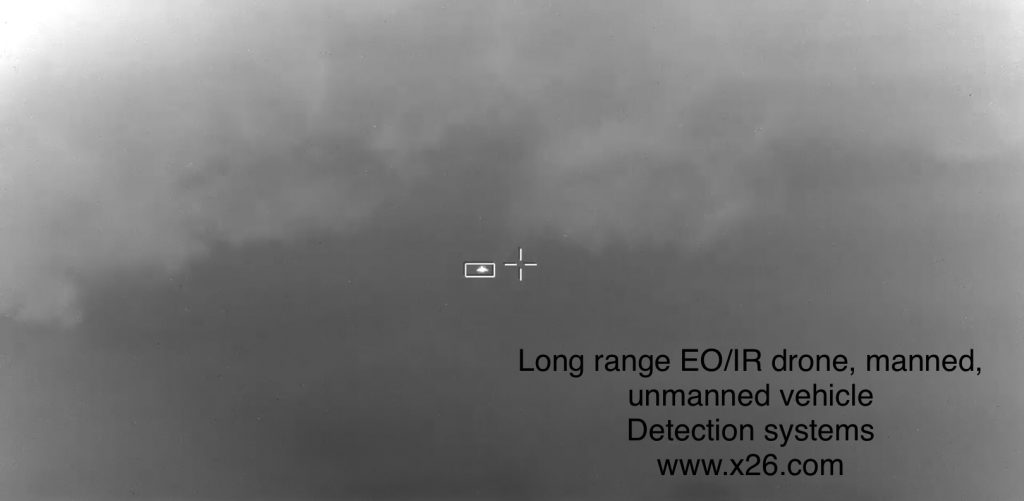
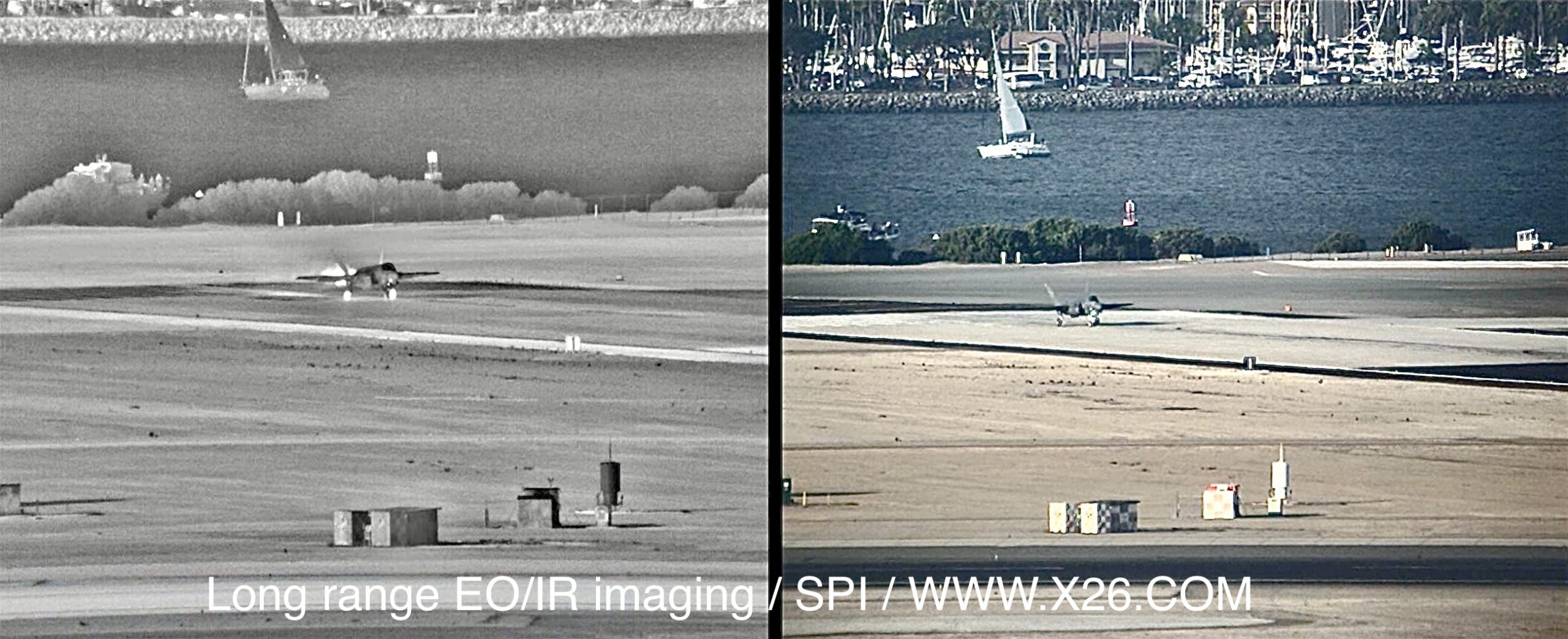
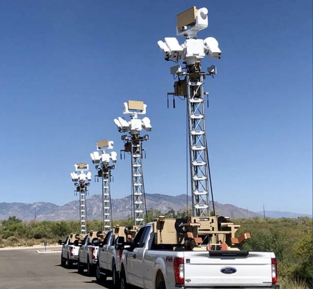
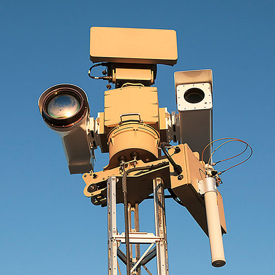
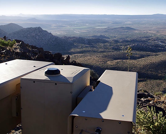
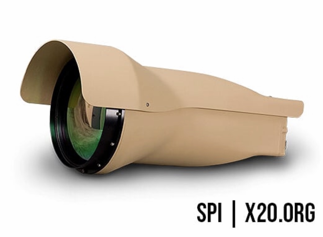
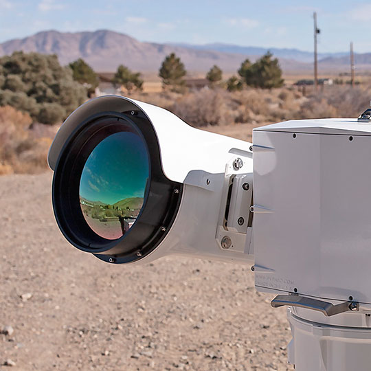
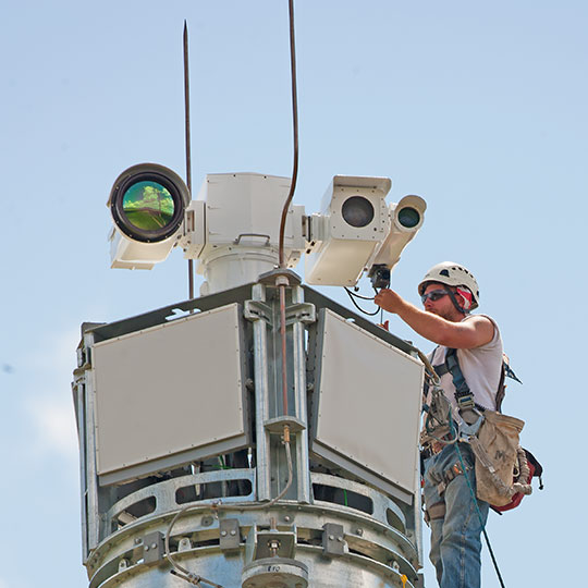
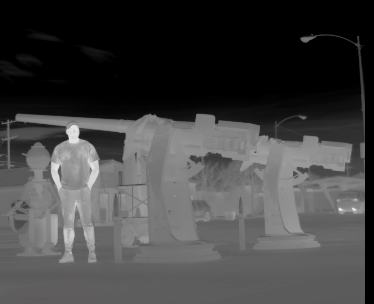
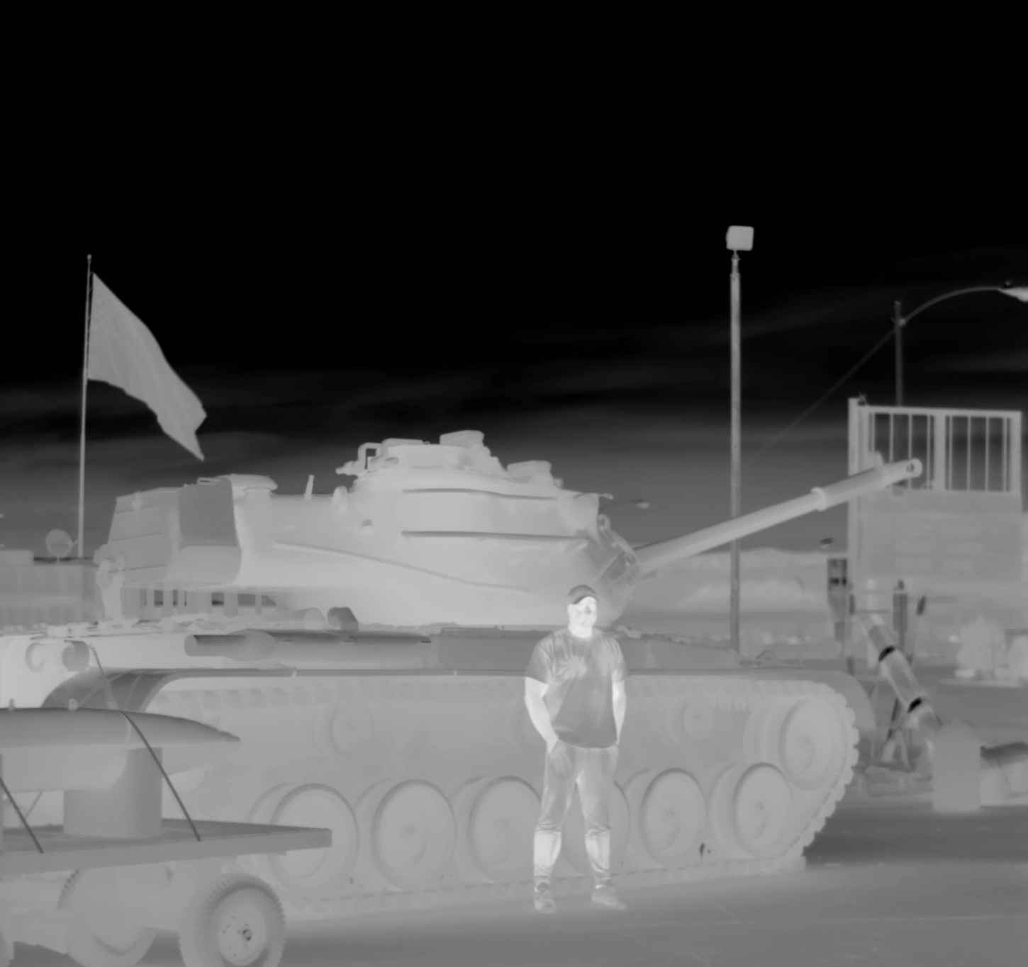
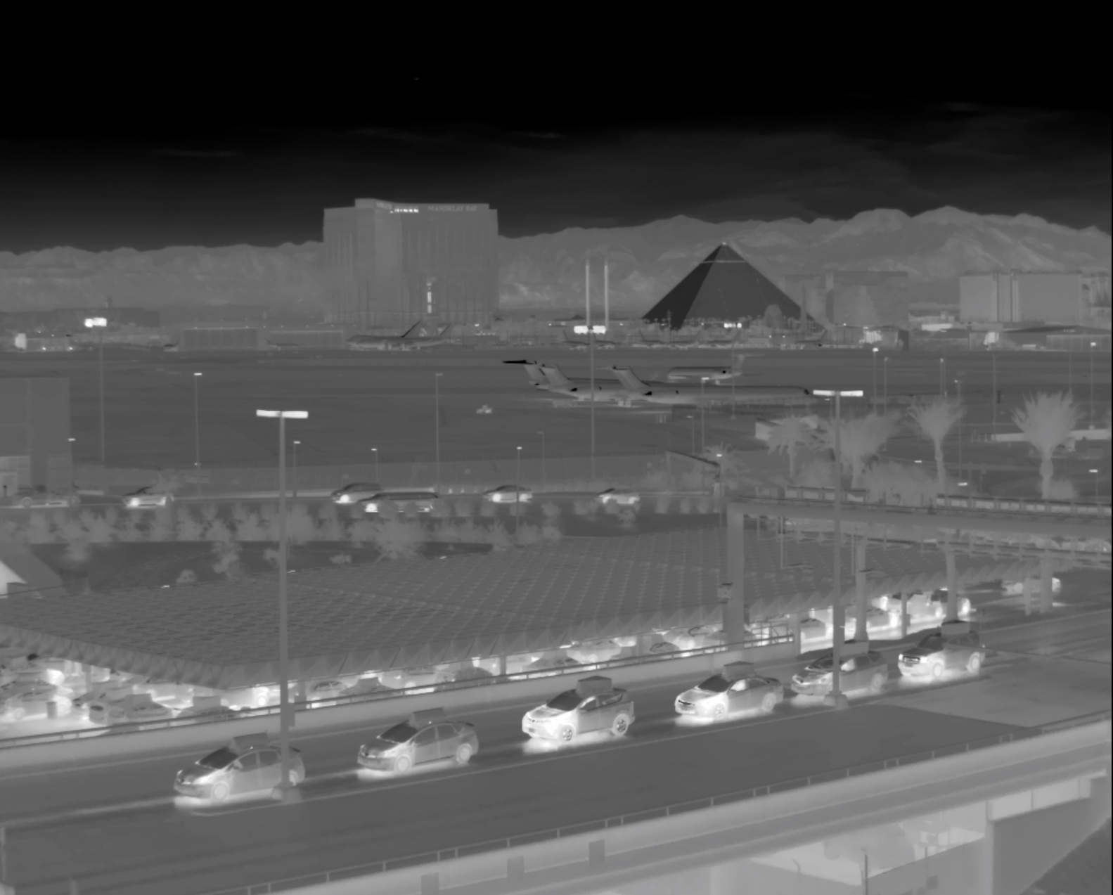
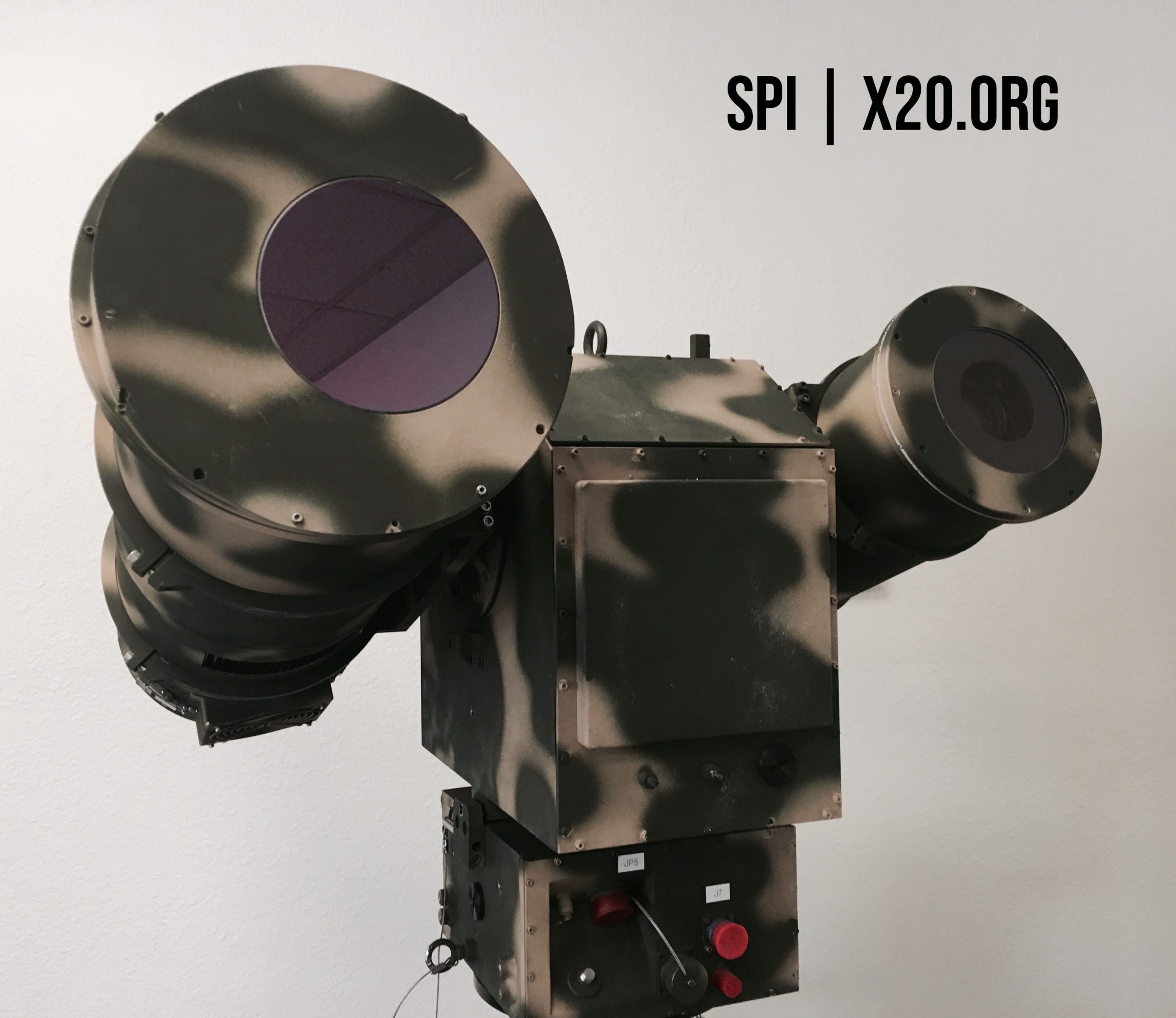
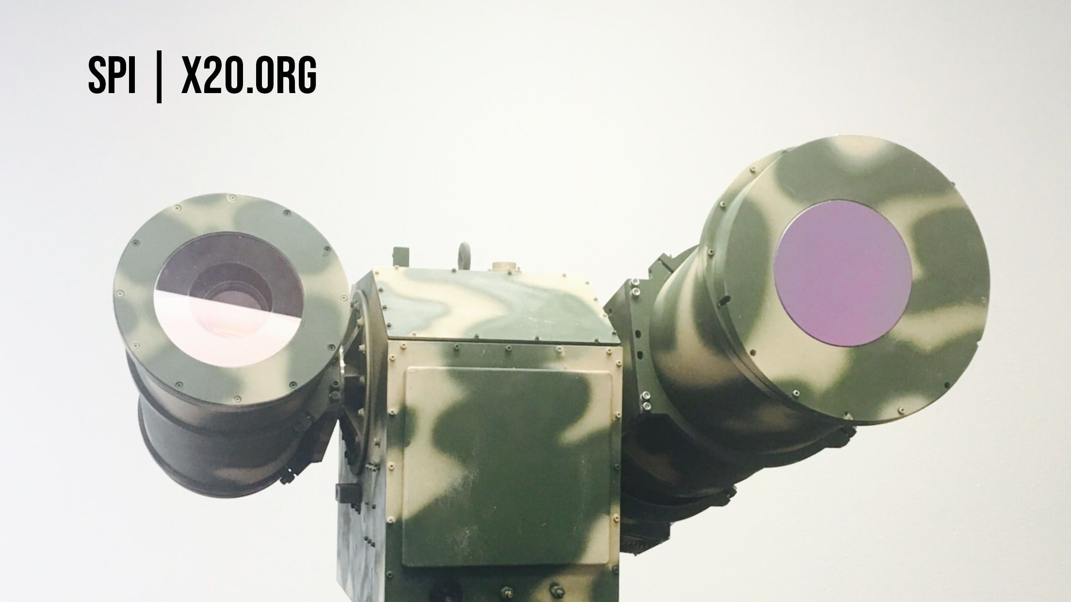
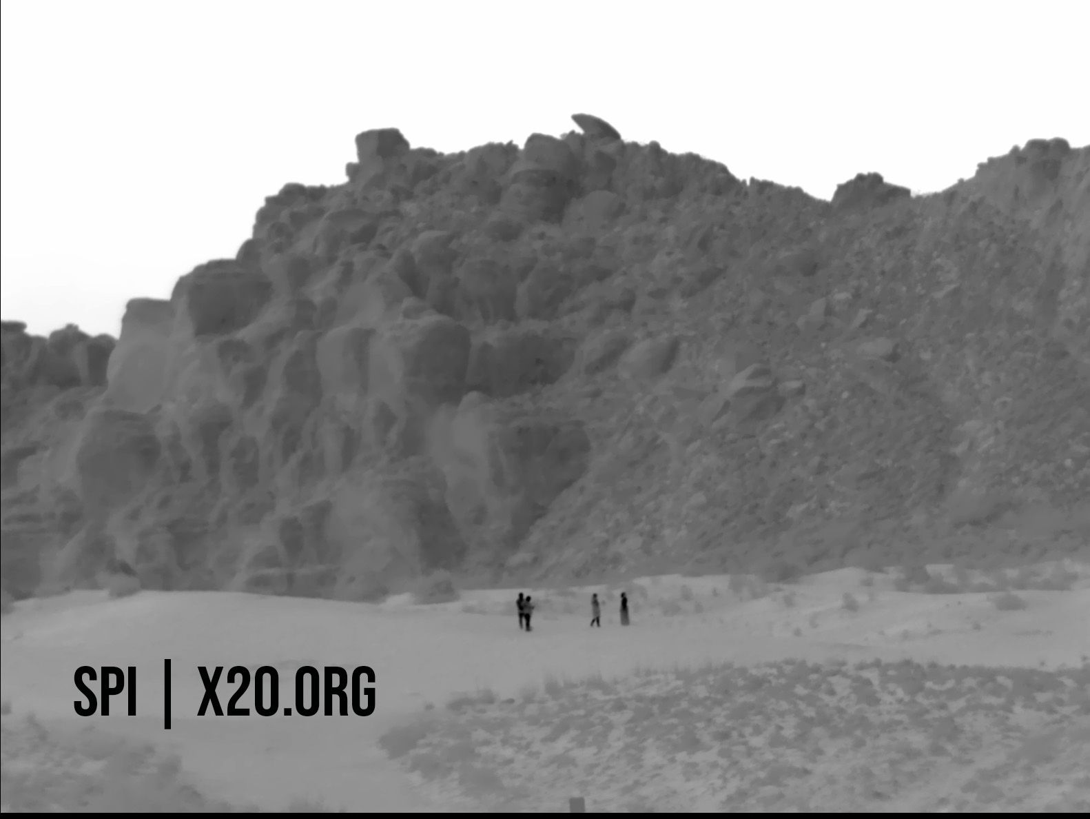
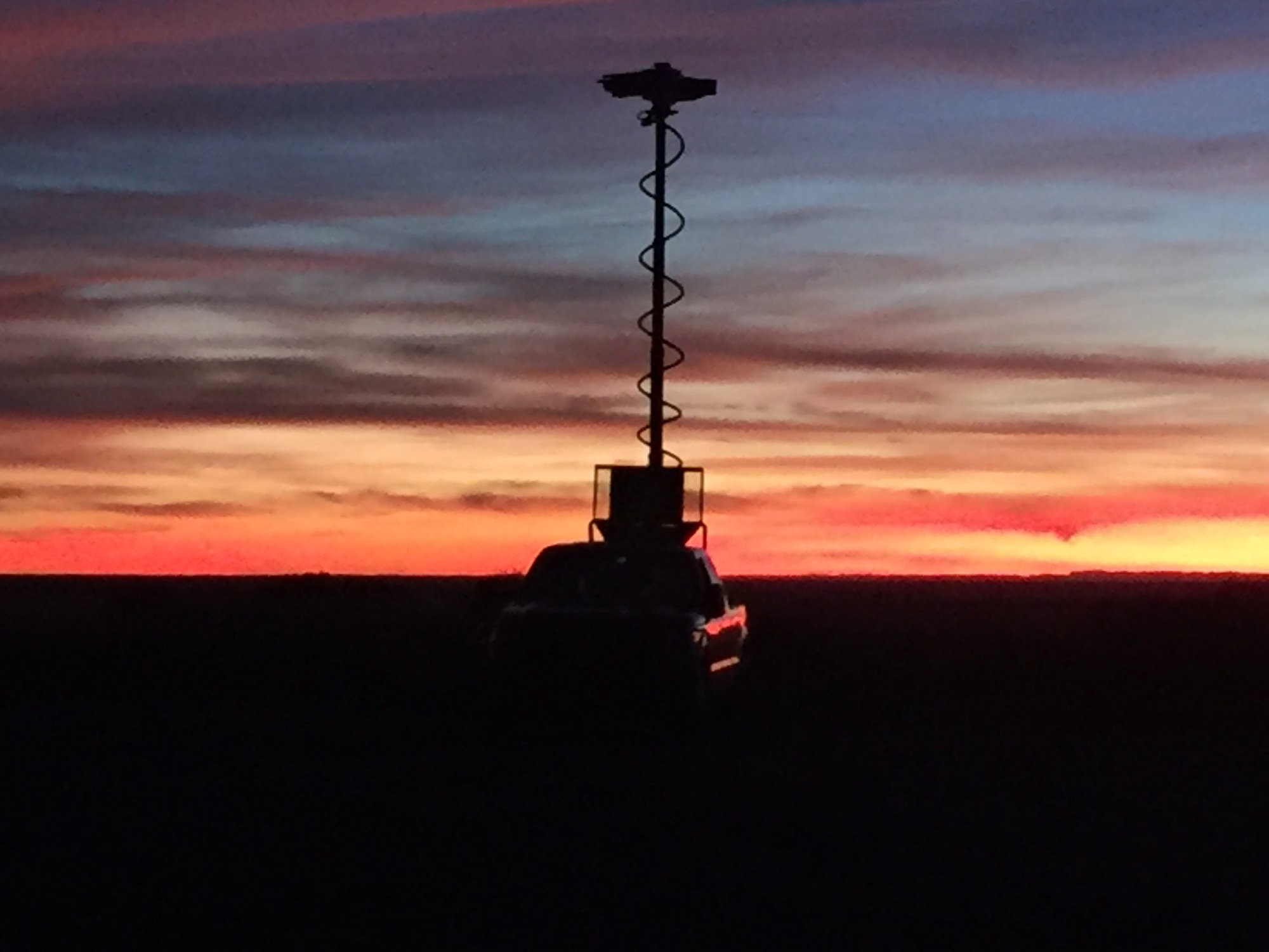
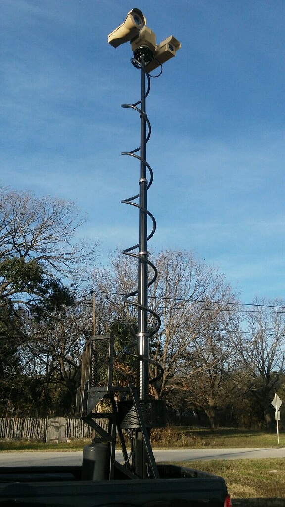
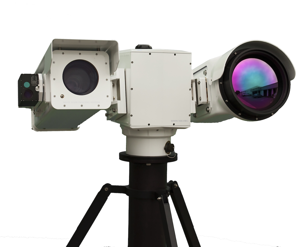
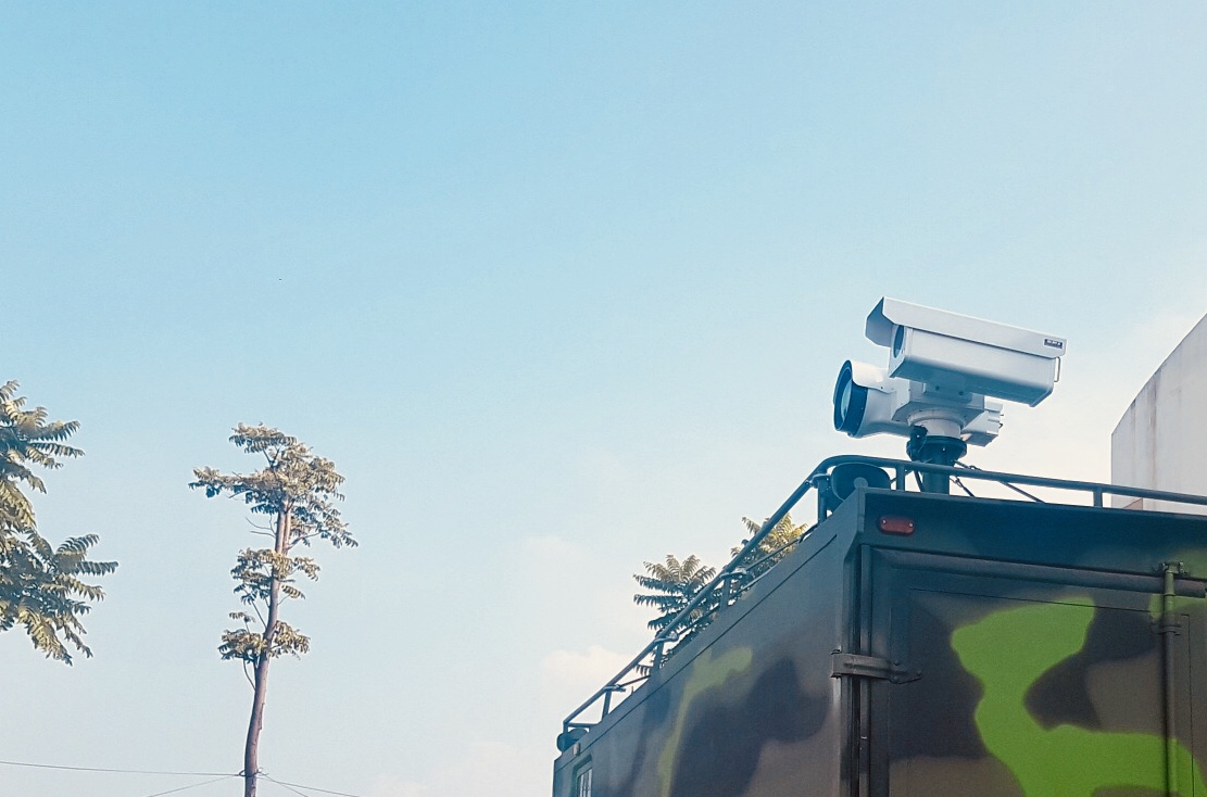
The M9 Is the Pinnacle of Super Ultra Heavy Duty, Image Stabilized Extreme long range cooled MWIR Thermal Imaging FLIR EOIR camera system. The system has incredible detection ranges up to 60 Kilometers. THE RUGGED M9 HAS THE BEST GYRO STABILIZATION + OFFERS THE HIGHEST PERFORMANCE, BEST SENSITIVITY & LONGEST DETECTION RANGES.
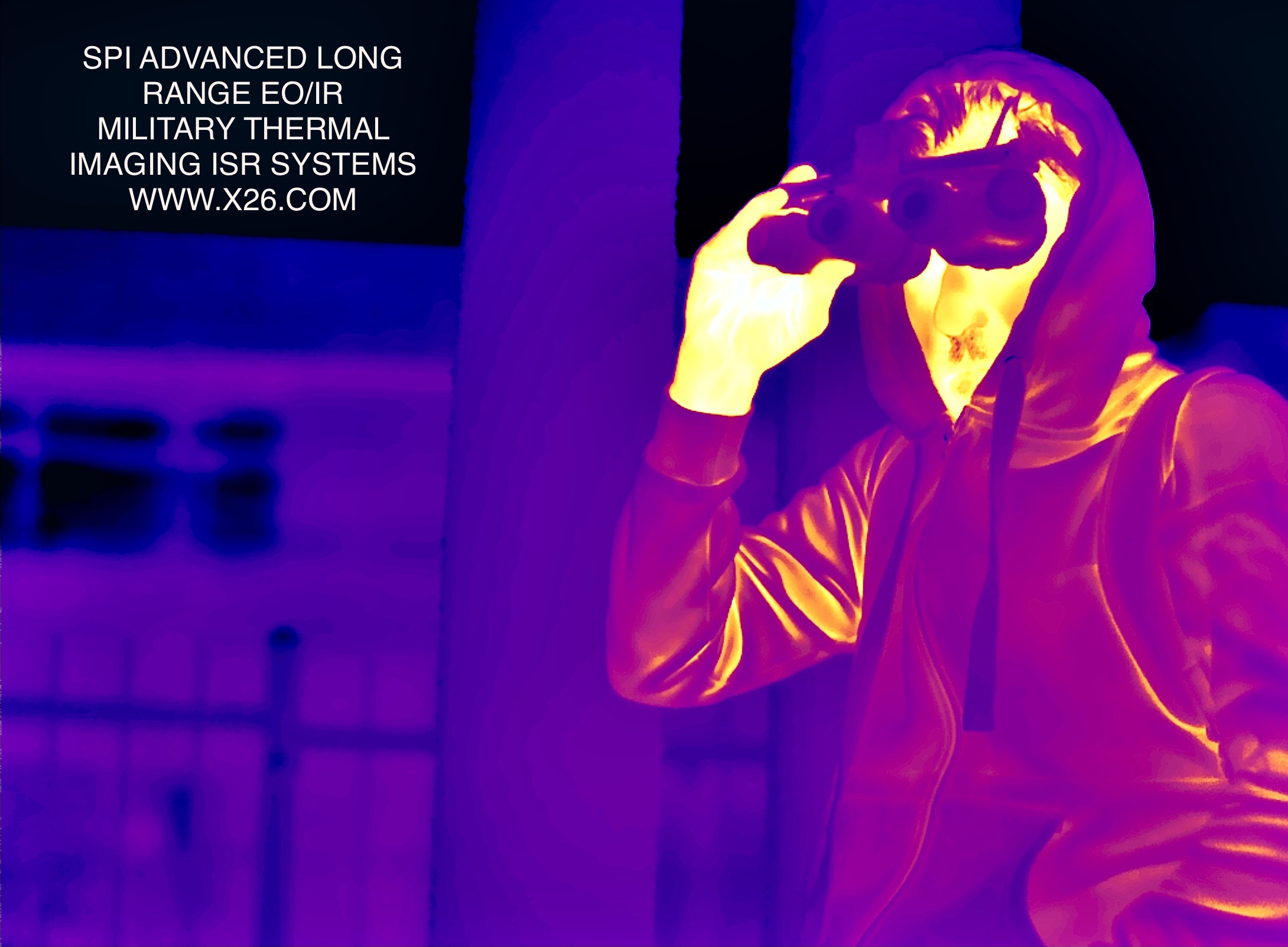
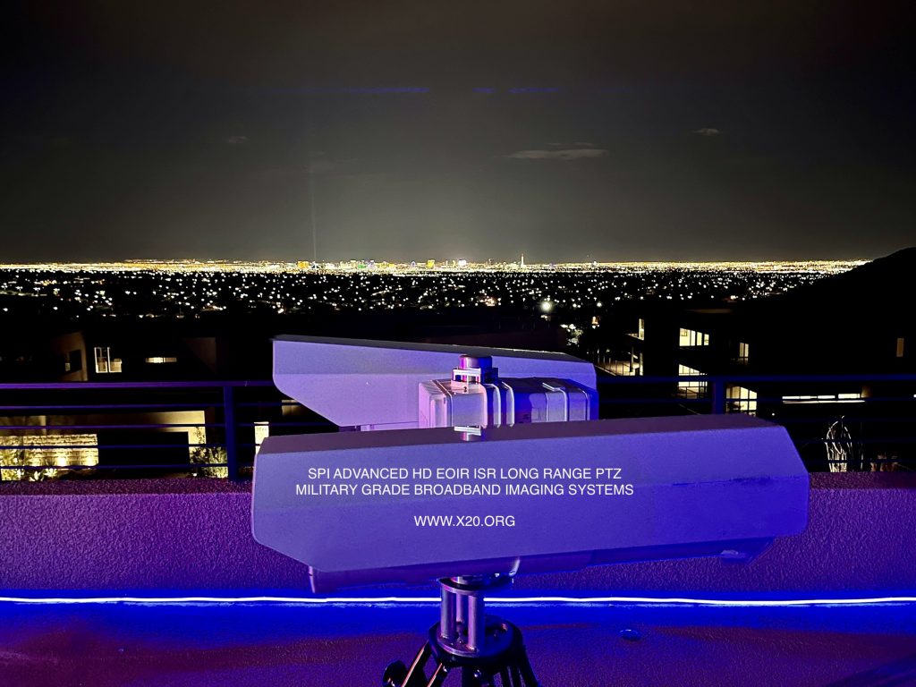
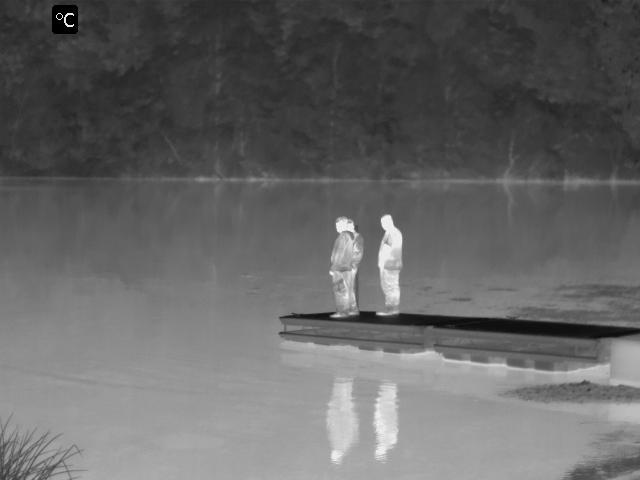
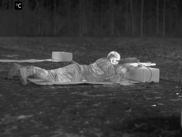
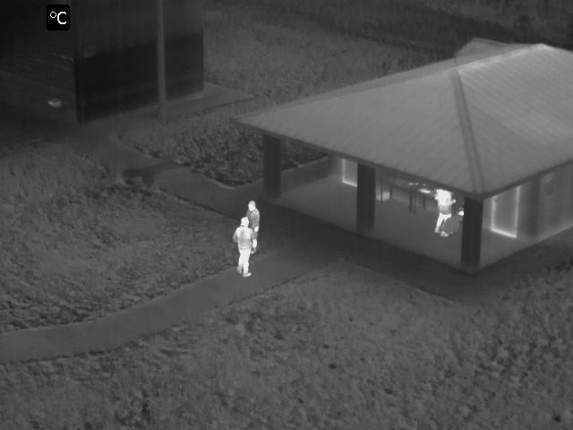
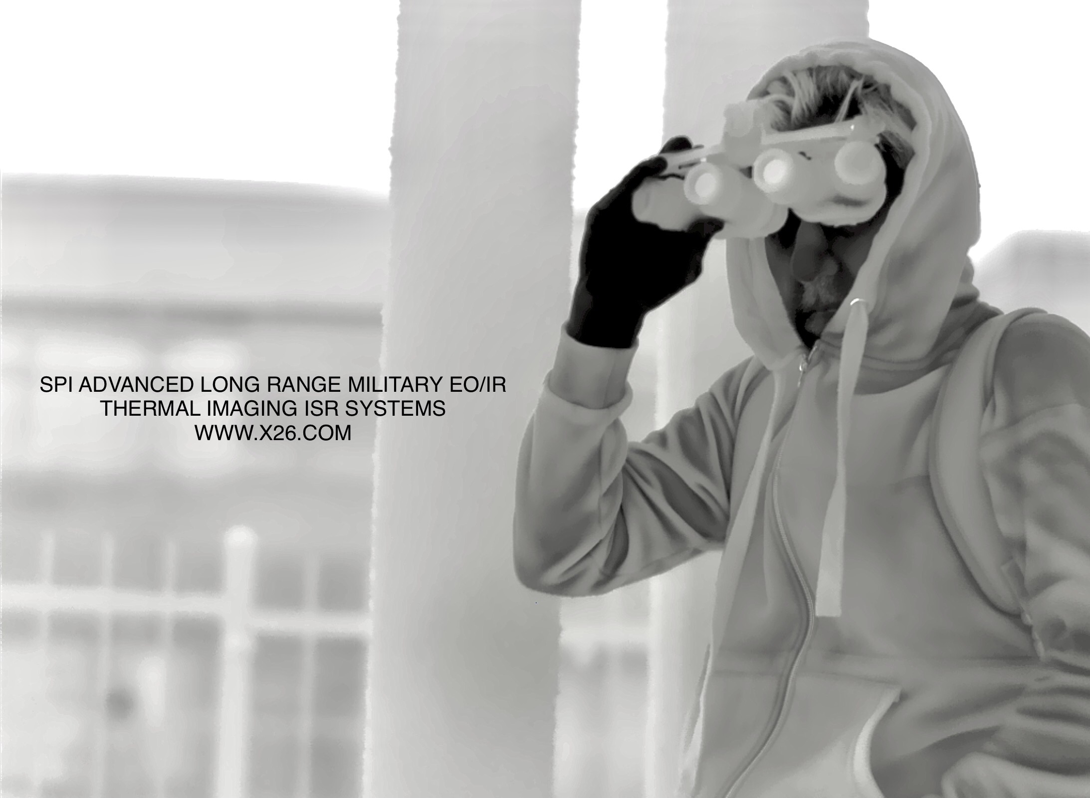
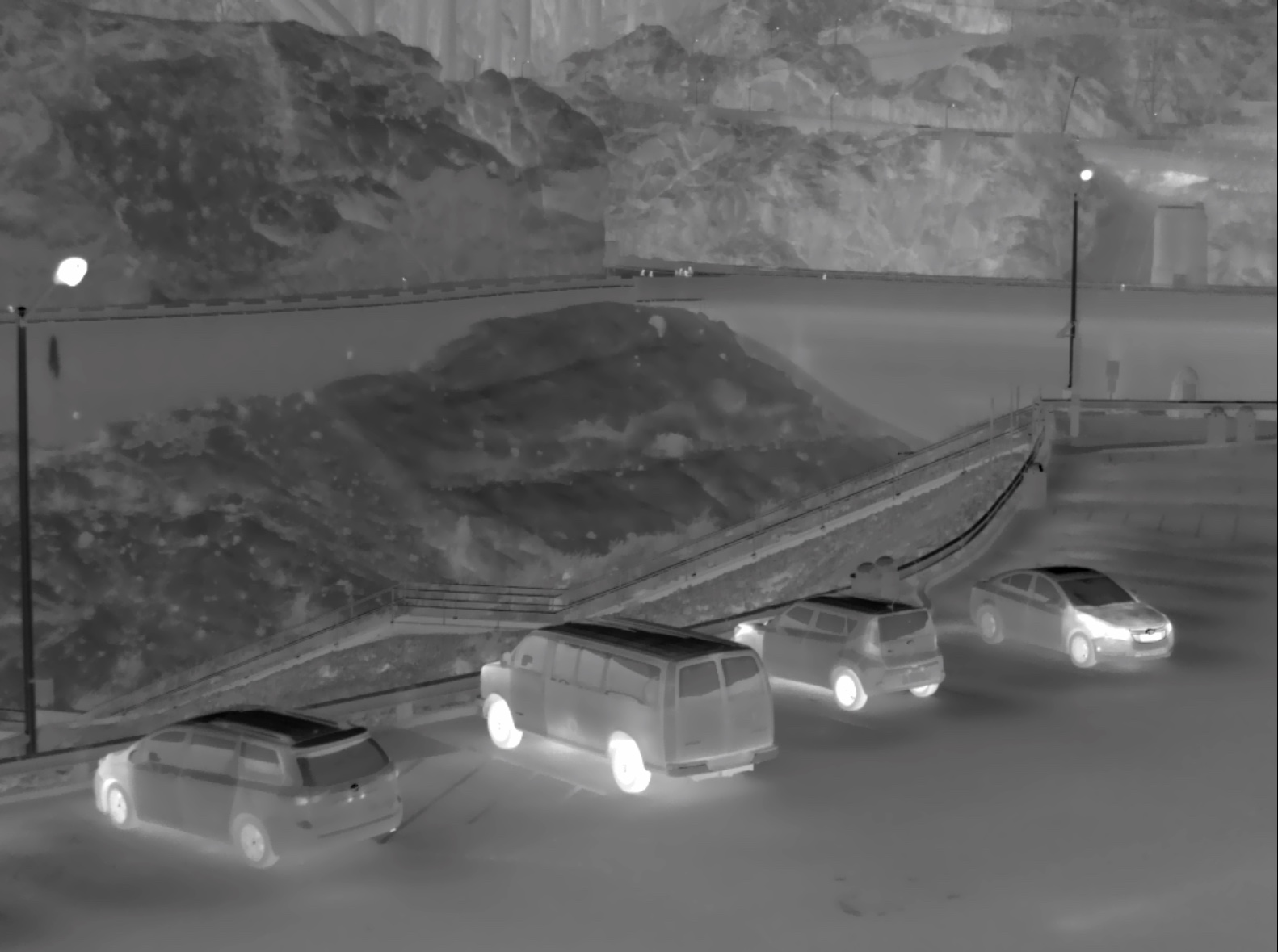
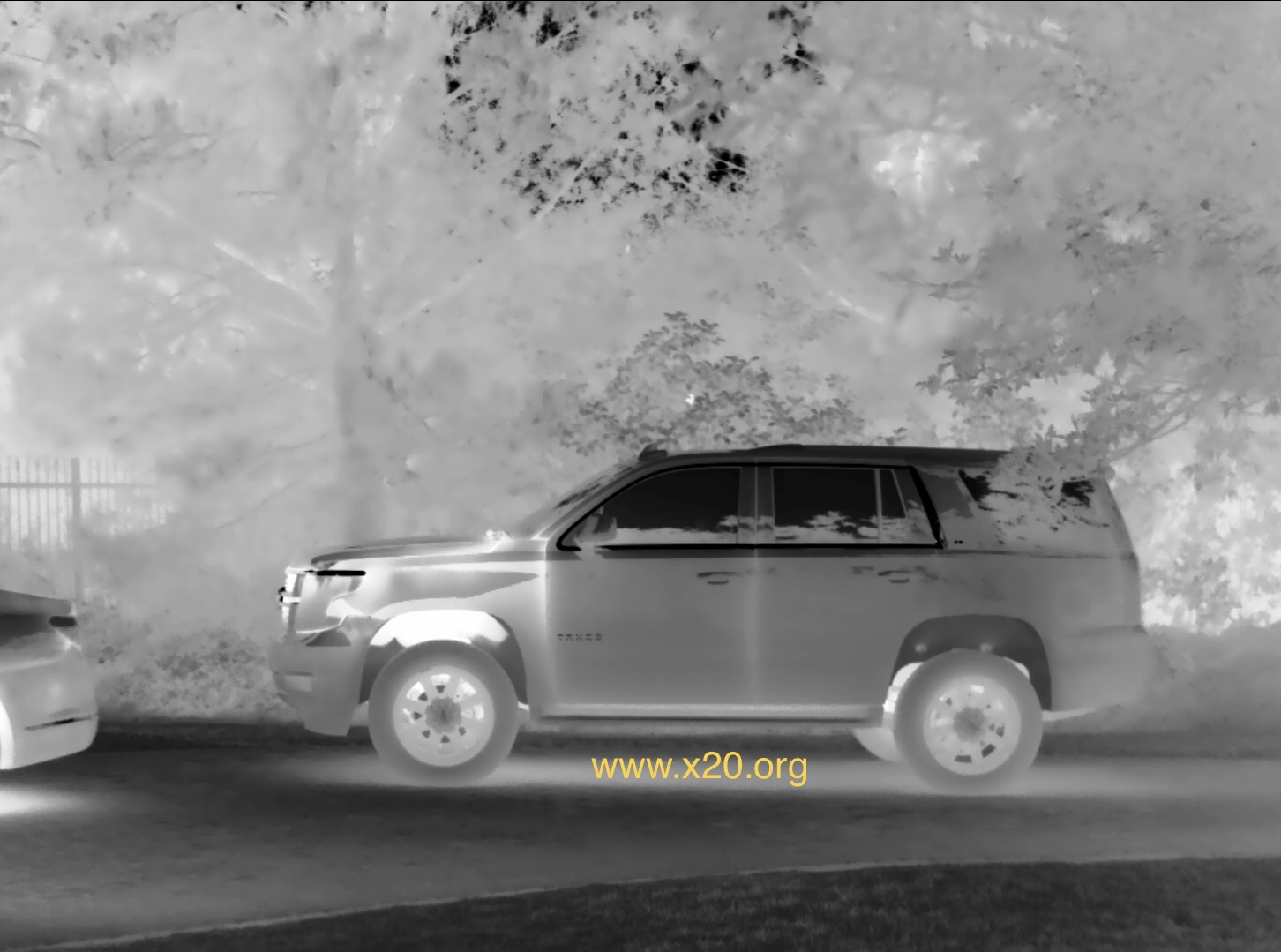
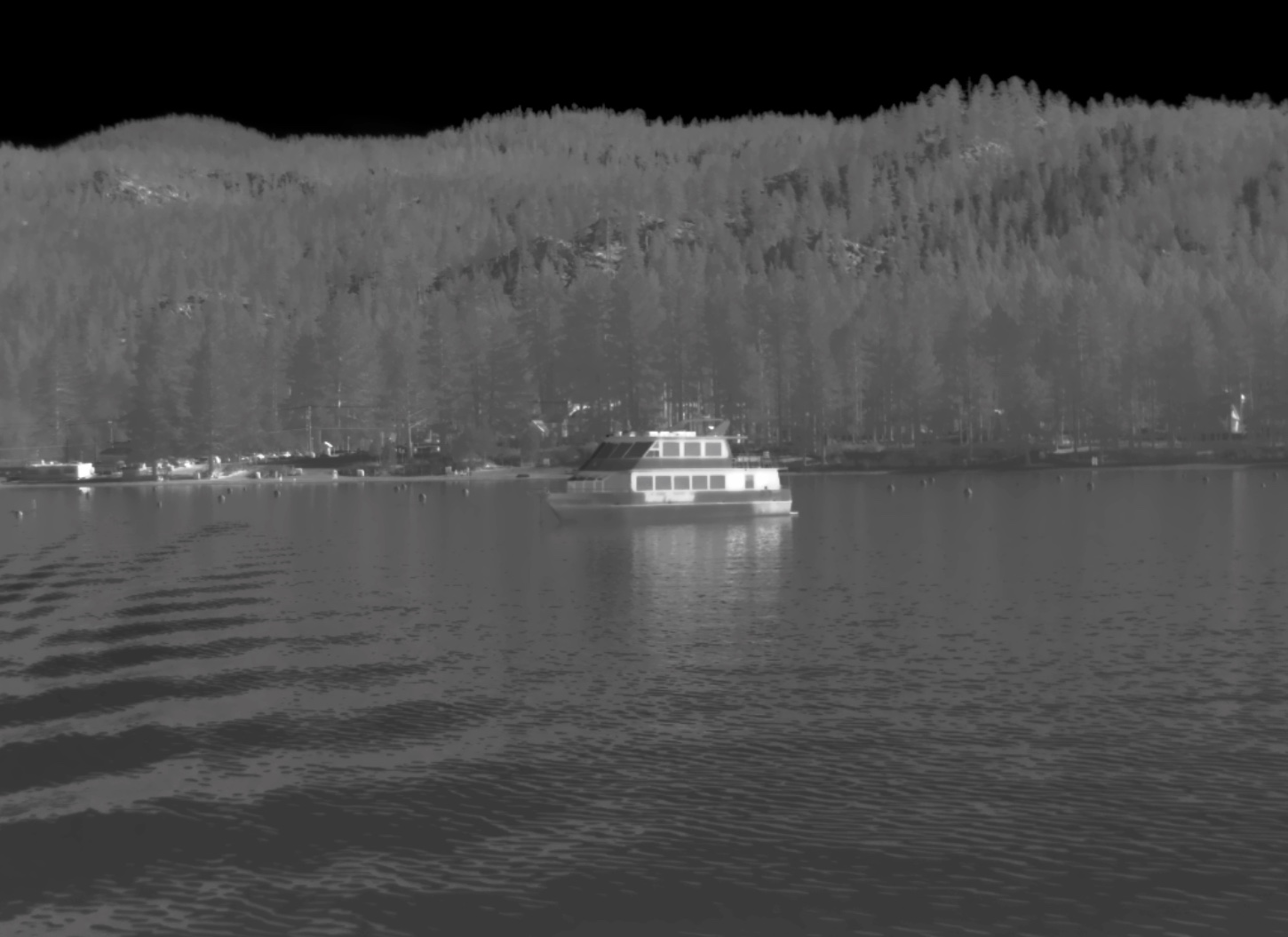
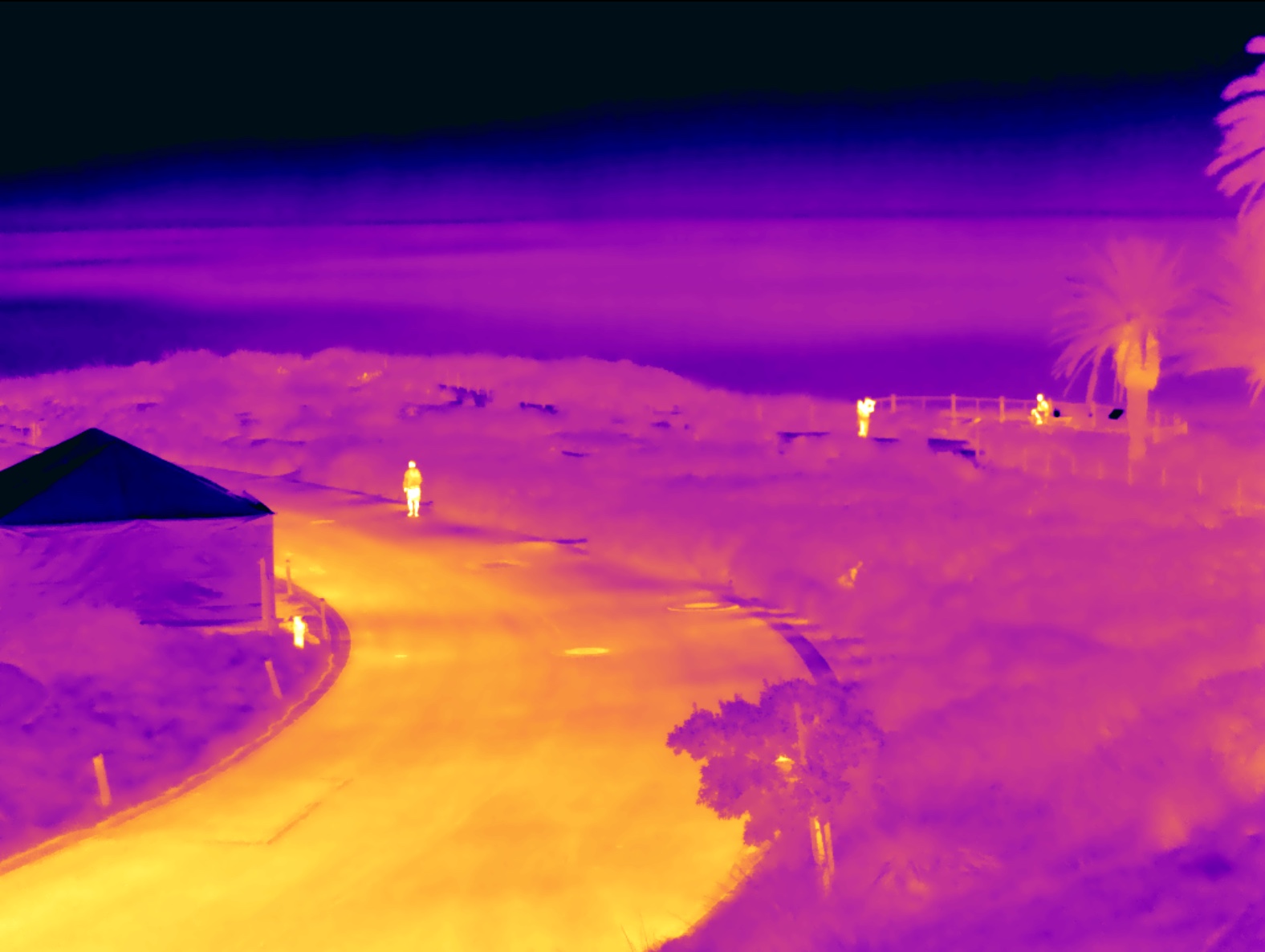
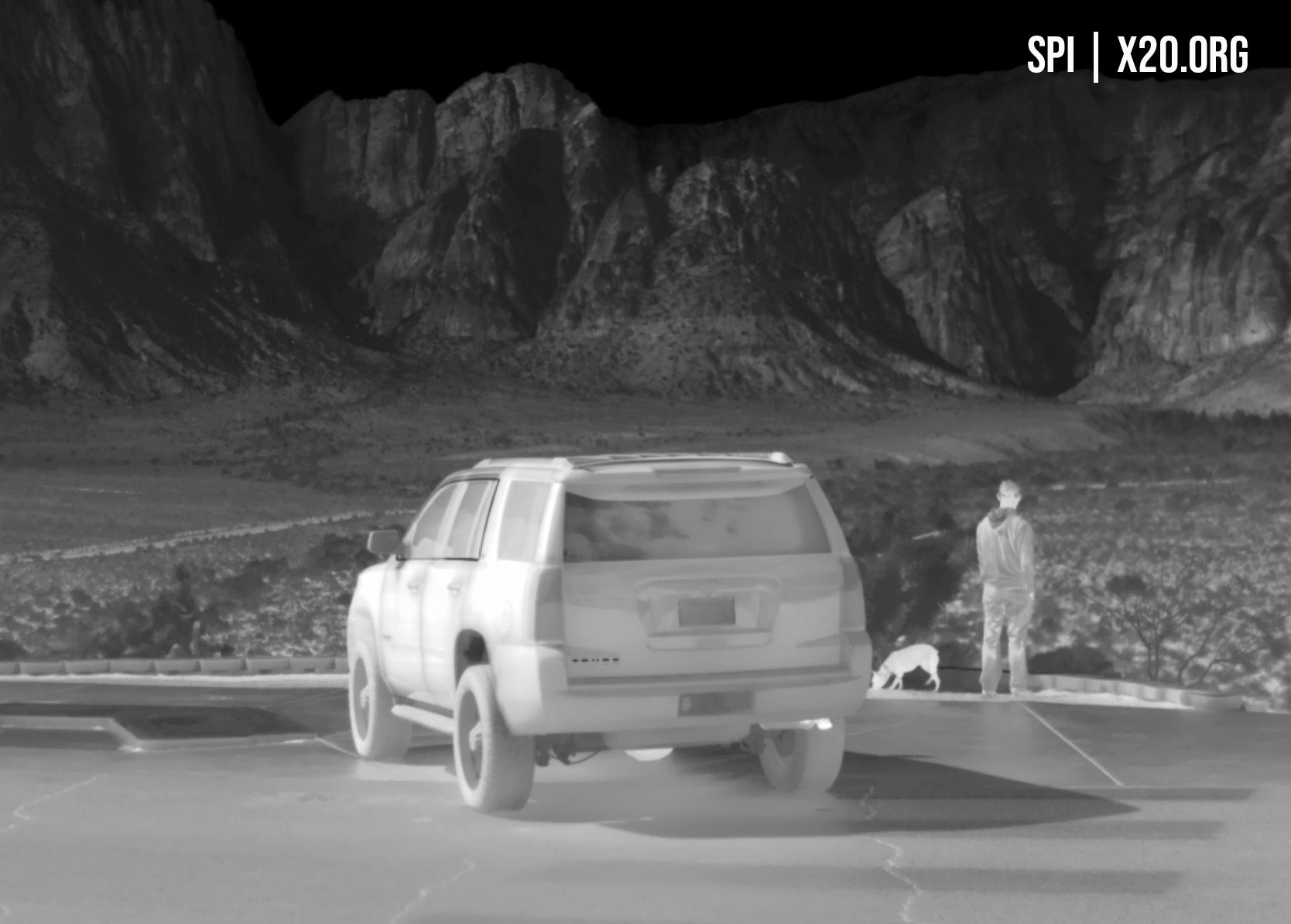
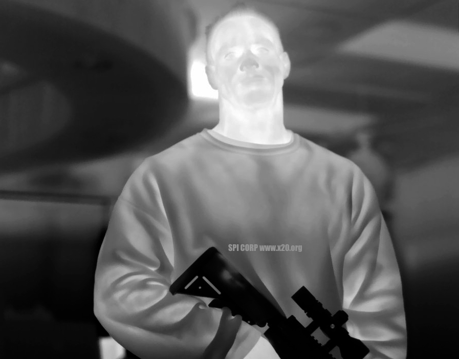
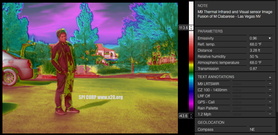
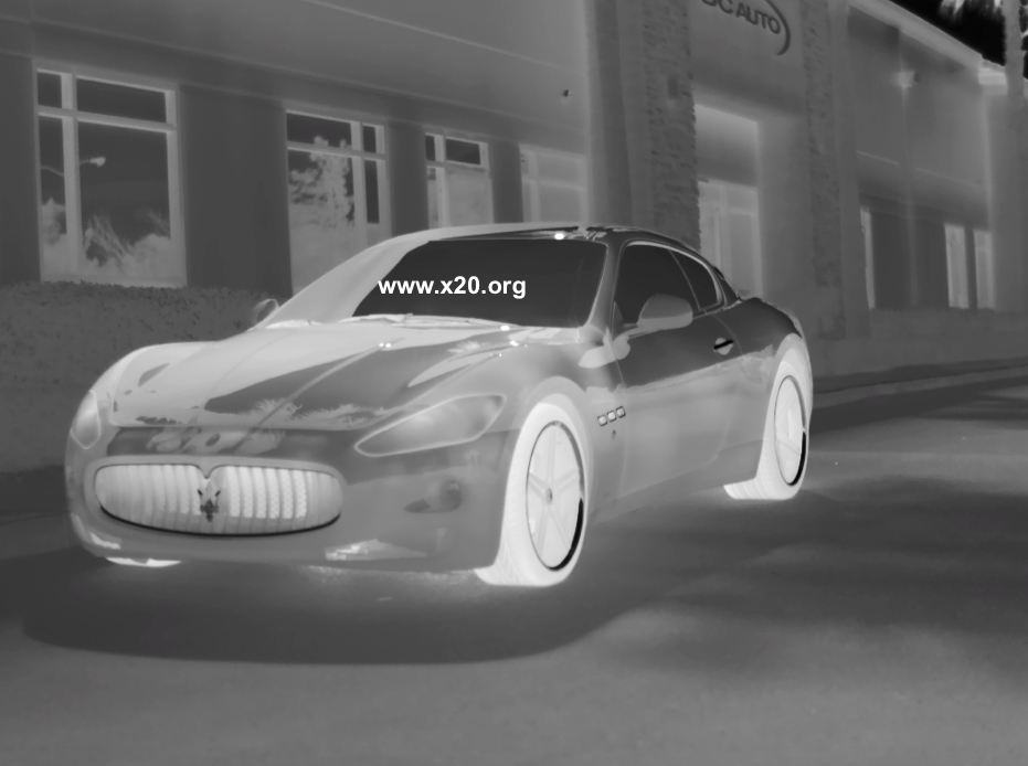
Thermal infrared night vision imaging uses cameras that “see” heat instead of light. Sometimes referred to as “FLIR” or Forward Looking InfraRed cameras, they produce an image that portrays objects using their temperature instead of their visible properties. SPI utilizes the absolute highest quality SD and HD Ultra extreme long range system manufactured for military, security and monitoring applications.
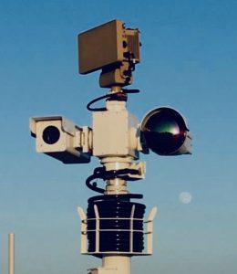
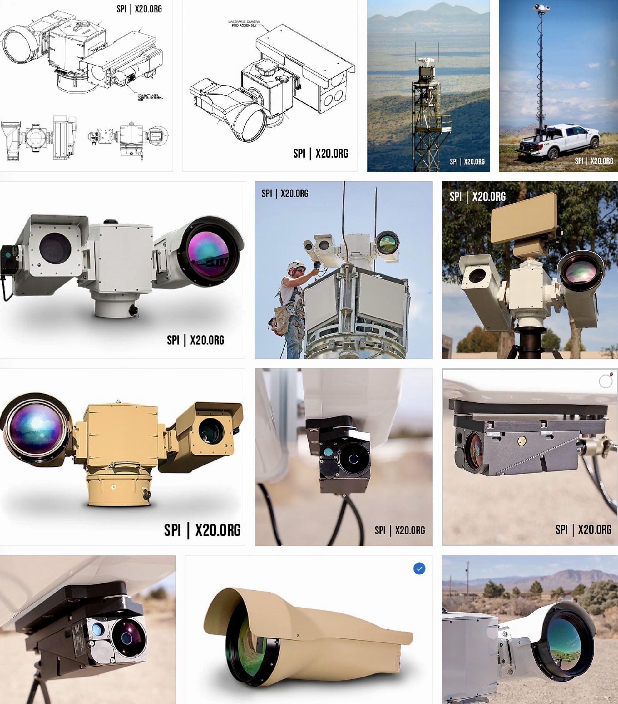
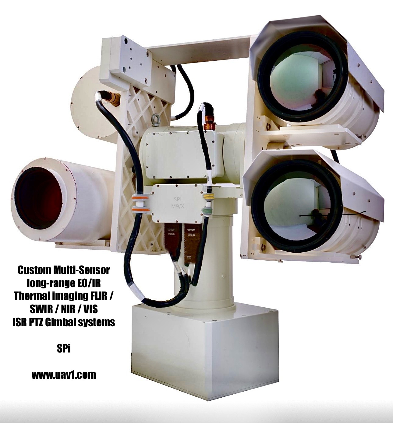
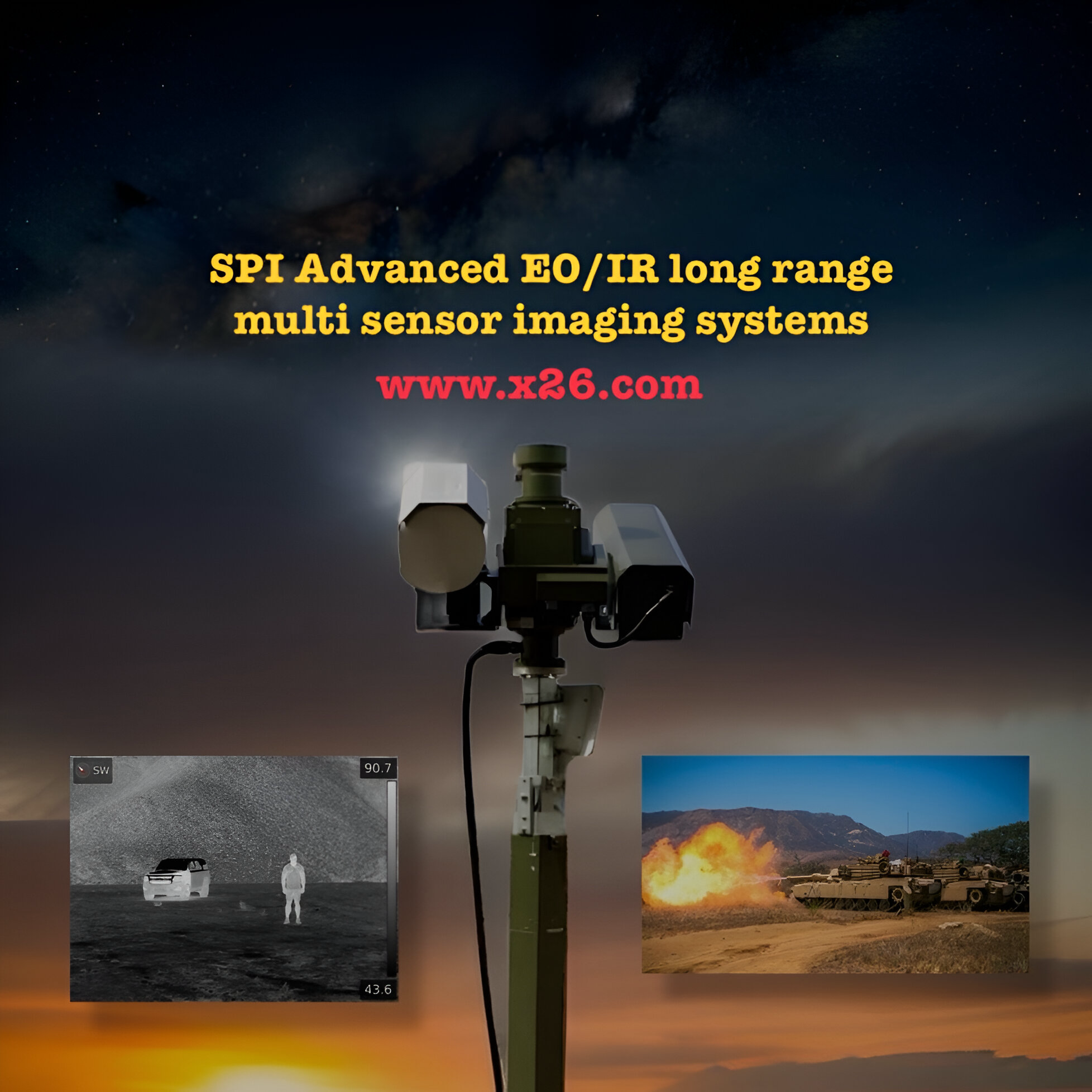
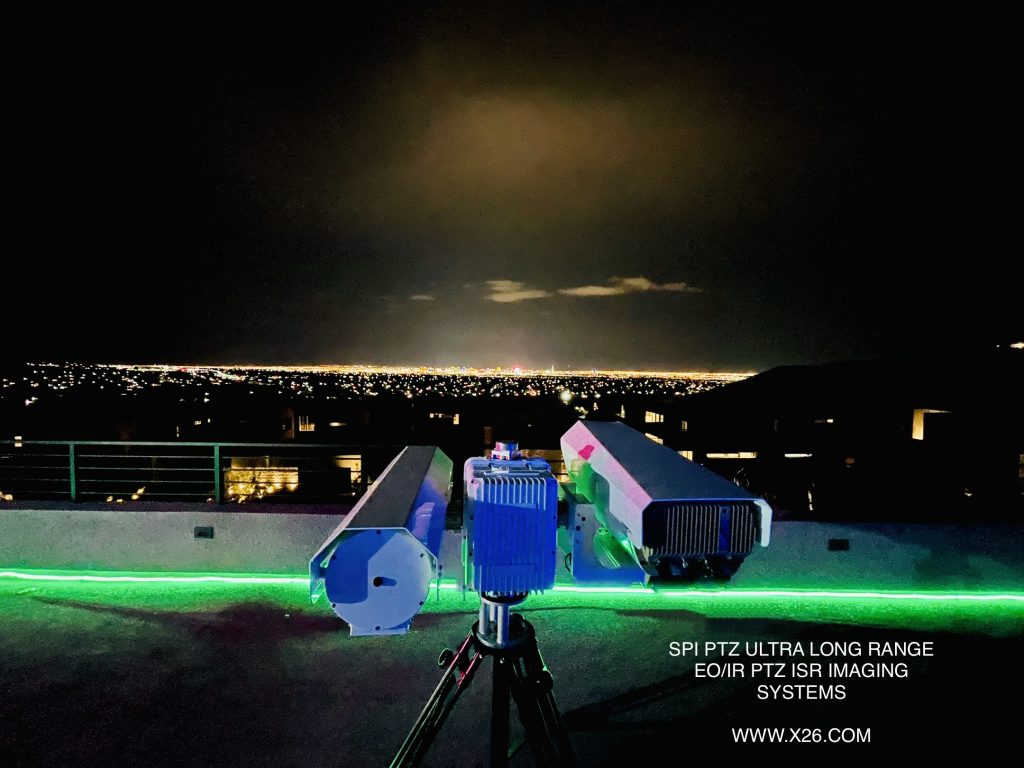
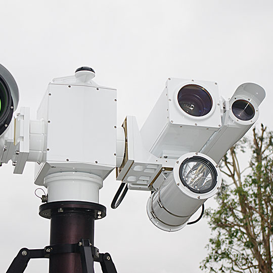
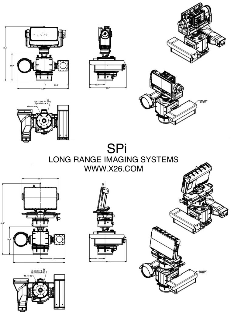
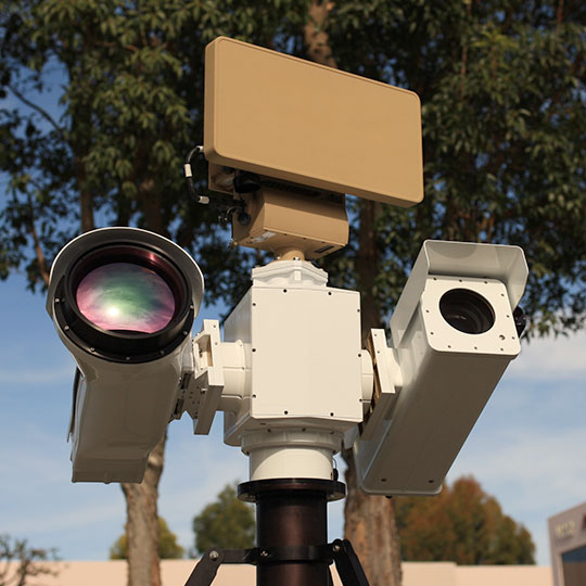
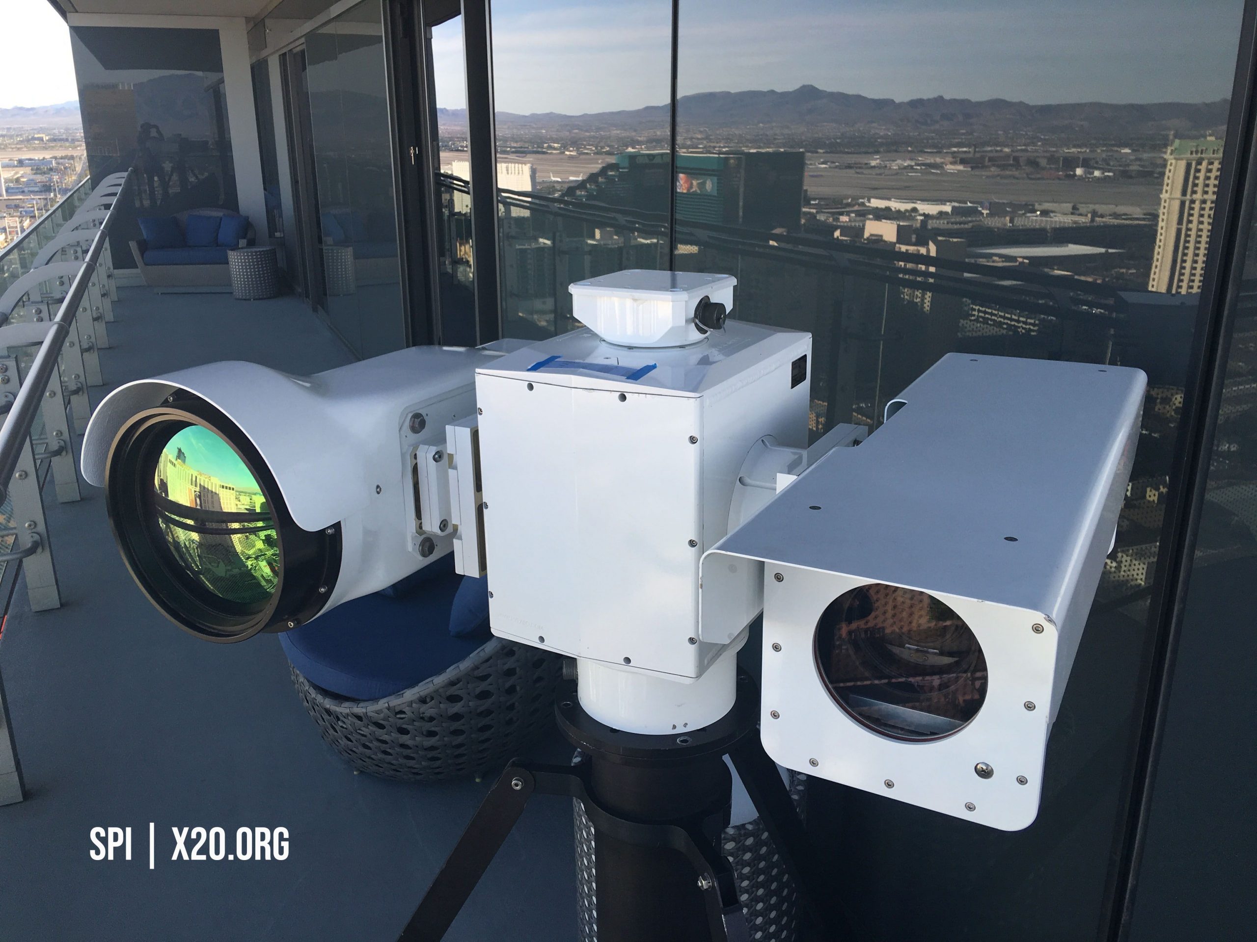
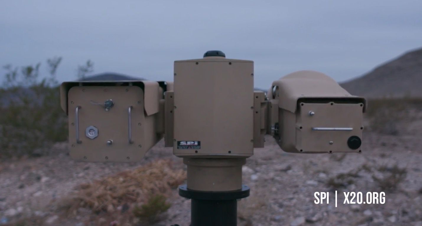
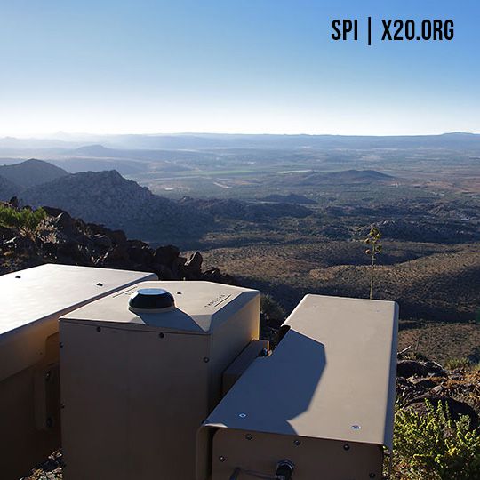
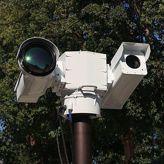
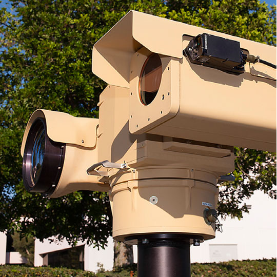
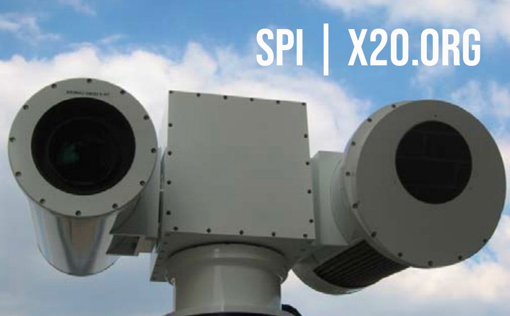
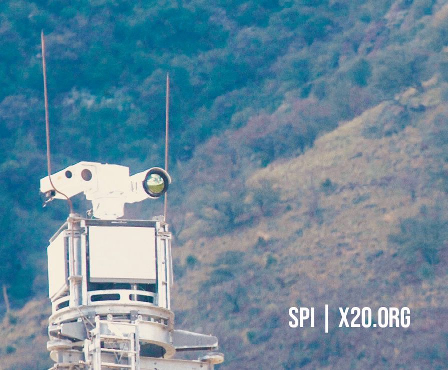
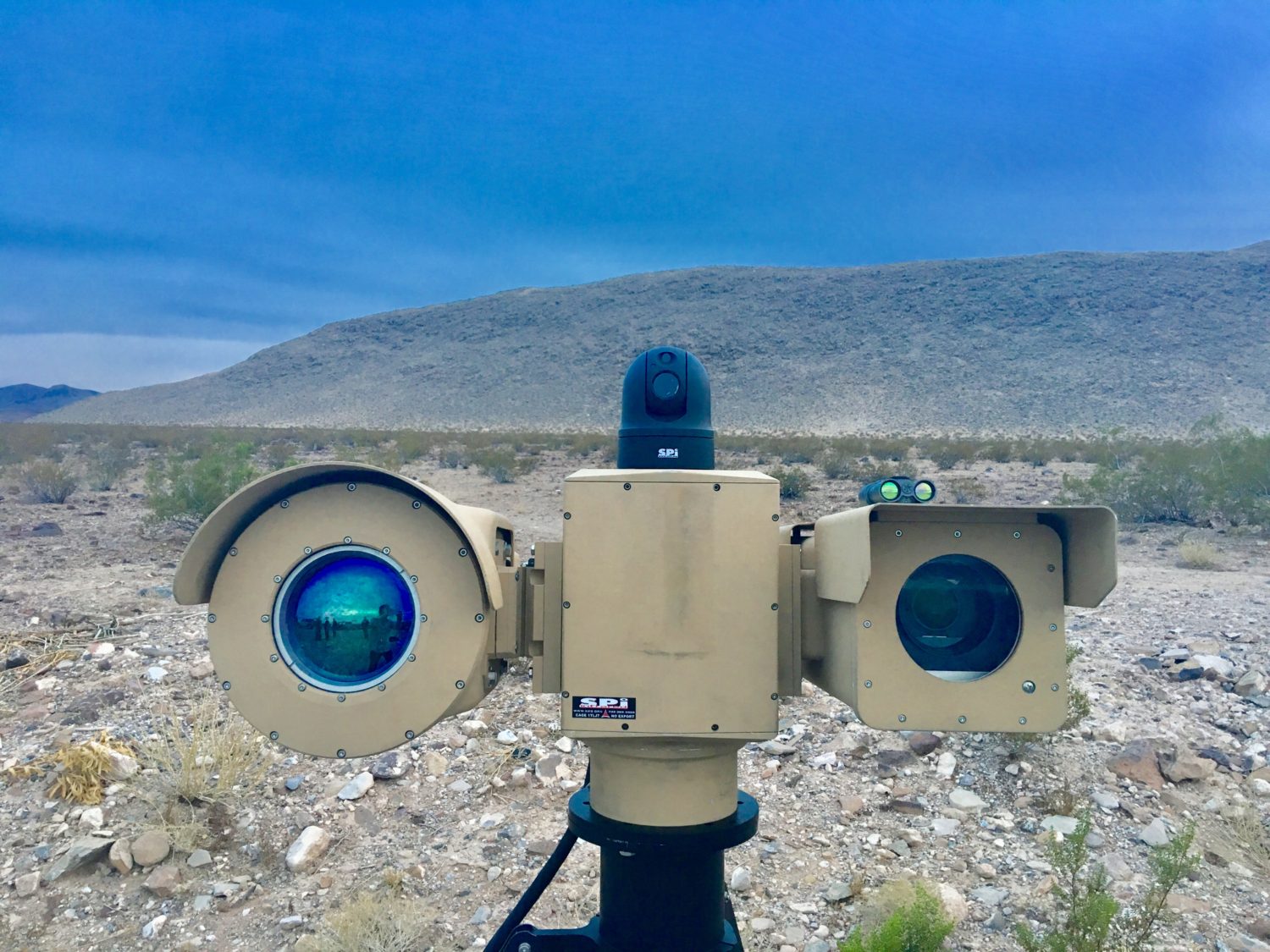
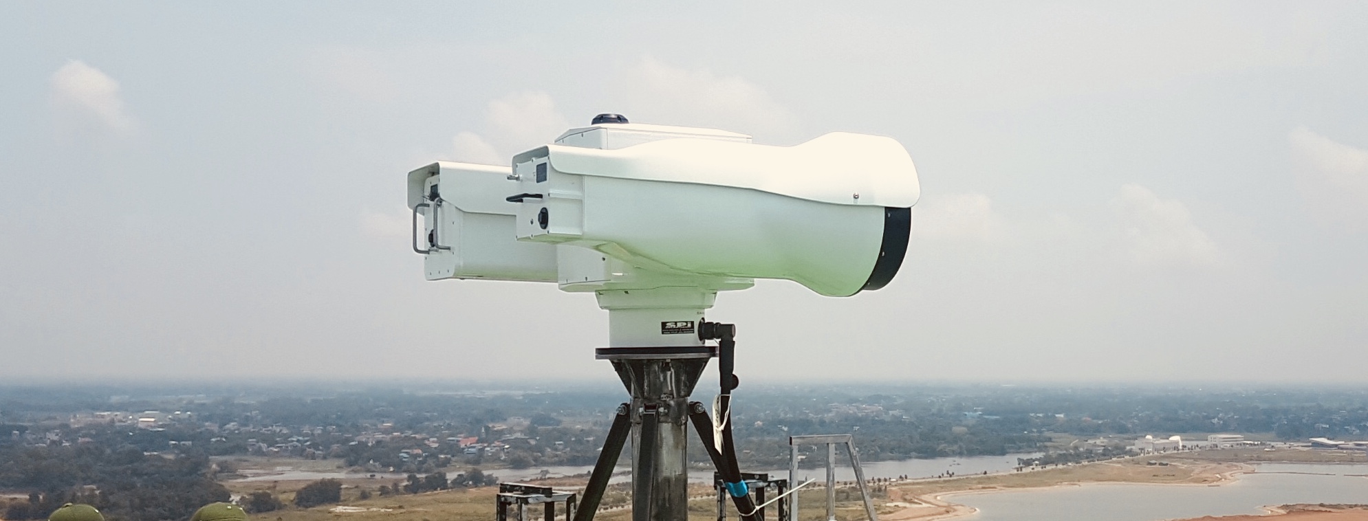
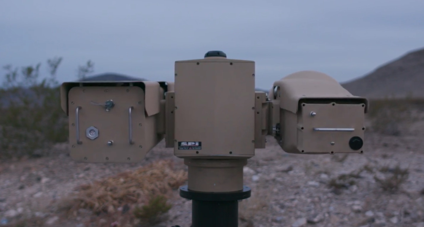
The SPI Family of rock steady Gyro Stabilized Military grade MultiSensor systems PTZ (Pan Tilt Zoom) integrate the long range, mid-wave (MWIR)/Long Wave (LWIR) High Definition thermal imaging M series cameras with a variety of powerful daylight sensors, and optionally a Laser Range Finder, GPS, SWIR, Color Night Vision, IR and Sniper detection optics, Digital Magnetic Compass, and Automatic Video Trackers. An array of advanced functions and options are available to meet the most demanding needs. All sensors on the SPI Long Range PTZ Thermal imaging flir night vision multi sensor cameras units are mounted on a fast and accurate all weather 100% Duty cycle weapons grade Pan & Tilt unit that can withstand any harsh environment or vehicular vibration.
SPI Has The capabilities of rapidly customizing a long range ptz Pan Tilt Zoom thermal imaging multi sensor platform to suit your exact requirements at the most competitive prices, We offer the absolute most ruggedized systems that are installed in key locations within the United States and throughout the world. Our customers rely on our products to work 24/7/365 uninterrupted without any maintenance issues. Call or email us for additional information and custom integration.
LINK FOR ZENITH M9 LONG RANGE CAMERA MAST RETRACTABLE FOLDING TOWER BROCHURE
• Spectral band: 8-12μm (LWIR) or 3-5μm (MWIR)
• Cooled and uncooled technology
• Full MIL Spec
• Compatible with Most all video and controlling units, solar, microwave, onvif, ip, ethernet, satellite, fiber and a host of remote and local communication options to match you network.
• Ultra Extreme wLong range night vision thermal flir image surveillance and target acquisition
• Day and Night + Adverse conditions
• Ability to see through barriers such as vegetation, camouflage netting, Etc
• Full support from beginning of application Statement of work to install and training
• The most complete range of Thermal Imagers
• 4rd Generation Thermal FLIR Technology
• High Definition HD Thermal IR camera integrated 1280 x 1024 SXGA/CCIR/Digital Video Output
• Superior range performance and extended situational awareness
• Dynamic scene, Adverse weather mitigation
• Compact and easily integrated on all platforms
• The Best Weapons grade shockproof, anti jitter, stabilized pan tilt zoom PTZ gimbal available anywhere
• Asymmetric Threat Identification
- Long Range MWIR COOLED Thermal EOIR Imaging PTZ zoom Flir
The M9 Offers the following Features.
-Ultra Sensitive Longest Range Cooled SD and HD InSb 15Um Indium Antimonide Detectors
-High reliability / High performance battle/Field proven system with many deliveries & Currently issued to US Military and Government agancies
-Ultra slow or lighting fast Pan/tilt movement with extreme precision and zero backlash
-Anti FOG/Haze/Clutter and Obscurant cutting Technology incorporated in our Exotic Sensors
-All weather system work flawlessly in Snow, humidity, tropical, desert and extreme harsh environments with 100% Duty Cycle
–THE ABSOLUTE TOUGHEST, MOST RUGGED AND RELIABLE PTZ EOIR IMAGING SYSTEM AVAILABLE ANYWHERE
-Optics are stabilized, double encased and hardened inside each enclosure ensuring countless years of trouble/maintenance free operation
-Precision Long Range MWIR Coated / Hardened Continuous zoom optics from 100mm to 1300mm at F/4
-Uninterrupted Extended Performance Military system with 50 Kilometer Detection Ranges in Day / Night 24/7/365
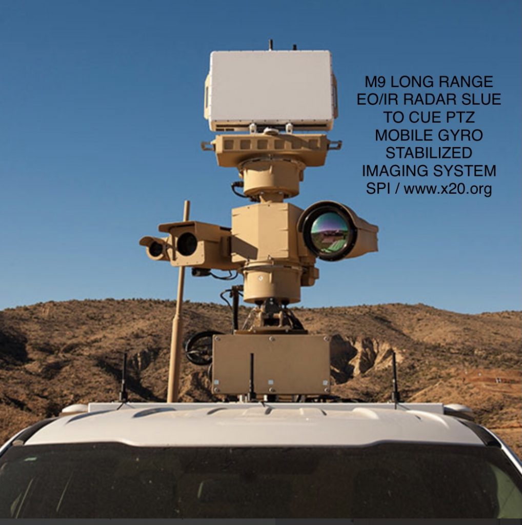
-Radar Ready for Slew To Cue Integration
-Long Range Eye Safe Laser Range Finder
-Ideal for Security/Anti-Terrorism, Insurgent/terrorist detection and deterrent
-ISO 9001
-MIL STD 810F
-Fully Submersible/Sealed/Nitrogen Purged
-GPS/Compass – Geo Location sensors
-Local Area Gain and Contrast
-Full on screen optoelectronics symbology with relevant positioning and functionality data
-Ultra fast HD CCTV BSI LLL CMOS Zoom Camera with 25mm to 2200mm continuous zoom lens
-Double / 4 Axis Gyro Stabilization built in to the 360 degree rugged PTZ Positioner and Inside the Thermal Camera and the CCTV Camera (4 Layer 4 Axis Stabilization)
-TASS Enhancement In Thermal FLIR camera and Zoom CCTV Camera
-Highest performing Absolute Encoder Resolution
-Direct Drive Servo Motors with no Hysteresis
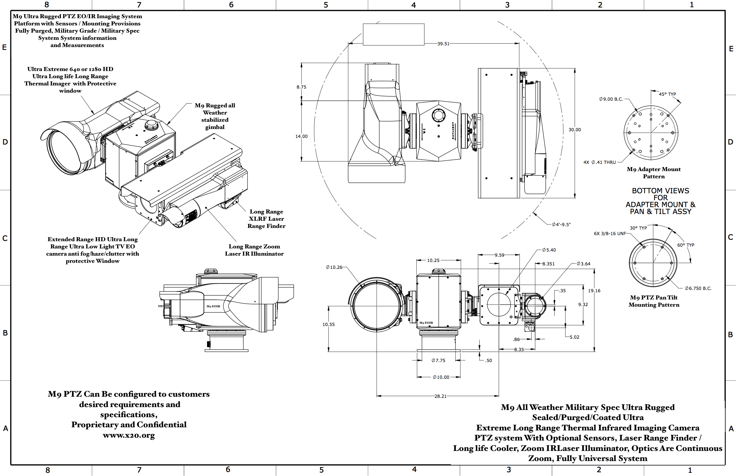
The M9 PTZ Long Range thermal FLIR Imager comes with F4 thermal imaging Zoom lenses Ranging from 250mm to 1750mm, Along with HD Daytime CMOS BSI CCTV
Long range IR Corrected Zoom lenses from 25mm-2600mm, A host of add on Sensors are available to compliment the M9 Platform to meet mission requirements.
The Ip68+ Submersible system is the most rugged Long Range EOIR Day/Night vision Imaging system available.
Ultra Long Range Multi Sensor PTZ thermal and cctv continuous zoom imaging systems with GPS and Compass are used for a wide
variety of land, mobile, fixed and marine applications. The M9 is totally custom built to your exact
Configuration with Long Range Laser Range Finders, and a host of exotic optional Lasers & Sensors. The M9 System Has the industries best
Turbulence/ clutter / fog / haze / smoke / Humidity Mitigation with advanced image correction/enhancement features that gives the user a smooth, crisp detailed EO + IR Image
The gyro stabilized M9 is the absolute highest performing, longest range, most rugged imaging system available anywhere. The weapon grade Ptz pan tilt zoom turret assures you years of trouble free/ maintenance free operation with the safest, smoothest and most rugged steerable positioner gimbaled Turret.
OVERALL PARAMETERS:
-High performance / high definition / High sensitivity – real time thermal imager utilizing minimum 640×512 or 1280×1024 resolution 15Um MWIR (Medium Wave / Mid Wave Infrared IR) Focal Plane Array FPA Detector technology
-The Absolute Most Rugged, all weather Gyro Stabilized system Offering the longest Range, highest performance and ultimate reliability.
-Infrared detector incorporating digital output with no image blooming, halo, streaking & no internal moving parts or choppers.
-ultra heavy duty brushless motor gyro stabilized weapons grade pan tilt zoom positioning steerable turret
-high resolution 1280×1024 sensor available upon request and can be integrated or upgraded into the existing platform
-Long Range MWIR COOLED Thermal EOIR Imaging PTZ zoom Flir
-Low power consumption and proven battlefield technology & reliability – Can operate flawlessly 24 hours a day in any weather condition.
-Smooth Continuous Zoom Carbon hardened/coated MWIR F4 Lenses from 100mm to 1300mm (Internal Gyro Stabilized)
-Fully digital platform with instant Thermal zoom
– Ultra Long ranger Extreme detection ranges of OVER 50 KILOMETERS
-Full 360 degree smooth axis pan Steerable rotation, robust tilt movement gimbal turret payload with HSS Home/Stow/Safety positioning
-Long Range Eye Safe LRF Rangefinder for assessing target or threat distance with on screen symbology
Vector compass heading with real time on screen readout
-Global Positioning System GPS with real time on screen symbology
-Integrated / Rugged 100% duty cycle military Pan Tilt positioning platform with
variable speeds and user selectable scanning presets + V/H positioning indicators and camera location indicator
-Advanced Auto Imaging modes with Auto Image Enhancement
-Auto target thermal detection threshold to assist in threat assessment and location
-Automatic Internal temperature controls for use in extreme cold or hot / humid climates
-Gyro Stabilized inside the PTZ Housing as well as the Cameras (Rock Steady Imaging at extreme long ranges or harsh environments)
-Fully militarized weatherproof / waterproof Rust and corrosion resistant System, Built to withstand harsh environments. Fully Nitrogen Purged
and includes internal desiccant. US Military Approved/Rated / Compatible with US Military or Standard Commercial Commands
-Fully sealed w/military qualified cables and connectors and cable coatings
-Crosshair Indicator
-Plug-N-Play setup and installation. Systems are checked & calibrated prior to shipping & include a 1 year warranty. MADE IN USA.
-Reliable System which can withstand 8G Vibration & 50g, 11 ms, 1/2 sine Shock & will function while moving up to 130 MPH
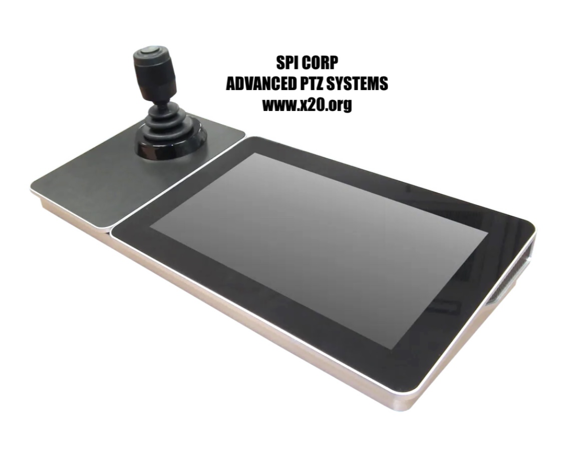
-Robust hand controller that can be operated with or without NBC gloves & has simple toggle switches for instant sensor commands
-System includes all cables, connectors, hand controller joystick, TFT flat panel LCD monitor
-Operator has full control via programmable electronics of individual sensor functions for custom applications, specific missions and harsh
environment settings.
-System is PELCO / Universally compatible and can easily be configured into your existing network
-Sensor fusion/image blending of 2 sensors for increased situational awareness and detection capabilities. Image fusion mixes both thermal and CCTV/SWIR into one scene.
-GUI providing control is provided. A serial command and telemetry protocol is also available, allowing custom integration.
-System is from typical 12-volt D.C. power and not draw more than 2.5 amps, While in continuous motion. The system will be delivered
complete and ready to install w/all cables, monitor, hand controllers, software & standard accessories. Burn in test performed for 7 days prior to shipping
-Extreme Long Life Component survivability and reliability
-Engineers Available at no cost to customer for integration / installation and training assistance.
-The Absolute highest reliability, longest lasting military sealed coolers ensure uninterrupted imaging for years.
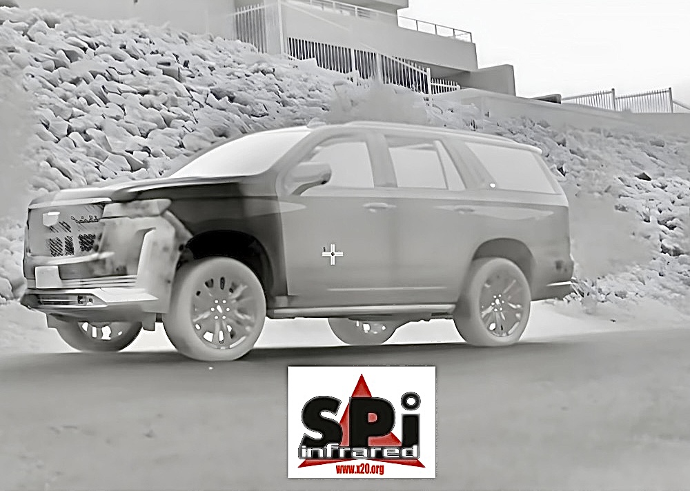
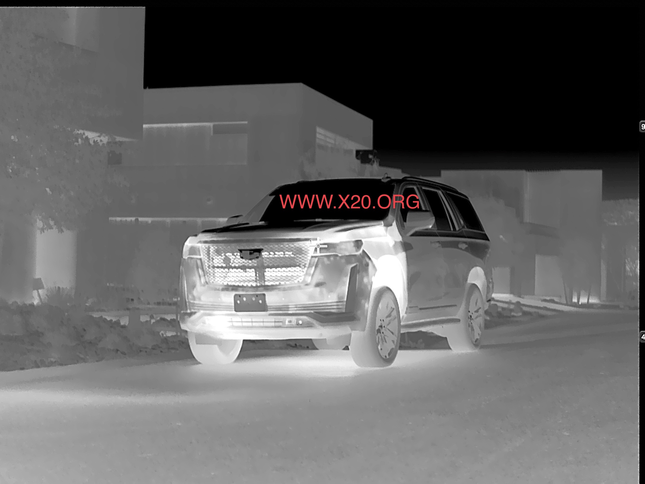
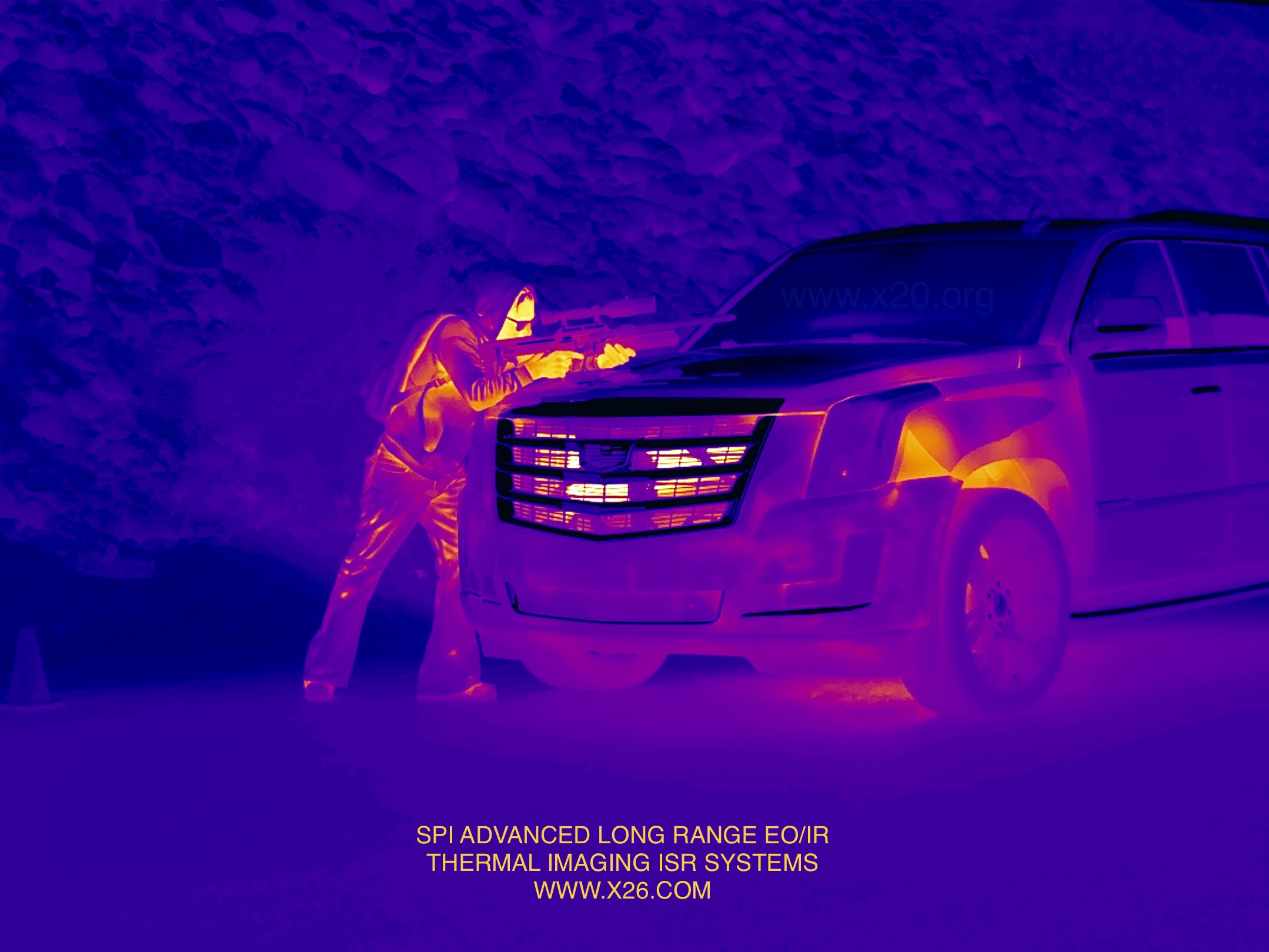
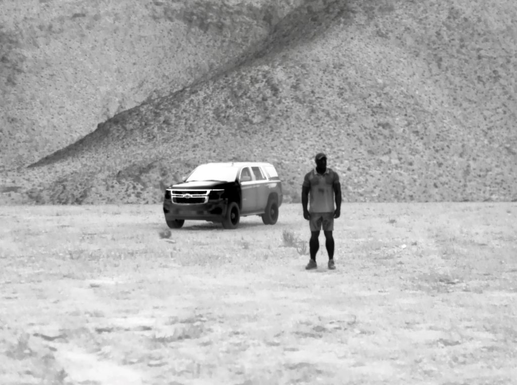
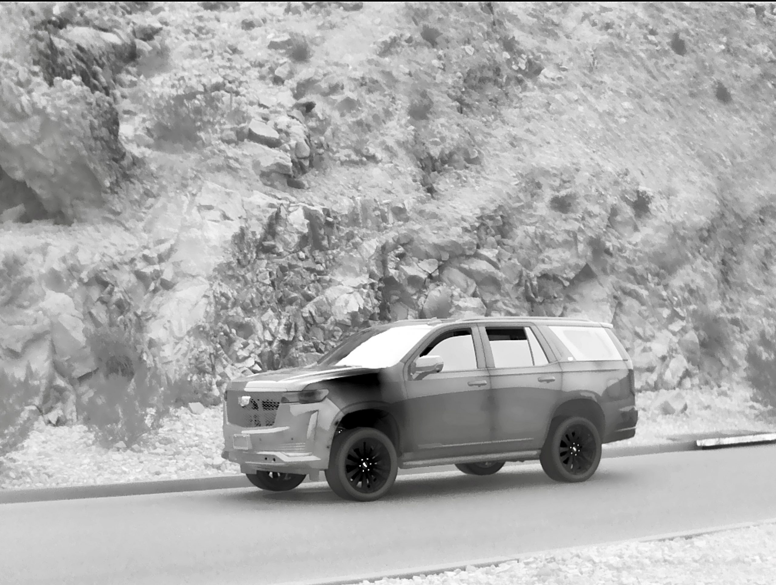
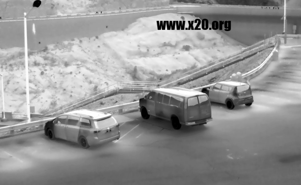
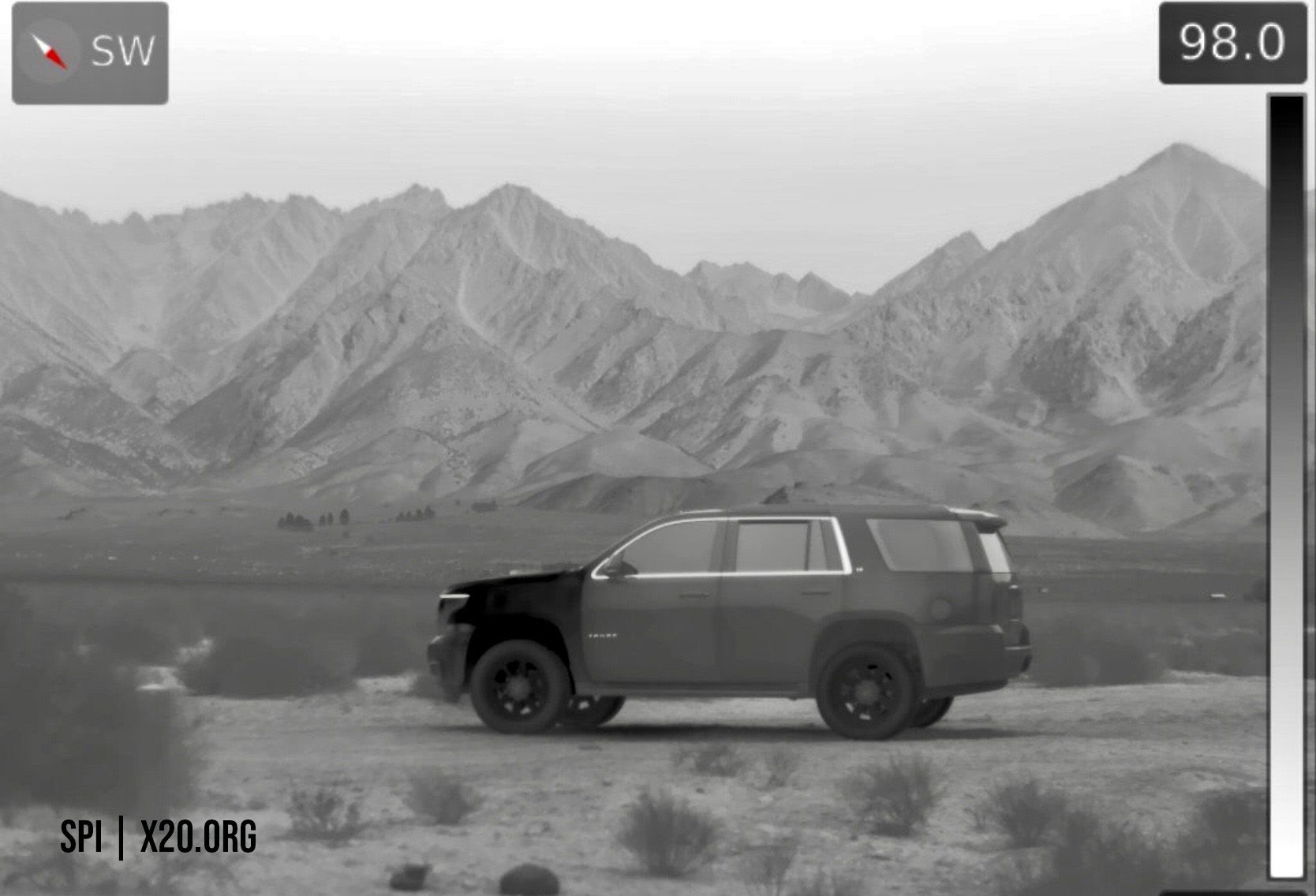
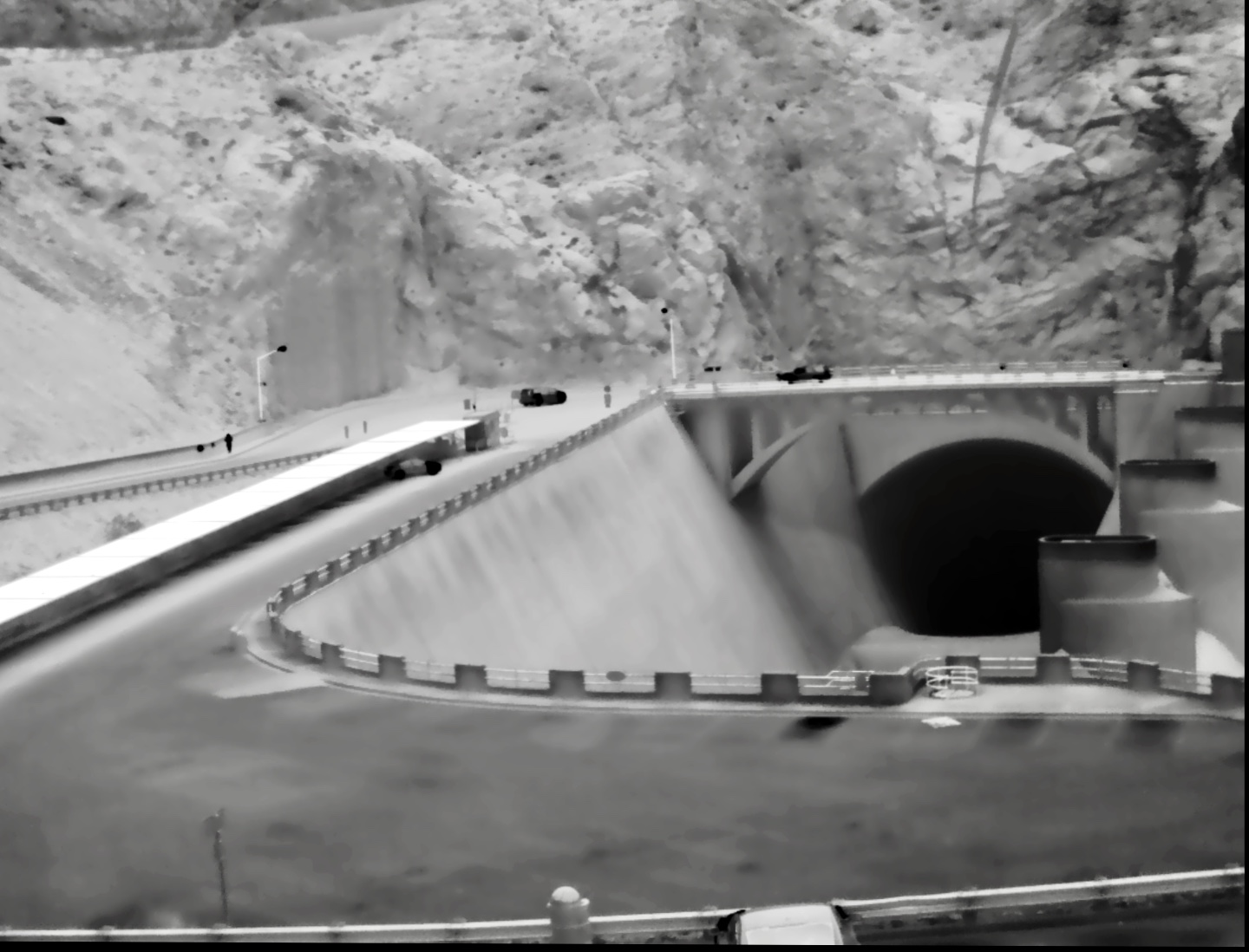
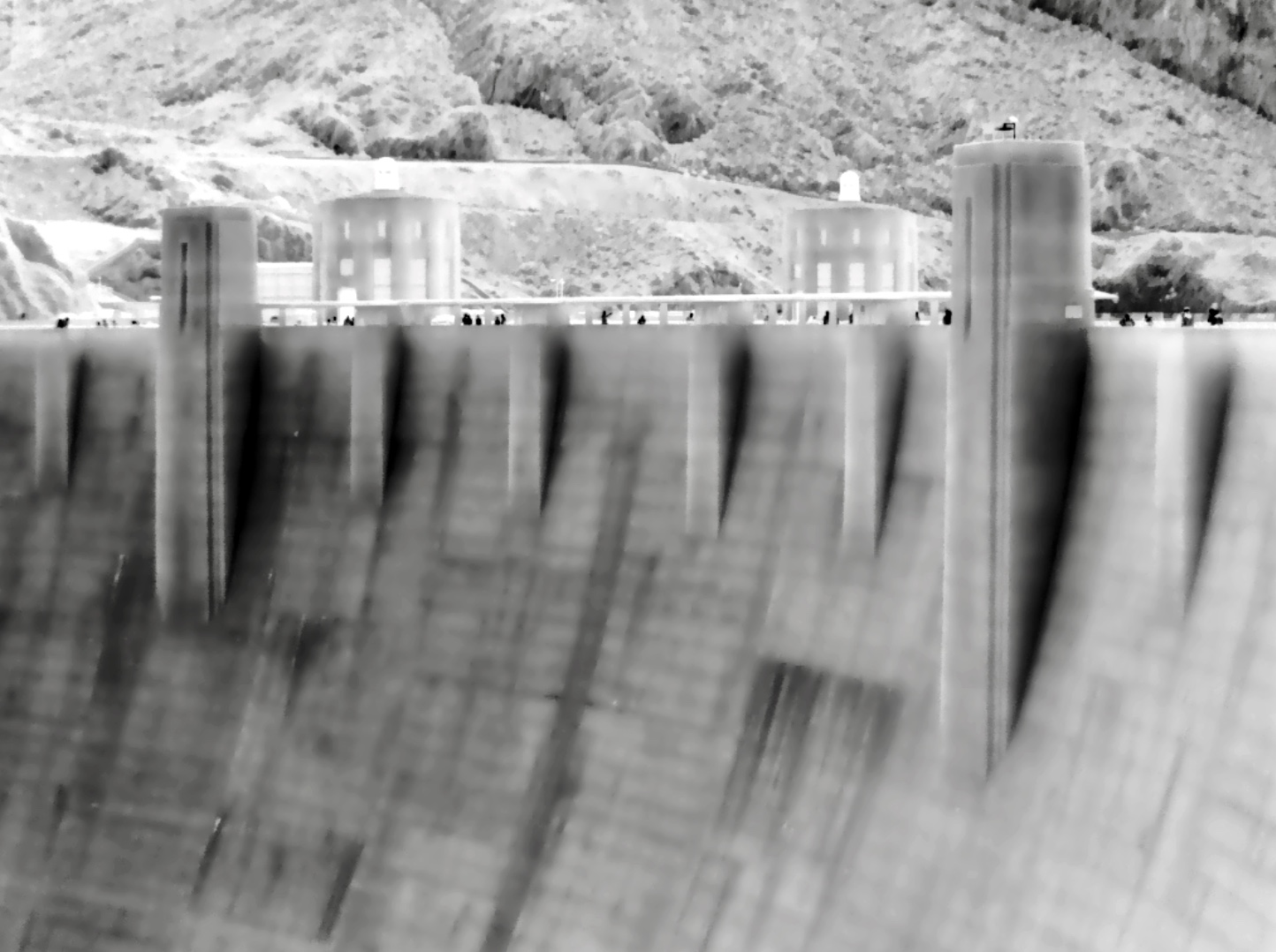
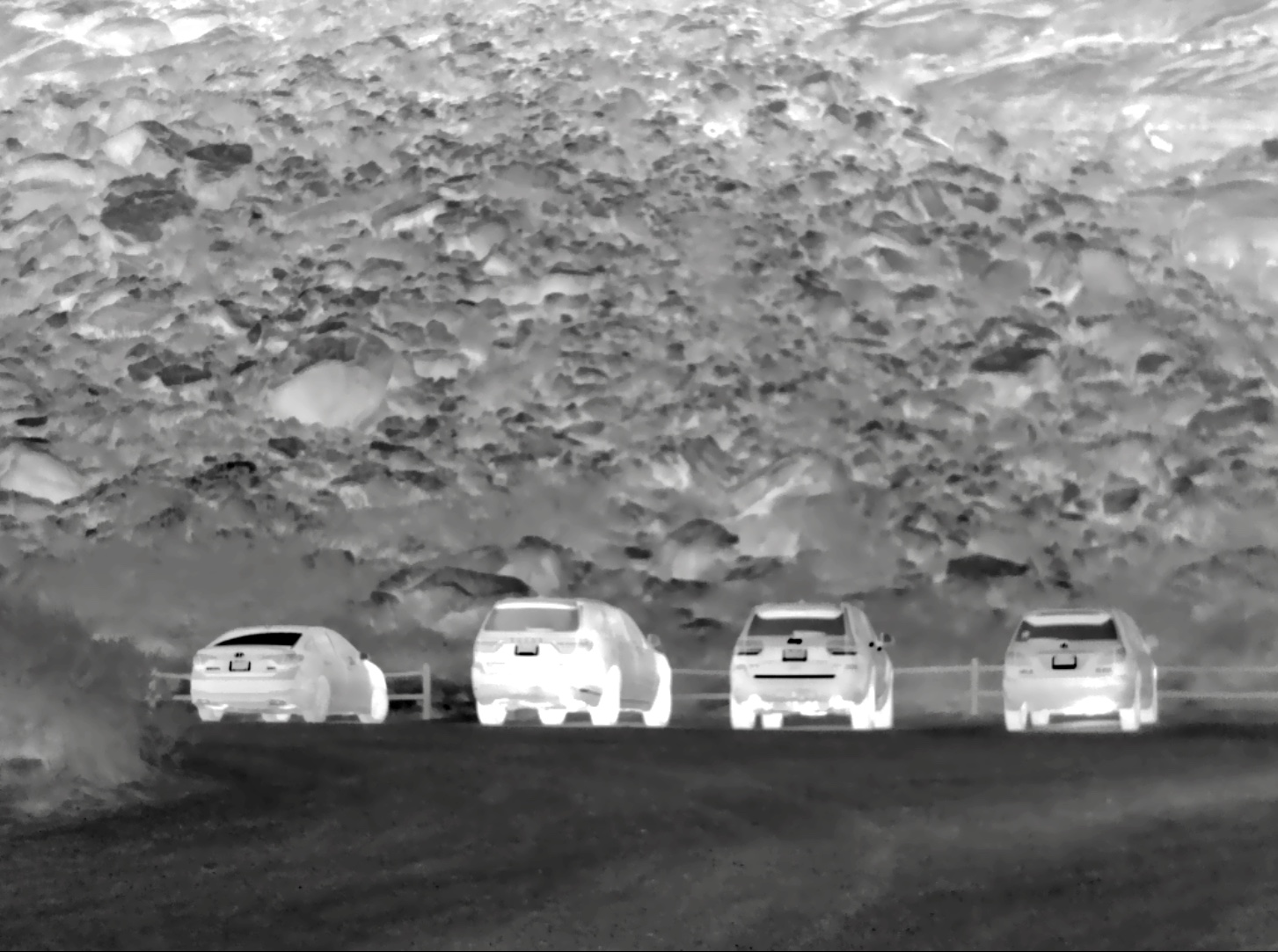
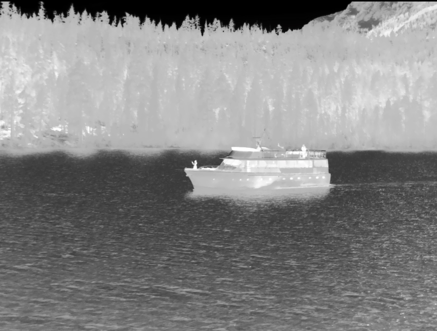
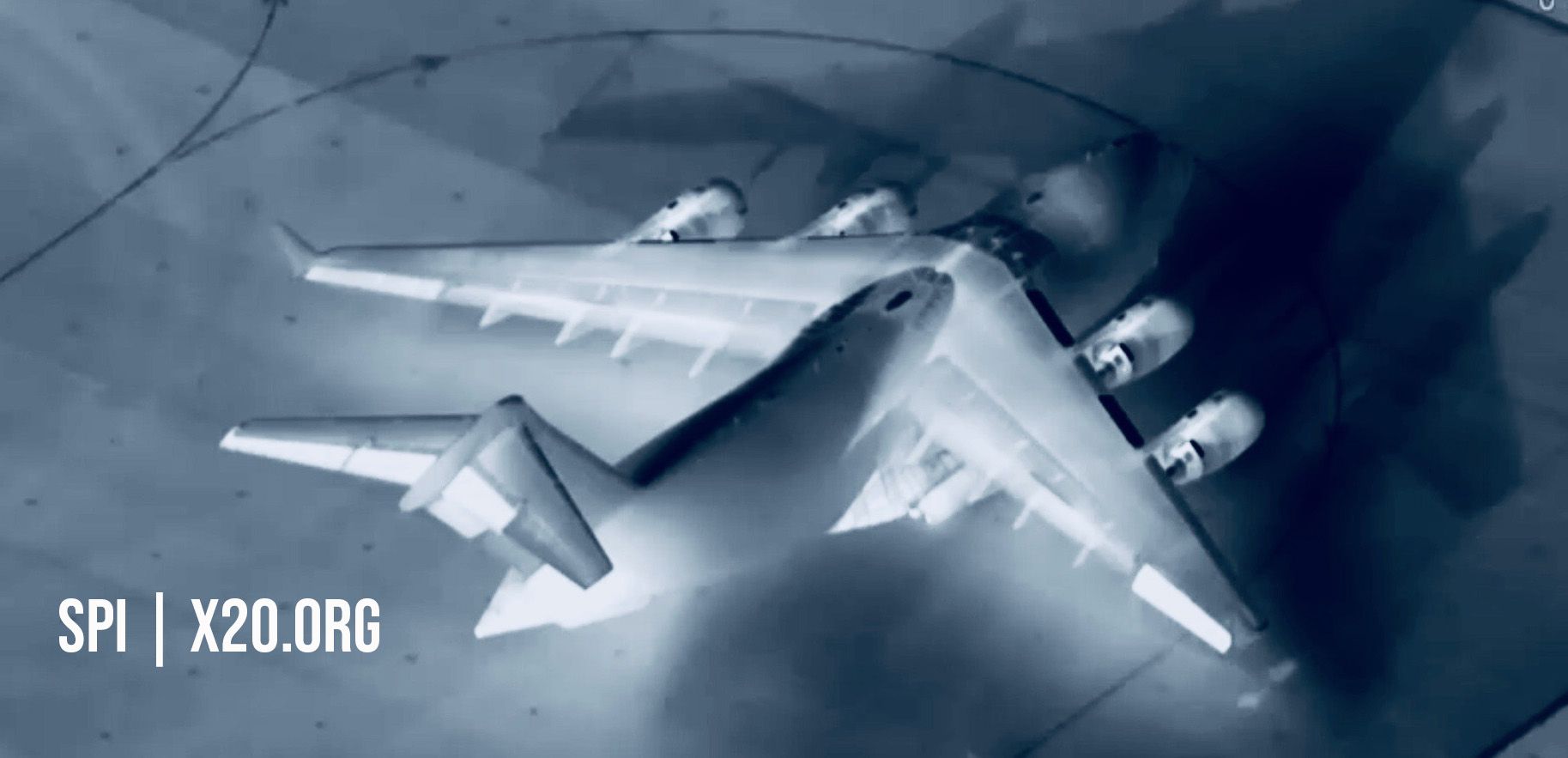
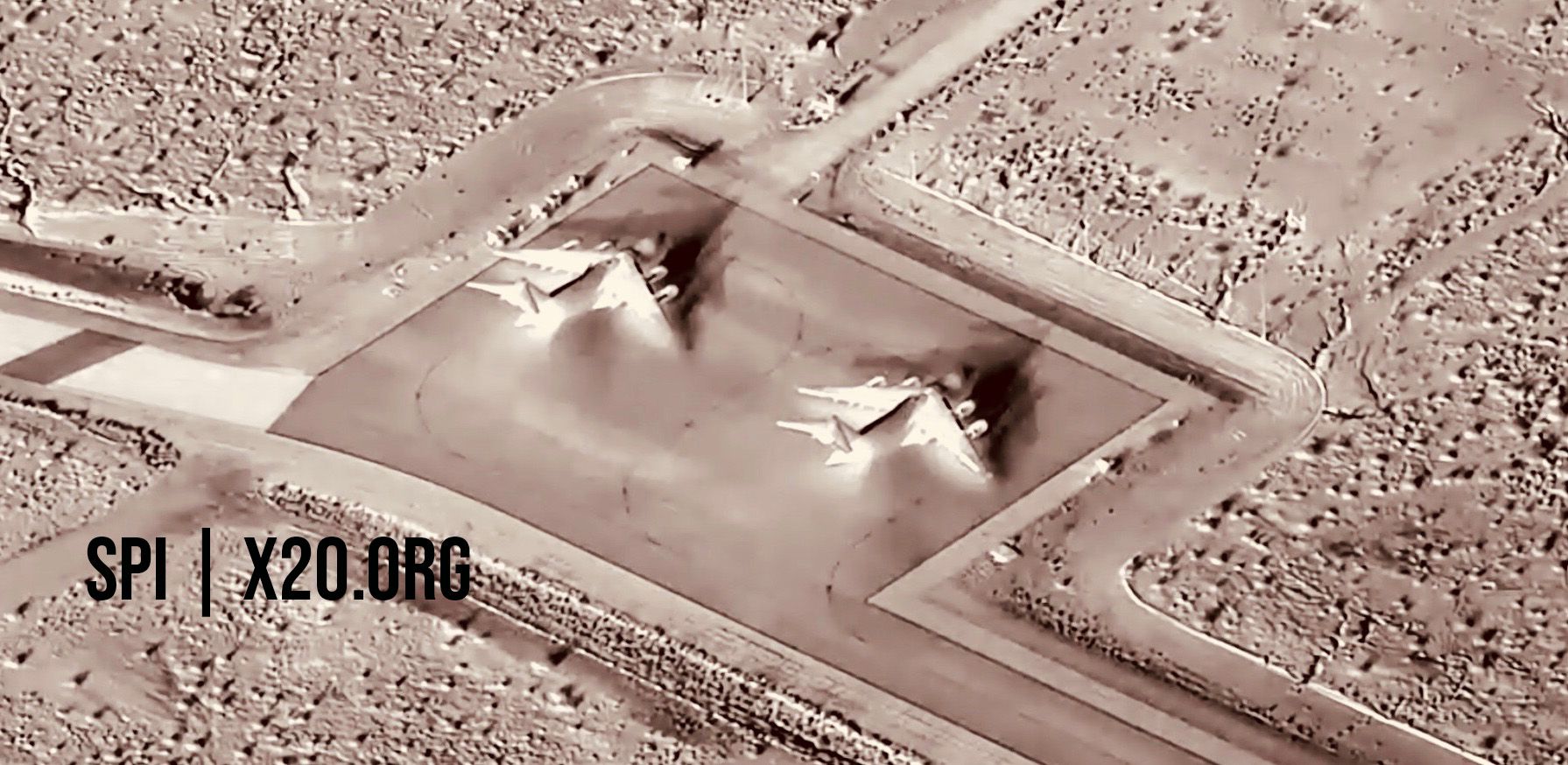
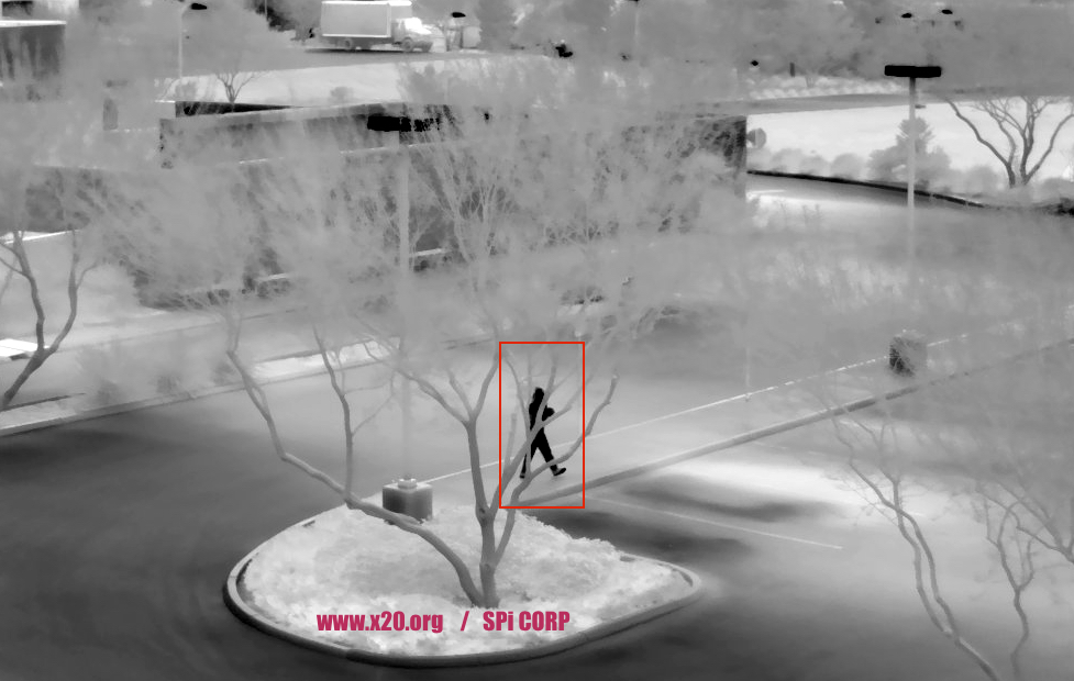
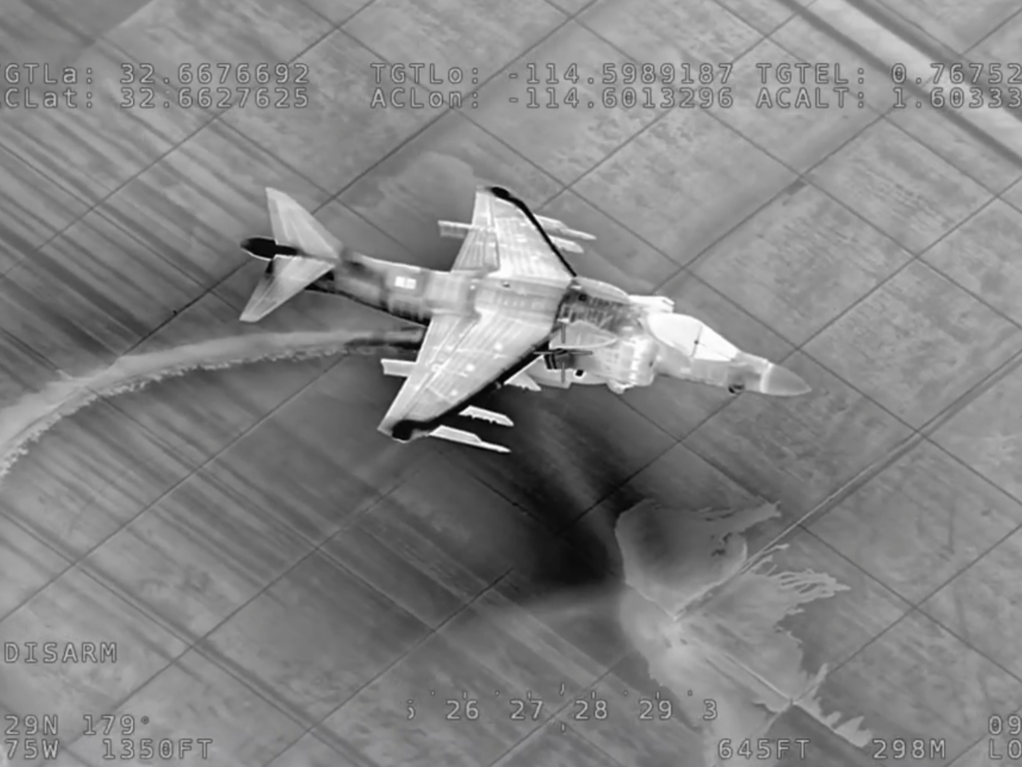
The Ultra Long Range stabilized 15Um COOLED MWIR M9 is a highly sensitive mid-wave IR camera designed for long-range surveillance and security applications.
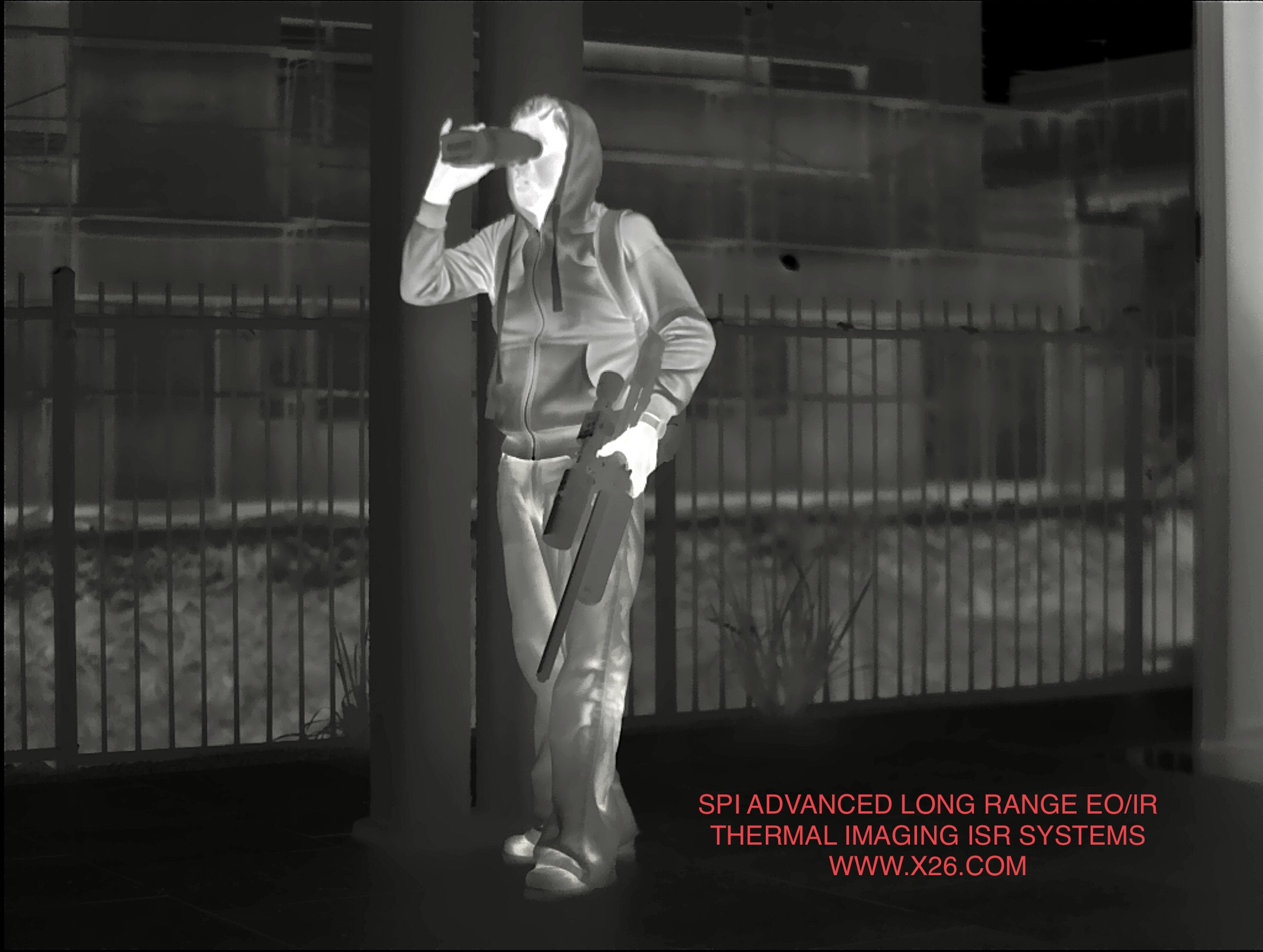
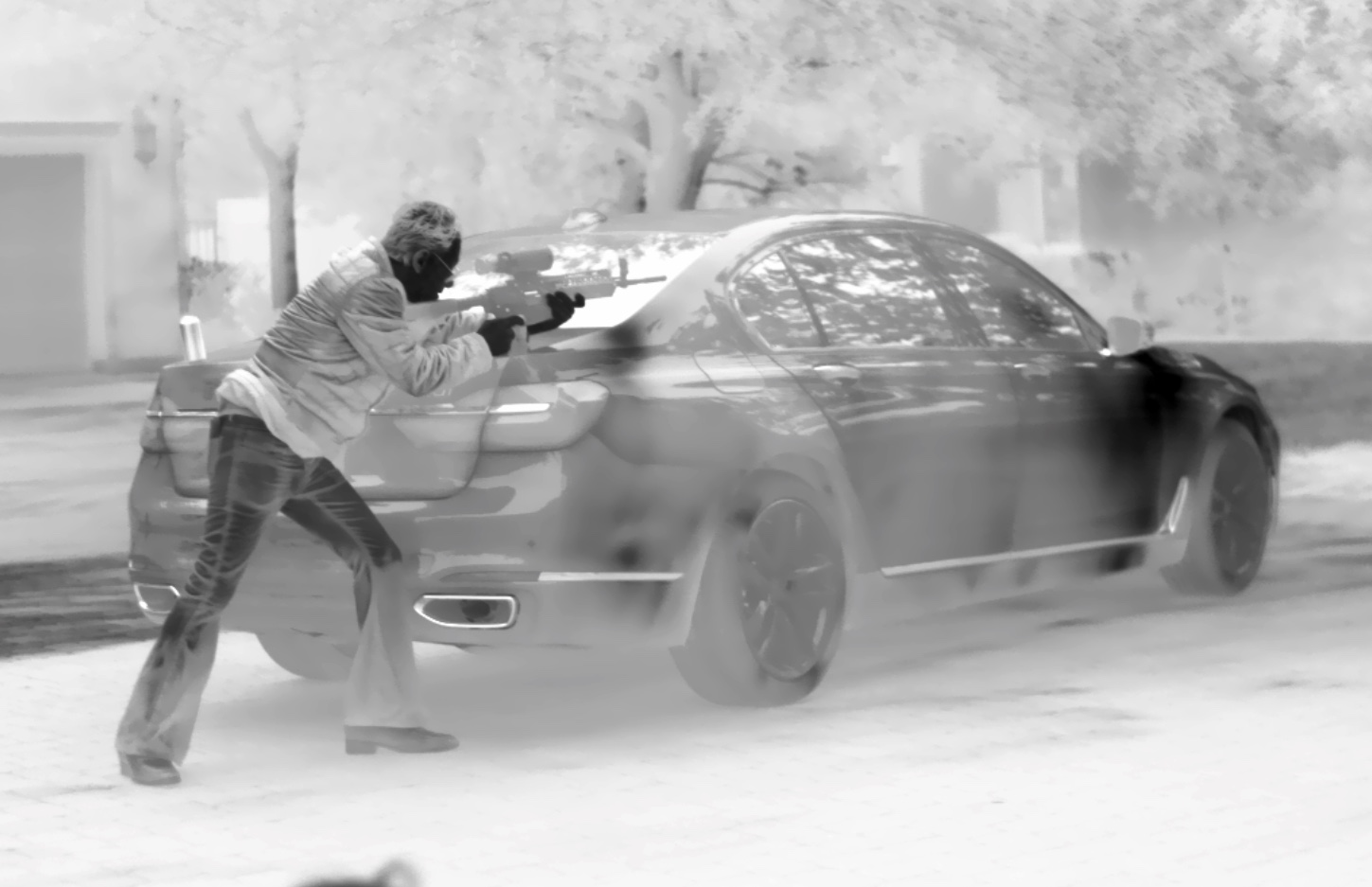
Ultra Long Range Stabilized F4 100 to 1300mm Lenses allow for detection ranges of over 50 Km with an auto focus optical continuous zoom lens, The enhanced image processing features brings out subtle details missed by other imaging cameras, the M9 Detects target That other cameras cant track. The Ultra Long Range Lenses allow for great situational awareness and long standoff distances between operator and target. The M9 is capable of achieving visible and infrared NIIRS 9, NIIRS 8, NIIRS 7, NIIRS 6, NIIRS 5, NIIRS 4, NIIRS 3, NIIRS 2, NIIRS 1
Both the CCTV and Thermal Sensors are Electronically and Mechanically Stabilized and offer Integrated TASS and full internal weather controls/climate stabilization. Our robust Radar integration allows for slew to cue/slew to alert with the aid of radars, VMS, tracking alerting and detection software suites are available for the m9 system.
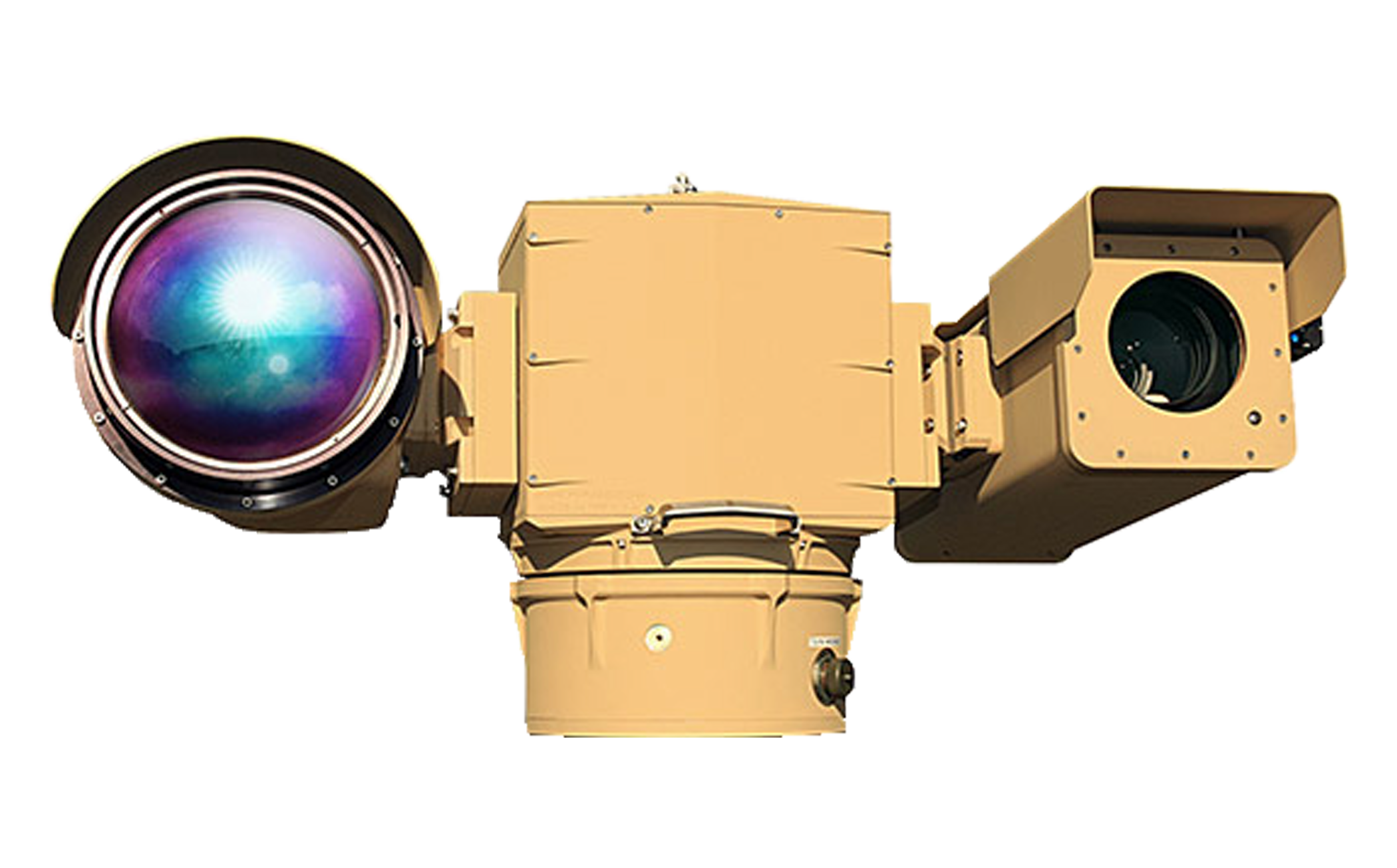
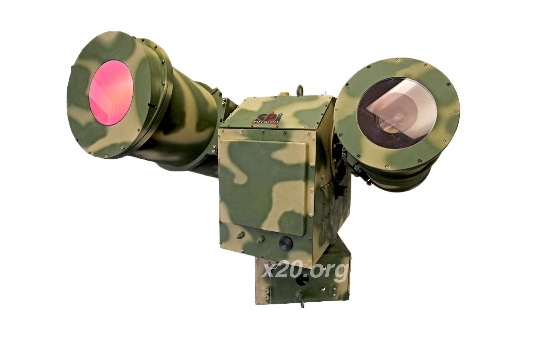
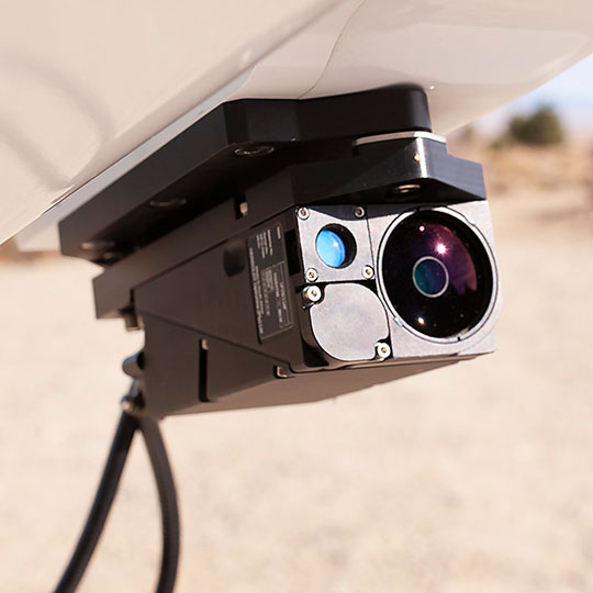
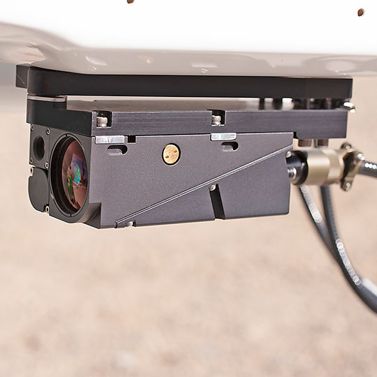
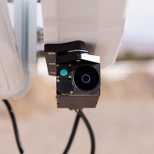
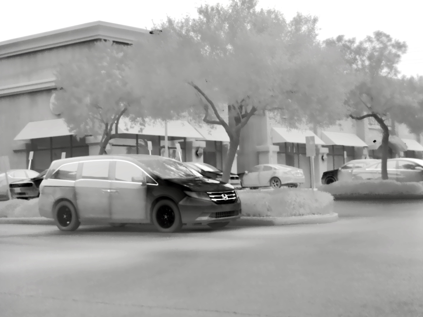
The Ultra Long Range Visible Sensor is a high sensitivity daylight camera with exceptional color and superior low-light capability that can be used for target detection and identification in challenging conditions. It is configured with a 2200mm optically stabilized continuous zoom lens and a multi-mode high sensitivity CMOS HD Backside Illuminated camera. The system includes an integrated TASS image processor to provide enhanced imaging capability in hot Tropical conditions. The M9 is a premier Advanced Next Gen Long Range MWIR COOLED Thermal EOIR Imaging PTZ zoom Flir Camera system.
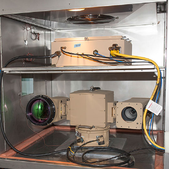
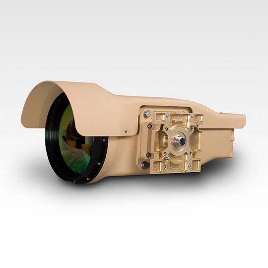
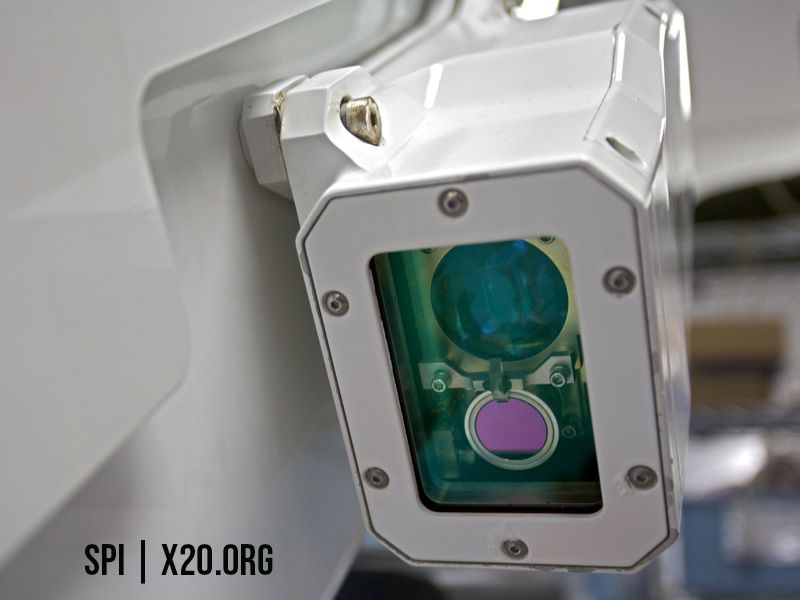
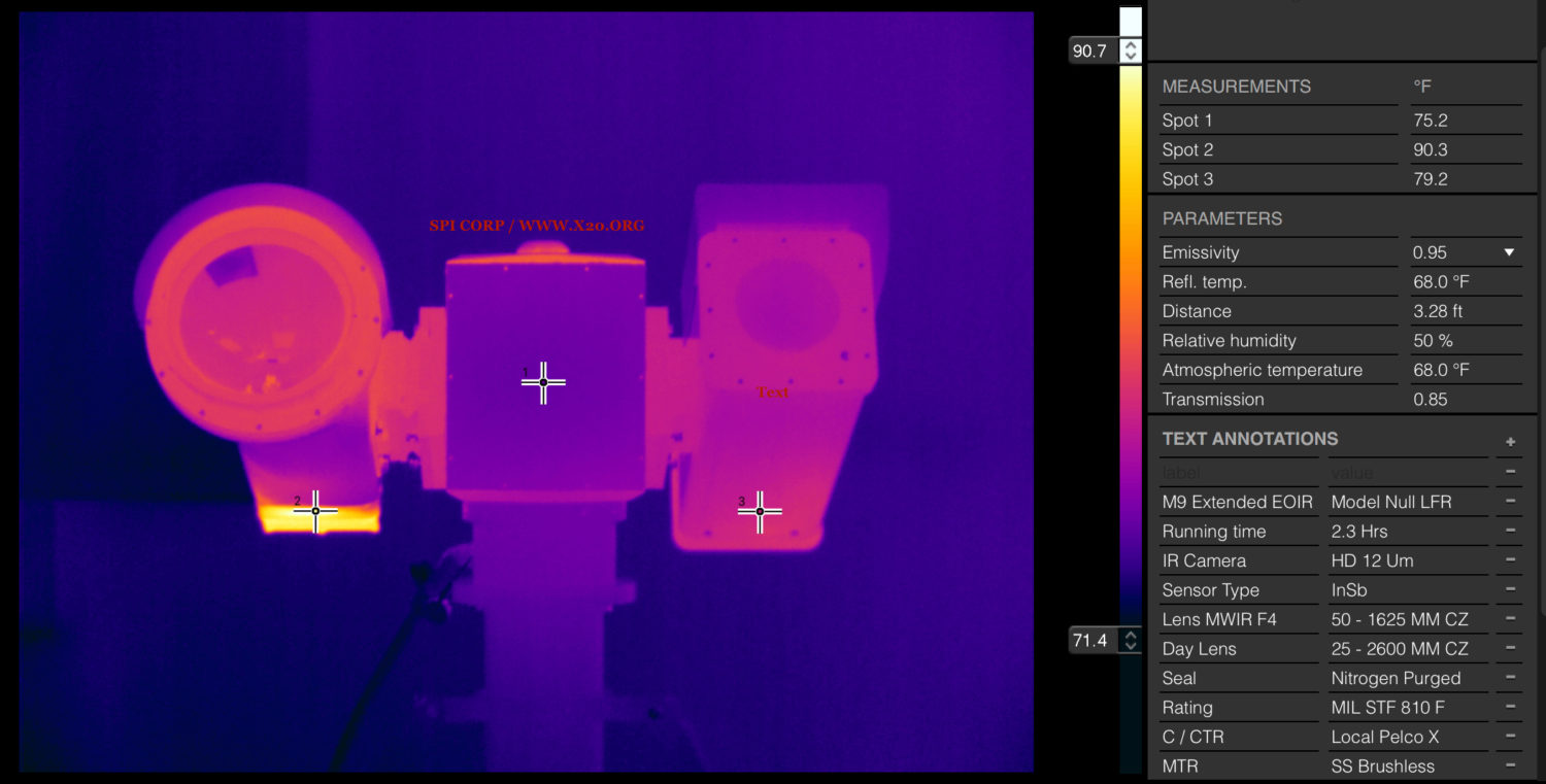
The System Rated to US Military ratings & is Ultra Ruggedized/ 100% Duty Cycle with battlefield proven performance, The Entire System is fully universal and offers stability, durability and ease of deployment. Installed in the Front of the EO and IR Cameras are ruggedized hardened Gm and Vis Windows to protect the Internal Optics.
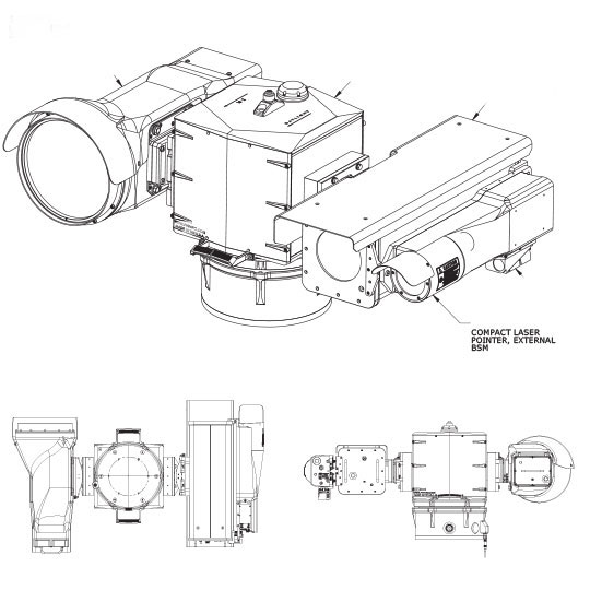
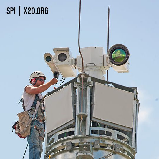
The system combines SPI’s proven bore-sight assembly design in an externally mounted configuration, that provides ease of adjustment, extraordinary stability and isolation from harsh environments. System power, serial interface and video output are all provided over a single hermetically sealed Military approved/Rated series connector.
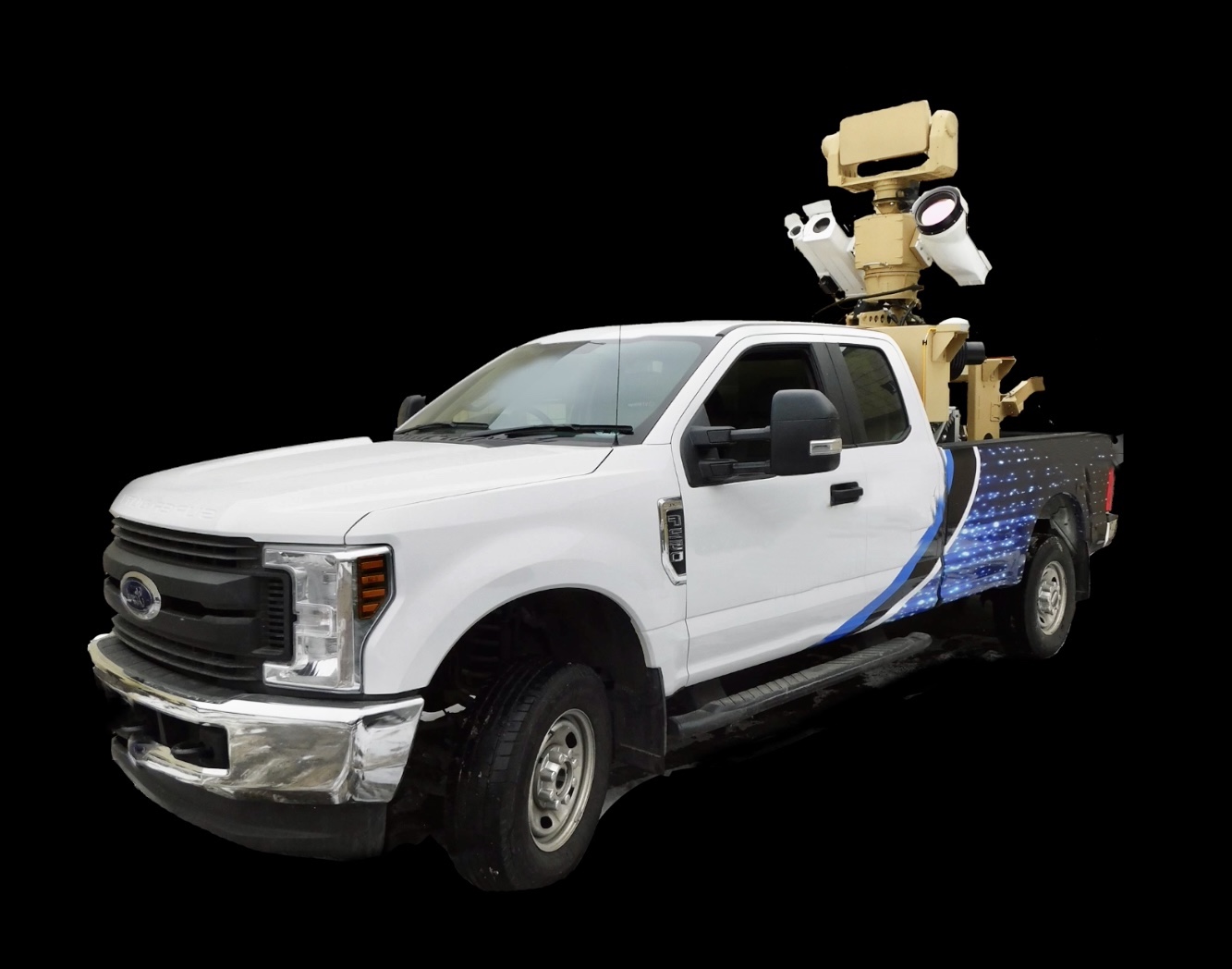
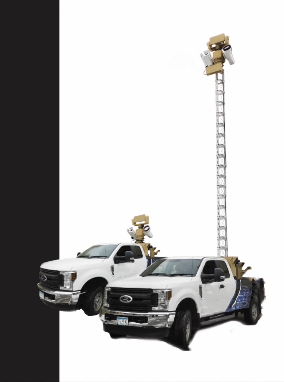
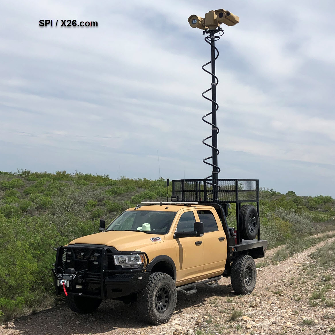
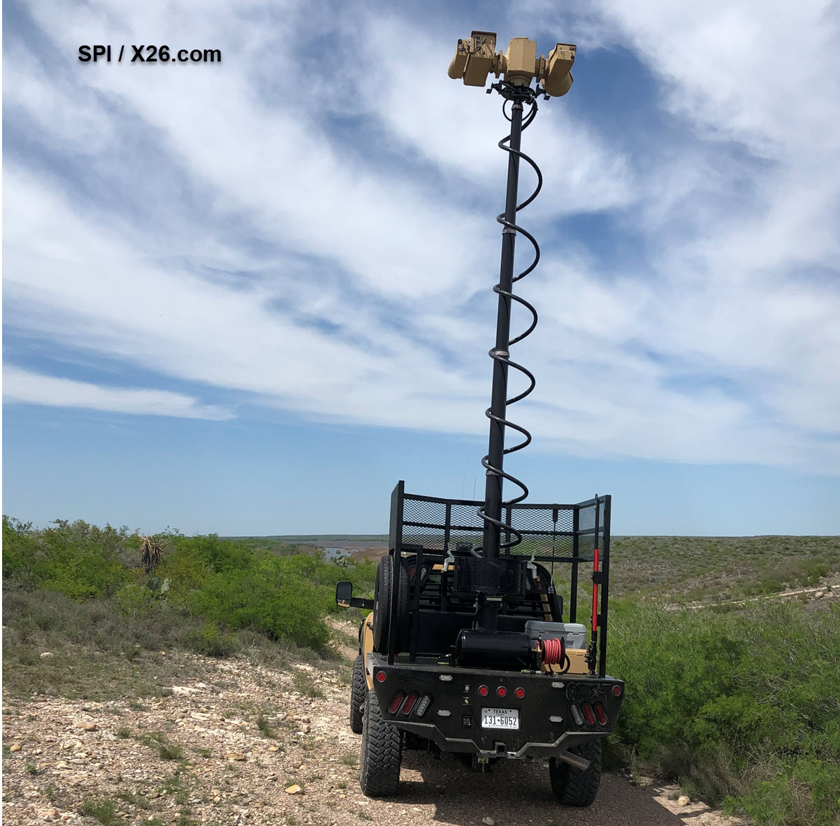
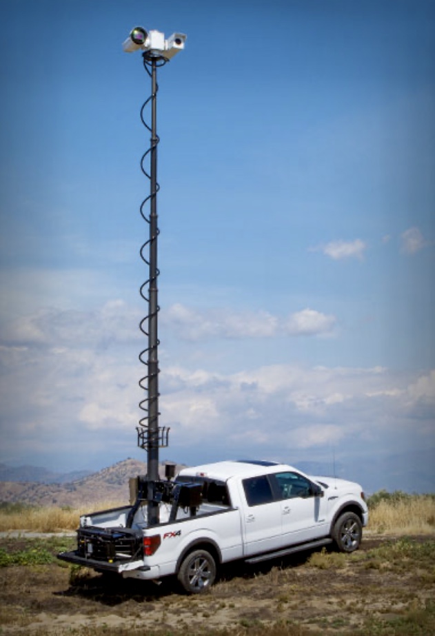
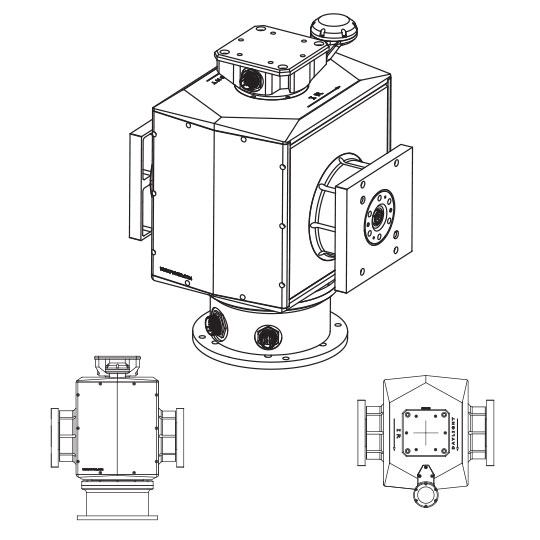
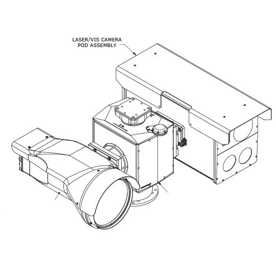
The M9 Steerable PTZ Positioner uses the absolute highest performance parts, it is a high-performance pan & tilt system well suited for day/night surveillance, Border Patrol, Coastline Patrol, scope truck mobile / mast mounted and General Security monitoring & perimeter security. The 4 Axis, 4 Level Gyro Stabilization is the top of the line in the industry and keeps the imagery rock steady even at full telephoto zoom, Equipped with a cooled MWIR FLIR thermal Camera and a Low Light CMOS BSI visible camera, the system has optional sensors as well, including a laser rangefinder, laser pointer/designator, and laser zoom imaging illuminator, as well as SWIR / NIR and LOW LIGHT COLOR NIGHT VISION. The M9 Family of long range multi sensor ptz gimbal systems are the most potent border patrol, border protection security and surveillance systems available anywhere.
Combining design elements from our field proven absolute encoders and servo motor direct drive train, the M9 provides extremely high pointing accuracy and performance in a small, light weight package with significant payload capability. Designed to operate in mobile / mast or stationary installations, it offers extraordinary flexibility and ruggedness, and provides continuous operation with no scheduled maintenance, even under extreme conditions.
All elements of the system are controlled over our Easy to read and understand & Operate graphical user interface. The interface includes universal external control functionality, allowing the system to be controlled with any of the currently fielded commercially available protocols & utilizing an internal user configurable command table. This external interface may be accessed through Ethernet or a local direct serial connection. ONVIF, IP, ETHERNET, 3G, WIRELESS and REMOTE operation is available
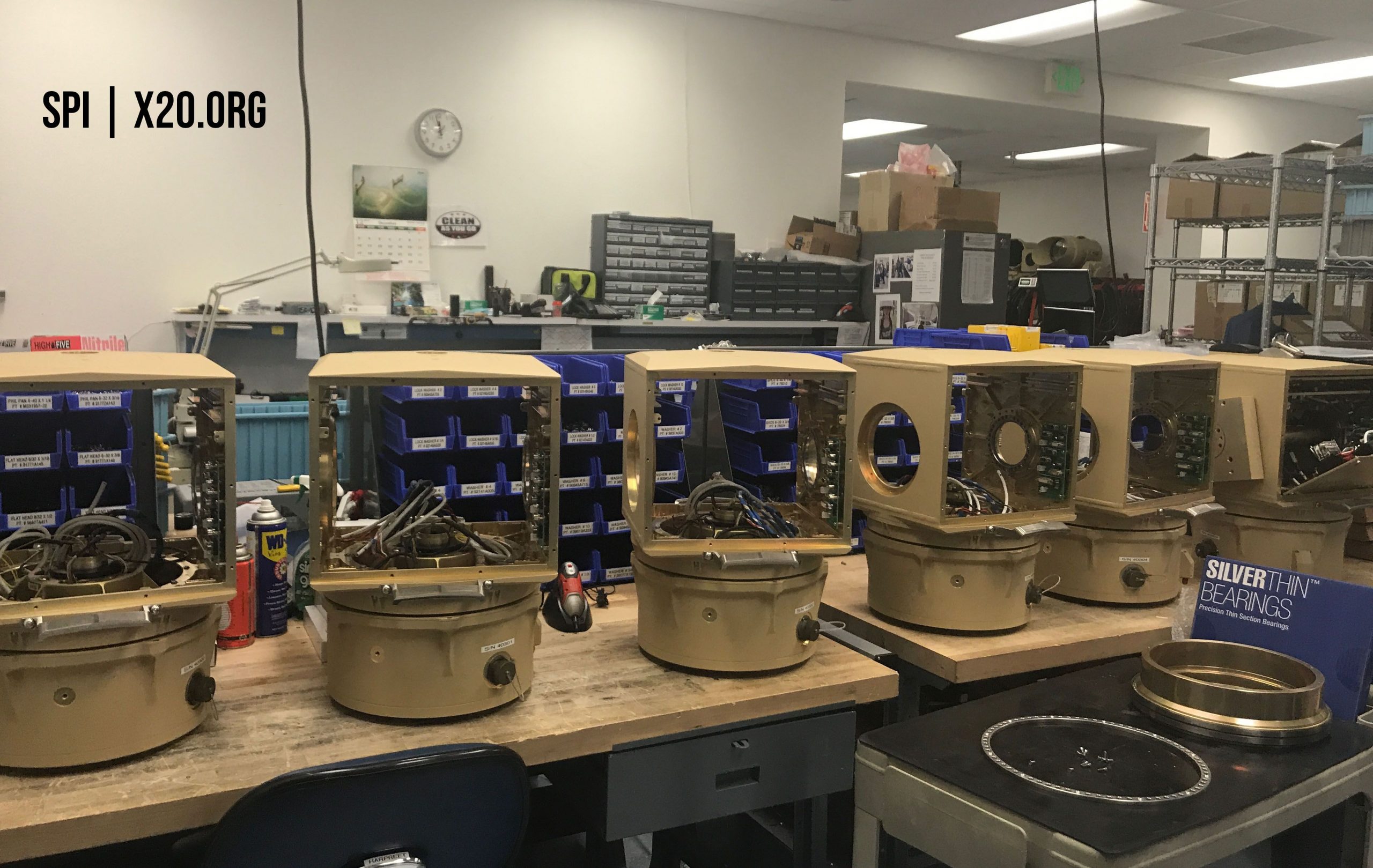
The M9 offers hot swappable, interchangeable sensors which are factory pre-aligned and mounted via precision guide pins, four captive bolts, and a TASS weatherproof connector, allowing sensor swap to occur in 4 Minutes or less with one person. Secondary or new sensors may be added and control code loaded remotely via LAN or Ethernet. The system incorporates the highest quality, ultra long life military coolers for years of reliable trouble free imaging.
APPLICATIONS;
Military combat surveillance applications
FOB perimeter/critical facility infrastructure, high value security
Border / coastline / scope truck / homeland security / AWD / 4×4 / All Terrain /frontier patrol & security
Security and surveillance, WAMI, ISR, C2, C4ISR, RSTA
Fully Integrated Sensor Suite
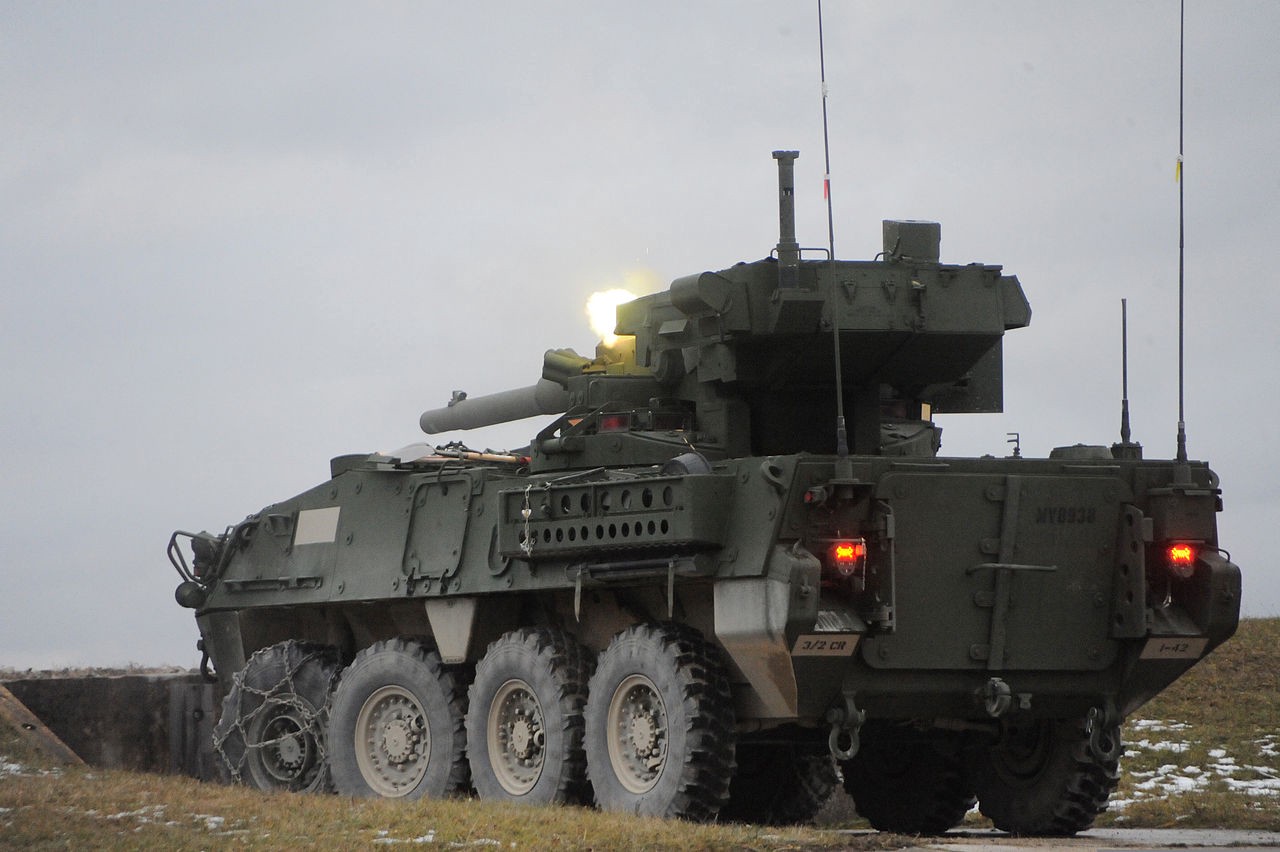
Tactical Combat armored vehicle
Law Enforcement
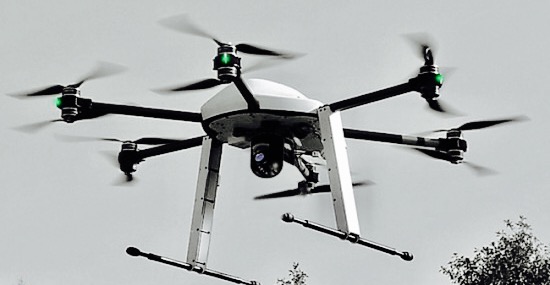
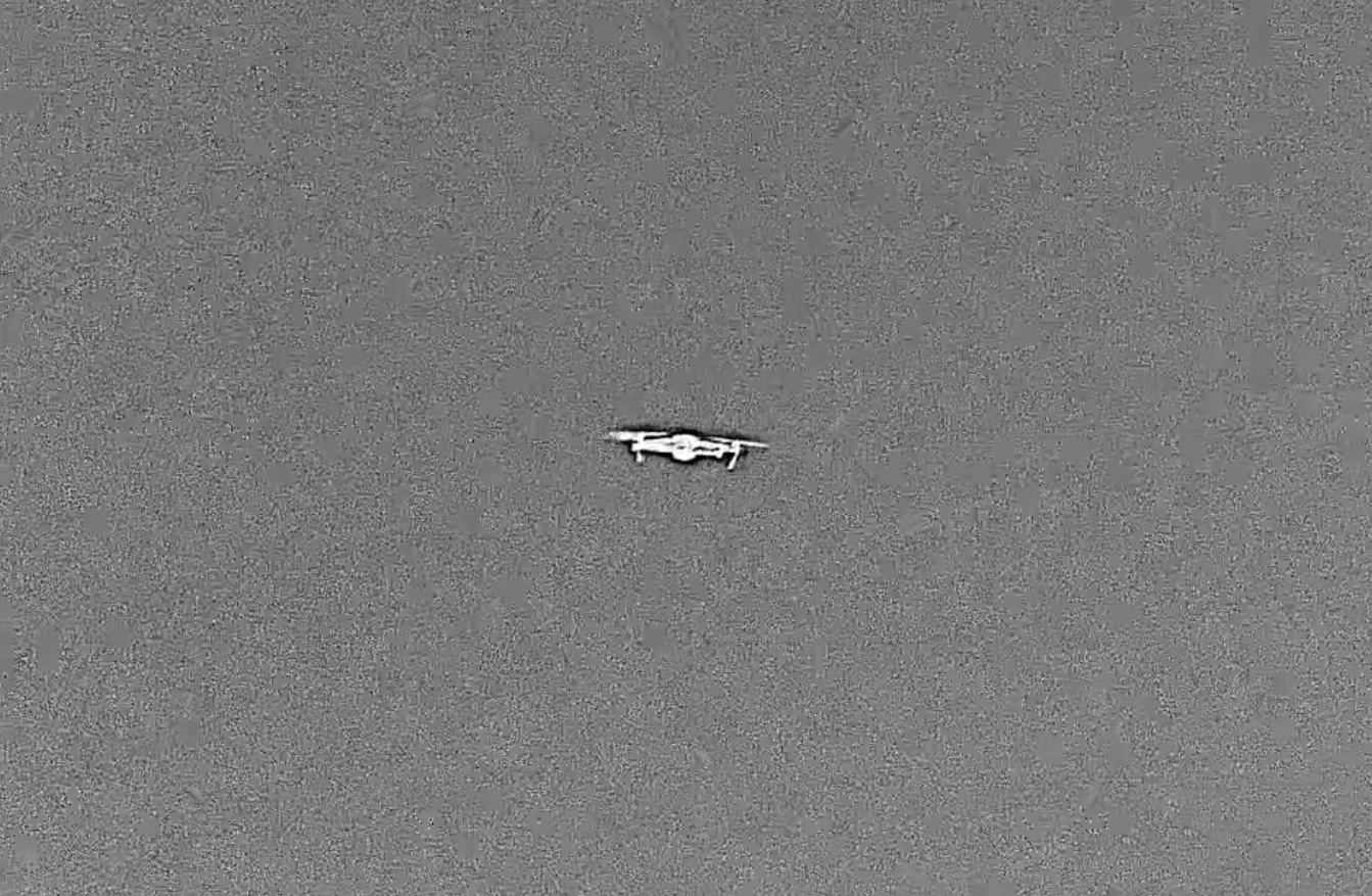
Drone/UAV/UAS/SUAS Detection
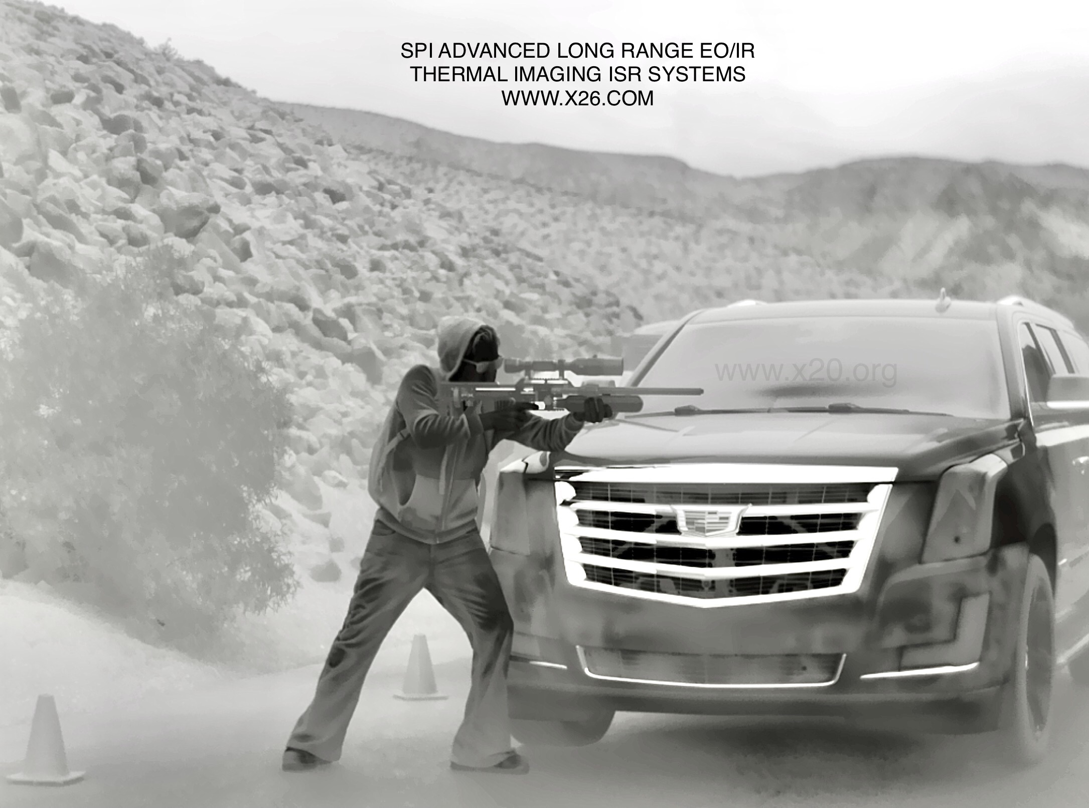
IED Detection, long range biometric facial recognition
Critical facility security (power stations, prisons, government offices)
Mobile, mast or tripod mounted for sea & land monitoring
Vehicle safety applications (railways, mines, heavy equipment)
Cruise ship man overboard detection & rescue
Land & sea security, search & rescue operations
Border//Frontier/Shoreline/Coast/Runway/Airstrip/Tripod/Radar Applicable
Laser IR Diode illuminators available in a variety of ranges from short/medium, long and ultra extreme long range
Military/Law Enforcement/Search and Rescue/Coastal/Frontier/Border + DEA & SWAT applications
Windows or MAC software compatibility
Remote operation with Ethernet, ip, fiber, solar, wireless, microwave gps and compass radar compatible slew to cue, slew to alert and alarm detection
Software development kit (SDK) for customized functionality / command and control
- Combining design elements from our field proven absolute encoders and servo motor direct drive train, the Ultra Rugged IP68+ M9 Long Range PTZ FLIR Thermal Imaging Camera provides extremely high pointing accuracy and performance in a small, light weight package with significant payload capability. Designed to operate in mobile or stationary installations, it offers extraordinary flexibility and ruggedness, and provides continuous operation with no scheduled maintenance, even under extreme conditions.
- All elements of the system are controlled over our GUI graphical user interface. The interface includes universal external control functionality, allowing the system to be controlled with any of the currently fielded protocols (i.e. TASS, Pelco D) utilizing an internal user configurable command table. This external interface may be accessed through Ethernet or a local direct serial connection. Multiple command and control Analog and digital IP Ethernet options are available.
- The M9 Long Range PTZ FLIR Thermal Imaging Camera offers hot swappable, interchangeable sensors which are factory pre-aligned and mounted via precision guide pins, four captive bolts, and a blind-mate weatherproof connector, allowing sensor swap to occur in 5-minutes or less with one person. Legacy or new sensors may be added and control code loaded remotely via LAN or Ethernet.
- The M9 Long Range PTZ FLIR Thermal Imaging Camera is well-suited for mobile and stationary applications including force protection, border and port security, tactical reconnaissance, and long-range surveillance. Machined from solid bar stock and supported by heavy-duty bearings, the large diameter elevation and azimuth shafts provide significant structural margin for mobile applications and operation in high wind environments. The modular design allows the gimbal base and yoke structures to be supplied with a range of length dimensions, from small to large scale, to support multiple user requirements. This provides a family of gimbal configurations with a common interface to significantly reduce software development and integration costs. As with all M9 Long Range PTZ FLIR Thermal Imaging Camera System use absolute encoders with a direct drive train providing extremely high pointing accuracy and repeatability.
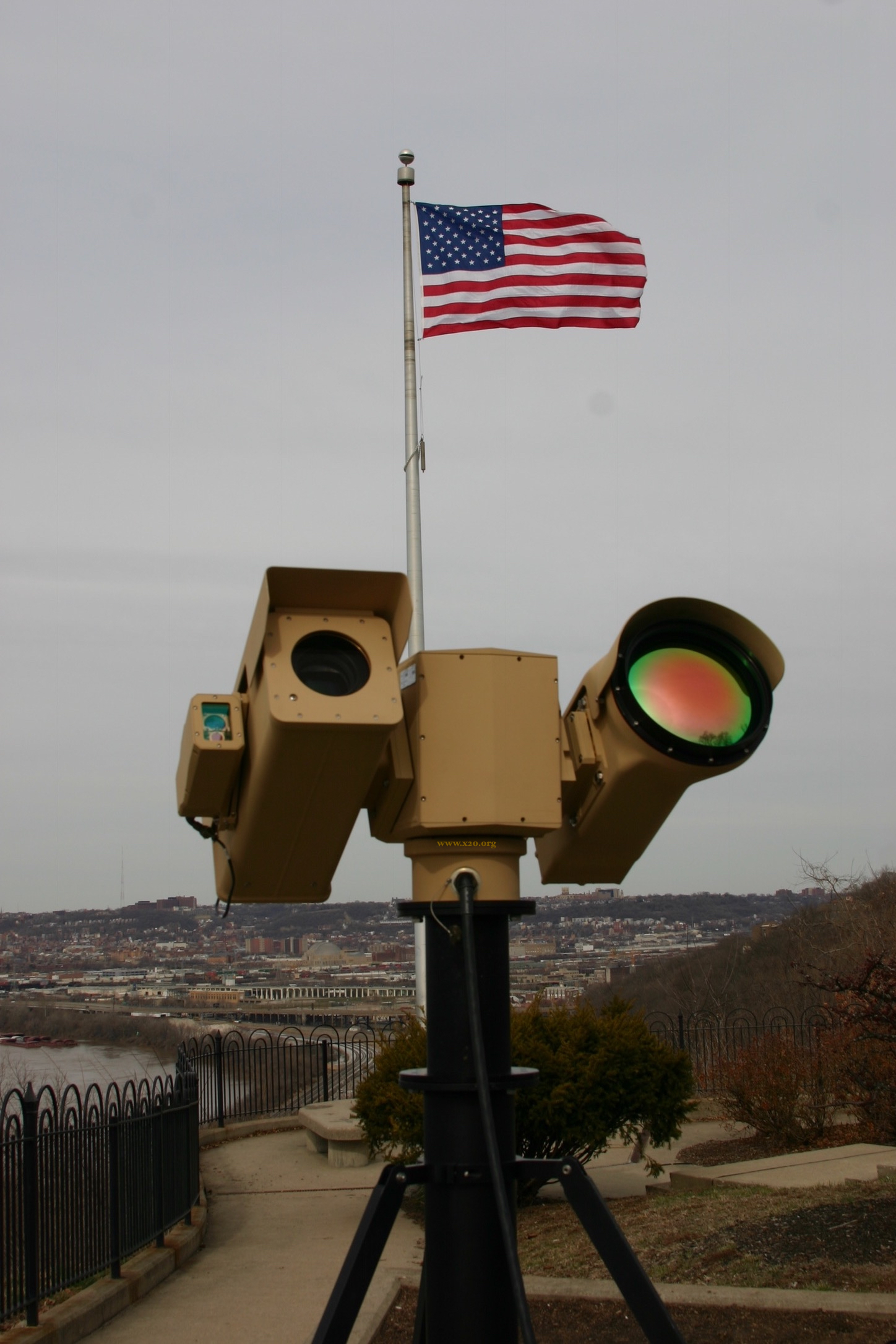
- The Long Range Zoom Laser Imaging Illuminator system provides variable field of view and uniform illumination out to ranges in excess of 5,000 meters to point out and illuminate targets, with sufficient coverage area for use with Multiple cameras and Night Vision Goggles (NVGs) in darkness. The laser illuminator is packaged in our fourth generation sensor enclosure that combines over 20 years of field proven performance with incremental improvements to enhance performance, stability, durability and ease of deployment. Designed to withstand the harshest conditions and environments, this configuration has been successfully deployed in both mobile and fixed homeland security roles throughout the United States, as well as in force protection roles in both Afghanistan and Iraq. Most recently, it was provided for industrial security roles in the Middle East.
- The Long Range Laser Pointer/Designator is an eye-safe at the aperture laser spot pointing system that provides a precision diameter laser spot to ranges in excess of 20,000 meters to point out targets and illuminate areas of interest. The laser system has been successfully deployed in both mobile and fixed homeland security roles throughout the United States, as well as in force protection roles in both Afghanistan and Iraq. Typical use is in spotting applications in tandem with Night Vision Goggles (NVGs) or NIR/Color Night vision BSTFA cameras.
- The Eyesafe Long Range Laser Rangefinder is a Class 1 eyesafe, long-range laser rangefinder with an APD receiver suitable for a wide variety of applications. With options such as lower beam divergence for smaller targets or increased range resolution, the LRF can be configured for specific applications.
- The Ultra Long Range Visible Sensor is a high sensitivity daylight camera with exceptional color and superior low-light capability that can be used for target detection and identification. With various lens and sensor combinations available beyond 2100mm EFL, the visible sensor can be tailored to the requirements of the mission. Sensor options include color, black and white, 3CCD color chip array, or low-light EMCCD array, and a host of advanced SD, HD and 4K CMOS and CCTV VIS/NIR Cameras.
- The system combines our proven bore-sight assembly design in an internally mounted configuration that provides ease of adjustment, extraordinary stability and isolation from harsh environments. System power, serial interface and video output are all provided over a single hermetically sealed Mil-38999 series connector. The Camera Control Board (CCB) handles communication and control of the camera and lens, and allows independent control of zoom, focus, iris, and optional filter functions.
- SPI sets the industry standard for Ultra Extreme Cooled long cooler life MWIR long range infrared Thermal FLIR imaging. The CZ continuous zoom lens allows the operator to frame the field of regard to suit the surveillance needs and achieve superior imaging capability at Multi Kilometer ranges for world class DRI Detection, Recognition and Identification Our LRTI Cameras provides many advanced features including:
- Local Area Processing
- Auto Focus
- Advanced EOIR image enhancement/correction
- Stabilization
- Zoom
- Threshold Based Averaging
- Digital detail correction
- haze and fog mitigation
- Ranging
We offer the lowest prices on Long range MWIR Cooled zoom thermal imaging security and surveillance PTZ FLIR cameras, the M9 can be custom configured to your exact application.
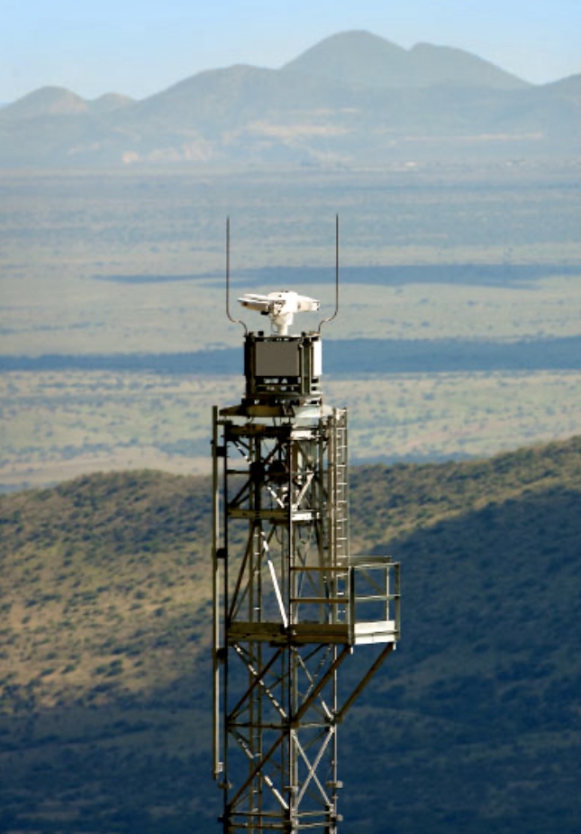
X99 LONG RANGE RADAR M9 INTEGRATION FOR TRUE
TRACKING AND SLUE TO CUE APPLICATIONS
The X99 radar is the latest upgrade to our proven heritage
of ground surveillance radar (GSR) technology and expertise.
The X99 long range radar provides wide area situational awareness
in a lightweight, low power package that is easy
to setup and use. The radar’s high reliability results in a low cost of ownership.
Maintainability is simplified with a modular design for field servicing.
The X99 precision radar can be coupled with the M9 long range PTZ thermal imaging EOIR
multi sensor flir camera system. By incorporating the X99 Radar to the M9 long range gimbal, you
Get true tracking and slue To cue capabilities.
Superior accuracy in range, azimuth and target acquisition allow for better performance
with image cueing, classification, and identification of targets. Automation of
electro-optic sensor cueing, audible alerts, multi- target tracking, and advanced
anti- clutter techniques are just a few of the features that allow system operators to focus
on what’s really important – the threat.
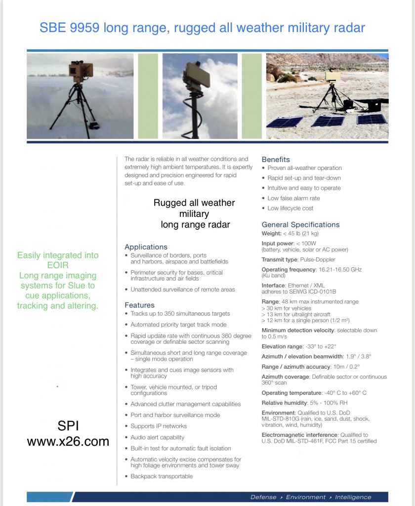
The X99 radar is reliable in all weather conditions and extremely high ambient temperatures.
Engineered and designed with the end user in mind, the radar is extremely easy to
setup and use, yet rugged enough to withstand repeated emplacements in any environment.
Multiple X99 radars are deployed worldwide – a testament to its reputation as a long range
GSR providing an unrivaled combination of performance and value.
The X99 radar is designed and manufactured in the USA.
CONFIGURATIONS
• Expeditionary (backpackable) • Fixed site (tripod or tower)
• Mobile (vehicle)
BENEFITS
• Operational in the most
severe weather conditions (extreme heat, wind, rain and salt fog)
• Transports easily and can be installed/set up rapidly by one person and in less than 10 minutes
• Intuitive, user-friendly operation and automated tasks make it easy to deploy
GENERAL SPECIFICATIONS
• Weight: < 45 lb (21 kg)
• Input power: < 100W (battery, vehicle, solar or AC power)
• Transmit type: Pulse-Doppler
• Operating frequency: 16.21-16.50 GHz (Ku band)
• Interface: Ethernet / XML (SEIWG ICD-0101B, cursor on target)
• Detection range:
– 12 km for a single person (0.5 m2)
– 21 km for small vehicles (10 m2)
– 32 km for large vehicles (30 m2)
– 48 km max instrumented range
• Minimum detection range: 50 m
• Minimum detection velocity: 0.25 m/s
• Elevation range: -33° to +22°
• Elevation beamwidth: 3.8°
• Range / azimuth accuracy: 10 m / 0.2°
• Azimuth coverage: Definable sector or full 360°
• Operating temperature: -40° C to +65° C
• Environment: Qualified to MIL-STD 810G
• Electromagnetic interference: Qualified to MIL-STD-461F, FCC Part 15 certified
• Ultra reliable system
FEATURES
Rapid update rate Low false alarm rate
Automated sensitivity settings for weather and clutter management
Simultaneous short and long range coverage
Automated priority target track mode
Performs ground, coastal and surveillance of low flying aircraft missions
Integrates with C2 and cues imaging sensors with high accuracy
Networkable
Built-in test for automatic fault isolation
Automatic clutter filtering compensates for mast or tower sway
Tracks up to 500 targets simultaneously
Automatic data recording with playback
Frequency agility Audio alert capability
Web interface for command and control
Multiple language user interface
M9 long range MWIR cooled PTZ Flir IR thermal camera applications:
- Port Security/surveillance long range thermal camera
- Coastal Security/surveillance long range thermal camera
- Border Security/surveillance PTZ long range thermal camera
- Perimeter Security/surveillance infrared imaging Pan Tilt PTZ FLIR
- Shoreline Security/surveillance infrared imaging Pan Tilt PTZ Thermal cameras
- Long Range Security/surveillancePTZ long range thermal camera
- Airport Security/surveillance PTZ long range thermal camera
- Runway Security/surveillance Thermal imaging Pan Tilt PTZ FLIR
- Maritime Security/surveillance IR imaging PTZ Thermal imaging
- Marine Security/surveillance Thermal imaging Pan Tilt PTZ FLIR
- Critical Infrastructure Security/surveillance long range thermal camera
- Vehicle mounted Security/surveillance Thermal imaging Pan Tilt PTZ FLIR
- Multi Sensor Security/surveillance Thermal imaging Pan Tilt PTZ FLIR
- Dual Sensor Security/surveillance IR imaging Pan Tilt PTZ thermal cameras
- Panoramic scanning Security/surveillance Thermal imaging Pan Tilt PTZ FLIR cameras
- Drone, UAV, UAS, SUAS Security/surveillance Thermal imaging Pan Tilt PTZ FLIR
- Range Security/surveillance Thermal imaging Pan Tilt PTZ FLIR
- Covert / Special operations tactical Security/surveillance Thermal imaging Pan Tilt PTZ FLIR
- Unmanned Ground Vehicle UGV Security/surveillance Thermal imaging Pan Tilt PTZ FLIR
- EO-IR Security/surveillance Thermal imaging Pan Tilt PTZ FLIR
- ISR Security/surveillance Thermal imaging Pan Tilt PTZ FLIR
Counter UAS / drone SUAS, UAV detection, recognition, identification characterization and countermeasures with EOIR
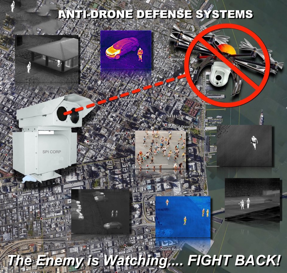
Detection of UAV Unmanned Aerial Vehicles
There are a number of methods that utilize technology in order to detect airborne small unmanned aircraft.
- Radar
- Electro-optical/Infrared visualization (EO/IR)
- Radio frequency (RF) detection or sourcing
- Acoustic or “listening” devices
Radar or radio detection and ranging utilizes radio transmissions and the return of deflected radio waves to detect the presence, range and speed of an object. Radar is considered a primary drone detection method. Specialized radar configurations are implemented for low altitude flying objects and in some cases the genesis of these systems are from military technology involving the detection of artillery, rockets and mortar fire.
These specialized radar systems are designed to track smaller objects and can offer a lower altitude azimuth profile with lower power transmission levels with some advanced systems being capable of full integration into longer range Air Traffic Control (ATC) radar systems. Because of the tuning of these specialized radars they may track larger aircraft at a distance as they appear to the system as being small objects.
Radar like all active detection radio frequency (RF) equipment requires unobstructed line of sight from the transmission source to the target and back to the source to be effective. Manned aircraft pilots will usually hear the transmission from ATC of “Radar contact lost.” when at very low altitudes or when flying below higher terrain which is between their aircraft and the radar source. These radar systems may have difficulty tracking hovering drones or drones that are tracking vertically. Radar provides 360 degree situational awareness and excellent early detection capabilities. Radar detects objects and not radio frequencies. Radio frequencies may or may not be emitted from a UAS as further discussed below.
Electro-optical and infrared (EO/IR) systems can be used as a stand alone system or as an integrated and validating component of a radar system to confirm that a target is not a “ghost”, artifact or bird. These systems are also valuable in providing visual separation of objects with a low radar signature from the background radar clutter of terrain which is behind and rises above the target. An available feature is that the optics can be made to “slew to cue” which causes the optics to automatically track the object identified by the radar system. The name EO/IR is descriptive as it is a dual optical system employing optical and thermal sensors designed for long range visual acquisitions day or night. This system configuration is common on military vehicles and platforms and can be easily identified on the nose of certain military helicopters.
These systems can be distracted on occasion in the event an object crosses the field of view of the optics. These systems are also capable of machine learning so as to identify the type of drone being visualized provided that the dimensions of the drone’s configuration has been added to the database within the software.
As with any optical or image capturing device quality is important and, in the case of drone detection, quality is critical. The FAA describes Pixels Per Foot (PPF) as a more predictable level of image quality. PPF is based on the area of coverage that the image captures, the distance from the camera, focal length and resolution of the camera.
Radio frequency (RF) detection systems detect frequency links being exchanged between the remote control device that commands the movement and features of the drone and the drone. The remote control link is also capable of receiving and displaying RF transmitted video and still imagery to a screen connected to the remote control device which is likewise detectable by RF systems. Depending on the software utilized these systems are able to determine the manufacturer of the targeted drone depending on the radio frequency data captured.
Much like radar systems these systems require unobstructed line of sight transmission reception for accuracy. Unlike radar systems these systems are susceptible to electromagnetic frequency disruption and environmental interference. Certain environments have a great number of potential sources of interference. Airports, busy marine terminals and metropolitan areas all have a very broad spectrum of radio frequencies being used.
There may be installations that emit byproduct interference such as high voltage power lines, generators, electrical motors and lighting fixtures or actual transmission fixtures or devices that emit interference such as transmission antennas, microwave towers, WiFi, cellular service and two way radio traffic. As any drone pilot will tell you, if there is significant interference in the area of operations that you are flying, your RF range to control the drone will be a fraction of the range the drone is capable of in normal conditions. The same holds true for RF detection systems.
A concern when performing GPS precision mapping is the issue of bouncing GPS signals off large objects. This is called multipathing and it causes inaccurate measurements or points. This phenomena also occurs with RF detection devices when the RF bounces off a building or large aircraft at an airport. An additional concern is the coverage area of RF devices as large areas require a number of sensors and in some instances multiple sensors confuse the location of the interloping drone.
Most RF frequency detectors only detect common, known and legal frequencies utilized commercially by drone and RC hobbyist manufacturers. What is known is in the vast majority of incursions, off the shelf drones have been used thus facilitating detection as those frequencies are likely in a library of “known RF frequencies”. Presently, off the shelf hardware components and open source software are available for an individual to design and construct a small or heavy lift “homemade” drone. A sophisticated bad actor will utilize an unexpected (and likely illegal) radio frequency in which case there will be little to no chance of detection. There are perhaps hundreds if not thousands of radio frequencies that can be used to control a drone. Although the FAA is presently developing rules requiring drone manufacturers to implement Radio Frequency Identification (RFID) for drones, there will still be a vast number of previously manufactured drones without RFID and bad actors will not incorporate RFID into homemade drones.
If a drone is programmed to fly autonomously without control input from a remote controller there may be no frequencies for an RF detector to detect. It will simply fly to the GPS/GLONASS waypoint(s) as programmed.
The attempted jamming of the GPS/GLONASS signals will likely not be effective if the drone is equipped with an Inertial Navigation System (INS) that does not require or rely on GPS/GLONASS signals to navigate. INS systems which are sometimes referred to as IMUs use gyroscopes and accelerometers along with a computer to keep track of a vehicle’s orientation using a starting point, velocity and time. Small and light INS systems called Microelectricalmechanical systems (MEMs) are currently in use in drones, although they come at a high price tag. MEM’s typically use algorithms and GPS/GLONASS signals for drift correction. INS systems have been historically used on aircraft, ships, guided missiles and spacecraft.
RF detection systems may not be presently suitable in areas of high electromagnetic interference as suggested by the FAA. They are nonetheless a very effective and valuable tool in the vast majority of areas with reliable early detection capabilities. Due to their portability, affordability and rapid set up time they are the only option in a number scenarios.
Acoustic detection is another method of detection whereby listening devices detect a drone’s acoustic signature that has previously been loaded into a library or database. This system can serve as a validation tool. A basic acoustic system will not give an operator time, direction, speed or distance as the system provides an acoustic presence near a sensor. As with radar systems, no radio signals need be detected. Depending on a person or asset’s distance from the outer perimeter and numerosity of the acoustic sensors, ample warning can be given if the drone is in close enough proximity to be identified by the sensor. As the system is subject to picking up sound, the most effective areas of deployment are areas with little to no background noise. Wind, rain and other environmental sounds caused by these conditions could cause sonic interference.
Two important questions presented by the FAA are: “Does the system differentiate and track multiple simultaneous targets? If so, what is the upper limit on the number of targets it can track?” Depending on the technology deployed a number of systems can “track” multiple targets with a finite number. If there is a “swarm” of incoming drones, radar appears to be the most capable detection device.
Integration of different detection systems creates redundancy and validation combined into a single interface. The integration of systems can be performed by a single manufacturer or by the combination of systems designed and built by different manufacturers.
Mitigation or Neutralization of Drone Threats
Methods of mitigation or neutralization:
- Electronic jamming or spoofing of a drone’s radio control frequencies or navigational GPS/GLONASS signals
- Concealment, visual obstruction or distraction
- Net systems (aerial and ground based)
- Birds of prey
- Ballistic or kinetic systems
- Directed energy weapons (lasers and microwave)
After successful detection the measures that can be taken is dependent on what federal laws and local laws are applicable to the person or organization seeking to mitigate or neutralize the drone threat.
Except for the specifically named federal agencies, all others including private citizens, local and state public safety and non-enumerated federal agencies are restricted from using most active countermeasures.
The jamming, spoofing or interference with drone transmissions or GPS/GLONASS signals could violate several federal criminal law statutes and FCC regulations including the prohibitions against the use of unlicensed RF jammers, interference with: radio communications, the operations of aircraft, satellite communications and statutes regarding wiretapping and computer fraud. Civil liability may attach to an operator using active countermeasure causing an aircraft to descend to earth uncontrolled causing injury or damage to persons or property. These laws arise, in part, because of the proclivity of jamming equipment to cause unintentional Electromagnetic Interference (EMI) of radio communications, GPS signals, aircraft navigation signals, WiFi signals, cellular signals, infrastructure communication links and emergency communications. Most jamming devices developed for domestic use are directional and are of limited power output and range unlike military applications. Hand held targeting and range effectiveness is not optimal.
Some detection systems have active countermeasures available as an optional capability. As mentioned above, only certain agencies are legally authorized to use these countermeasures. The only “countermeasures” available to all others is more in the form of mitigation. A question presented by the FAA is: “Can the system detect and geolocate the UAS pilot-in-command (using RF)?” After the threat is identified, involved personnel could be directed to the perceived takeoff point to locate the drone operator. This countermeasure would be the optimal solution for local and state public safety in view of the legal restrictions currently in place. Private citizens and business interests could mitigate privacy issues and proprietary exposure by concealment, visual obstructions or distraction.
Netting systems much like the casting of a fisherman’s net have been developed to either ensnare the offending drone causing it to crash or to catch and retain the offending drone by ensnaring it with a net system tethered to a larger drone. Some ground based systems will use compressed air to canon launch a net system to ensnare a drone. The problem with airborne net systems is the size and speed necessary of the interceptor drone in order to catch and then carry an offending drone. The pilot of any such interceptor drone must possess considerable skill to catch a maneuvering target drone. Ground based canon launch systems may be limited by range and an arching trajectory.
Ballistic and kinetic systems may involve gunfire, shotguns or another aerial vehicle being set on a collision course against the offending drone. Firearms, long gun fire and kinetic countermeasures could violate criminal statutes prohibiting the destruction of aircraft or statutes prohibiting the discharge of weapons in certain geographic areas. Discharged rounds could return to earth causing injury or death to persons or damage to property. Successful kinetic measures and ballistic measures could also cause injury or damage to persons or property on the ground creating both criminal and civil liability.
Birds of Prey have been trained to capture small drones but the effectiveness of this method is questionable. Larger drones can cause serious propeller injury to humans and animals alike and are too large for a bird of prey to disturb or capture.
Directed energy weapons are for now within the realm of the military. Laser and microwave weapons must have significant power sources for effectiveness. Ultimately counter drone destructive technology appears to be in the form of highly accurate laser systems particularly when the targeted drone is not susceptible to RF disruption.
The laws restricting the utilization of promising active countermeasures were made at a time when the future proliferation of drones were unforeseen. State laws and ordinances across the country vary or conflict. A congressional solution would ensure all law enforcement agencies have the authority to utilize whatever measures or tools that are necessary to respond to real or perceived threats caused by offending drones while at the same time preserving the ability to utilize these measures or tools safely in the National Airspace System.
Small UAS Range and DRI data
| Probability >> |
|
|
50% |
50% |
50% |
70% |
70% |
70% |
90% |
90% |
90% |
|
f (mm) |
SD HFOV |
“DJI” D |
“DJI” R |
“DJI” I |
“DJI” D |
“DJI” R |
“DJI” I |
“DJI” D |
“DJI” R |
“DJI” I |
| Cooled MWIR 300 |
300 |
1.83 |
4.44 |
0.95 |
0.58 |
3.33 |
0.63 |
0.38 |
1.97 |
0.33 |
0.19 |
| Cooled MWIR 690 |
690 |
0.80 |
9.91 |
1.96 |
1.33 |
7.50 |
1.31 |
0.88 |
4.48 |
0.68 |
0.44 |
| Cooled MWIR 900 |
900 |
0.61 |
12.52 |
2.81 |
1.73 |
9.56 |
1.89 |
1.14 |
5.76 |
0.98 |
0.58 |
| Uncooled LWIR 75 |
75 |
5.87 |
1.57 |
0.3 |
0.2 |
1.18 |
0.2 |
0.13 |
0.7 |
0.1 |
0.07 |
| Uncooled LWIR 150 |
150 |
2.93 |
2.27 |
0.41 |
0.28 |
1.69 |
0.27 |
0.18 |
0.96 |
0.14 |
0.09 |
| Uncooled LWIR 225 |
225 |
1.96 |
4.25 |
0.84 |
0.57 |
3.19 |
0.59 |
0.38 |
1.89 |
0.29 |
0.19 |
| Uncooled LWIR 300 |
300 |
1.47 |
5.56 |
1.12 |
0.76 |
4.21 |
0.76 |
0.51 |
2.5 |
0.39 |
0.26 |
M9 / M11 Long range thermal imaging camera capabilities and executive summary
SPI Long Range thermal imaging camera Modular Open Architecture System design supports both new and legacy platforms and applications;
and provides a seamless upgrade path as requirements and technologies change. Our goal is zero
obsolescence, at a system level, and the lowest cost over the life of the program or platform. We aim to
achieve this goal while providing users with the capability to deploy the latest and best sensor technology
available.
Our modular design concept using true line replaceable units can simplify maintenance and support capability
upgrades in the field. This capability eliminates the need for any special tools or equipment. Our gimbal
systems minimize the use of external cables to simplify system integration and reduce potential failure points.
All of these aspects combined result in a sustainable long term approach to your long Range thermal imaging camera systems.
SPI provides innovative and cost-efficient solutions to support the most complex Long Range electro-optical imaging
applications, utilizing modular system design that is easy to integrate, configure, upgrade, and service. Our
products include the design and manufacturing of high-precision two-axis stabilized gimbals, EO-IR system
integration, COTS EO-IR long range PTZ FLIR thermal imaging mobile force protection, coastal and border solutions, laser range finder LRF systems
fabrication, and full high definition (HD) IR (full HD Visible) EO tracking systems.
When the mission hinges on synchronizing multiple sensor suites tracking multiple targets from a variety of
remote geographical locations, we incorporate an intuitive Command and Control graphical user interface,
high precision mechanical and electronic assemblies, and an open architecture interface to work seamlessly
with existing networks.
The SPI Team is made up of experts in the fields of electrical and mechanical engineering, optical
design and analysis, IR thermography, 3D solid modeling (CAD/CAM), and precision machining and assembly.
SPI’s Long range thermal imaging FLIR PTZ security camera systems are currently utilized by US Customs and Border Patrol, US Marine Corps, US Air Force, US
Navy, US Department of Homeland Security, NASA, the Panama Canal, the South Korean Navy, Saudi Aramco Oil, and MIT Lincoln Labs.
WHY THE SPI LONG RANGE THERMAL IMAGING PTZ FLIR CAMERA SYSTEMS ARE THE BEST CHOICE FOR LONG RANGE CAMERA PROJECT
Modular Open Architecture System objectives
• Support both new and legacy platforms and applications
• Provide a seamless upgrade path as requirements and technologies change
• Our goal is zero obsolescence, at a system level, and the lowest cost over the life of the program or
platform
• We aim to achieve this goal while providing users with the capability to deploy the latest and best
sensor technology available.
• Design system modules as true line replaceable units to simplify maintenance and support capability
upgrades in the field.
• Eliminate the need for any special tools or equipment
• Eliminate or reduce the need for sensor alignment after replacement
• Maximize the use of captive fasteners for all LRUs to support installation in extreme and challenging
environments
• Minimize the use of external cables to simplify system integration and reduce potential failure points
Lowest Cost Over the Life of the Program
• Zero system level obsolescence moving forward based on the ability to integrate new sensor
technology as it is released
• Allows engagement of Legacy and New Sensors: Reverse Compatible to legacy sensors, or a
combination of long range thermal imaging EOIR new sensors and legacy sensors as spares
• Forward compatible from SD to full HD, as new sensors are introduced
• No wear components
• EOIR long range thermal imaging Sensors and Gimbals sealed within Aluminum Weldments or Carbon Fiber sealed IP 68 plus enclosures which are full immersion tested.
• Very High industry leading MTBF
• Uses standard Ethernet or Serial C2 connections
• Code for new sensors upload-able remotely into the on-board FPGA from system Ethernet connection
• Rapid upgrades saves time and material costs
• Rapid Sensor changes reduce labor and down time
• Streamlined integration effort minimizes schedule and technical risk
• This approach drives the cost down for each platform over the life of the Program while at the same
time still remaining competitive at initial purchase cost for each system.
KEY CONSIDERATIONS
• DIRECT DRIVE SERVO MOTORS AND ENCODERS DIRECTLY CONNECTED TO THE AZIMUTH AND
ELEVATION DRIVE SHAFTS SUPPORT THE FULL RESOLUTION OF THE 19 BIT ABSOLUTE ENCODERS WITH
NO HYSTERESIS
• BRUSHLESS MOTORS AND OVERSIZE BEARINGS PROVIDE HIGH RELIABILITY, EXCELLENT ALIGNMENT
RETENTION AND SIGNIFICANT STRUCTURAL MARGIN
• THERE ARE NO WEAR OR LIMITED LIFE COMPONENTS IN THE SYSTEM THAT REQUIRE SERVICE OR
MAINTENANCE
• SUPERIOR DESIGN & LONG TERM RELIABILITY
OUR HARDWARE PROPOSAL
PROPOSAL FOR EO / IR, VISUAL & THERMAL CAMERA COMBO GIMBAL SYSTEM
The M9 LONG RANGE PTZ THERMAL IMAGING FLIR CAMERA SYSTEM
The M9 is a Long Range high-performance, high-definition pan and tilt system that is ideal for day/night
surveillance over long ranges in the harshest of conditions. The M9 Long Range thermal imaging ptz system was designed with the specific
intent to support the highest performance sensors available. HD video data is transmitted with a high-speed
fiber optic connection, with no compression or data loss. In addition to the standard suite of high
performance imaging sensors, the M9’s HD’s gimbal can accommodate additional optional sensors,
including laser rangefinder, laser pointer/designator, laser zoom imaging illuminator, and many other devices.
SYSTEM FEATURES & BENEFITS:
360° azimuth, continuous rotation
Direct drive servo motors
Superior HD image processing
Extreme zoom range with HD resolution
HD resolution imaging in extreme environments
Remote updating, GPS-referencing, dual HD-SDI outputs
Optional gyro stabilization for tower, mast, marine vessel & vehicle applications
HD Long Range thermal flir imaging & EO CCTV video tracking options
Integrated system controller: controls all motion & sensors via a single Ethernet connection (this allows
for changing sensor types without re-coding the user C2 interface)
Rugged design thrives in the harshest of environments
HD LONG RANGE THERMAL MWIR CAMERA FEATURES:
Auto focus & fine focus
Electronic image stabilization
Turbulence mitigation
HD resolution, 1280 x 1024 Pixels, 15μm pitch
Edge enhancement & contrast enhancement
200-1,200 mm Coated Hardened Continuous Optical Zoom Germanium Lenses
LASER POINTER FEATURES:
Eye safe at the aperture
15km range
4Hz flashing mode and 30Hz continuous mode
LASER RANGE FINDER FEATURES:
20km Long range LRF
Eye safe at the aperture
Solid state design for long life
LONBG RANGE HD DAYLIGHT CAMERA
ASSEMBLY FEATURES
• 0.009 lux ½” HD CMOS 2.2 MP
• High speed auto focus
• Heat haze/wave removal &
image stabilization
• Black glass (low pass filter) for NIR Imaging
LENS OPTIONS
• 16.7-2000mm zoom Long Range Visible HD camera with optical
stabilized lens
• 16.7-2000mm zoom Long Range Visible HDTV camera
M11 MODULAR LONG RANGE THERMAL IR IMAGING FLIR PTZ EOIR CAMERA SYSTEM
The M11 Is A Long Range Modular Gimbal System which is an agile system for medium
payloads — a yoke-style gimbal design for today’s challenging tracking applications. Because the payload is
supported over the azimuth axis, the result is both faster response and greater accuracy. This integrated
sensor system combines our industry-leading gimbal with cutting edge Long Range Thermal infrared and HD visible sensors. These
systems can accommodate a wide range of laser pointers, Custom Long Range NIR, SWIR Optics, LRF laser range finders and laser illuminators.
SYSTEM FEATURES:
• 360° azimuth, continuous rotation
• Direct drive servo motors for maximum accuracy (within 0.0006°)
• Over-the-azimuth payload design provides low inertia for high speed tracking capability
• Blind mate connectors provide rapid installation or re-configuration in the field
• High resolution imaging achieved in extreme environmental conditions with heat haze & fog mitigation
• Fully network enabled for integration into existing IP surveillance networks
• Optional gyro stabilization for tower, mast, marine vessel and vehicle applications
• Proprietary design provides the lowest operational cost over the life of the system
• Image stabilization
• Rugged design thrives in the harshest of environments
For the single payload day camera gimbal we recommend 3 pcs of the following:
M11 Long Range MWIR Cooled IR Camera with an Ultra Long range EO payload.
The Visual EO camera payload would be as follows:
HD DAYLIGHT CAMERA
ASSEMBLY FEATURES
• 0.0006 lux ½” HD CMOS 2.2 MP
• High speed auto focus
• Heat haze/wave removal & electronic
• Image stabilization
• Black glass (low pass filter) for NIR Imaging
• Turbulence, Haze, Clutter and fog Mitigation
• LENS OPTIONS
• 16.7-2000mm zoom Long Range Visible HD camera with optical
• stabilized lens
Overview
Lowest Cost Over the Life of the Program
• Zero system level obsolescence moving forward based on the ability to integrate new sensor
technology as it is released
• Allows engagement of Legacy and New Sensors: Reverse Compatible to legacy sensors, or a
combination of new sensors and legacy sensors as spares
• Forward compatible from SD to full HD, as new sensors are introduced
• No wear components
• Long Range Sensors and Gimbals sealed within Aluminum Weldments or Carbon Fiber sealed IP 68 plus enclosures
which are full immersion tested
• Very High industry leading MTBF
• Uses standard Ethernet or Serial C2 connections
• Code for new sensors upload-able remotely into the on-board FPGA from system Ethernet connection
• Rapid upgrades saves time and material costs
• Rapid Sensor changes reduce labor and down time
• Streamlined integration effort minimizes schedule and technical risk
• This approach drives the cost down for each platform over the life of the Program while at the same
time still remaining competitive at initial purchase cost for each system.
KEY CONSIDERATIONS
• DIRECT DRIVE SERVO MOTORS AND ENCODERS DIRECTLY CONNECTED TO THE AZIMUTH AND
ELEVATION DRIVE SHAFTS SUPPORT THE FULL RESOLUTION OF THE 19 BIT ABSOLUTE ENCODERS WITH
NO HYSTERESIS
• BRUSHLESS MOTORS AND OVERSIZE BEARINGS PROVIDE HIGH RELIABILITY, EXCELLENT ALIGNMENT
RETENTION AND SIGNIFICANT STRUCTURAL MARGIN
• THERE ARE NO WEAR OR LIMITED LIFE COMPONENTS IN THE SYSTEM THAT REQUIRE SERVICE OR MAINTENANCE
We are here to help assist you in selecting the absolute highest quality, cost effective
day/night video security/surveillance system for your needs.
Additional Long range thermal cameras
are available at this LINK
Click here for the history and terminology related to thermal
infrared flir imaging and night vision equipment.
Long range thermal imaging flir PTZ camera resources
M9 long range HD cooled MWIR thermal imaging PTZ flir camera capabilities overview
M9 LONG RANGE THERMAL IMAGING COOLED CAMERA OVERVIEW PDF BROCHURE
CALL (702) 499-9551 OR EMAIL US FOR
ADDITIONAL INFO AND DISCOUNTED PRICING


 LONG RANGE HD SWIR IMAGING CAMERA CHANNELS ARE AVAILABLE WITH EXTENDED 2550mm ZOOM SWIR OPTICS
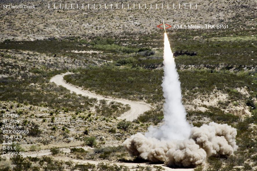


